
Abstract
Multipath interference has been one of the most difficult problems when using global navigation satellite system-based vehicular navigation in urban environments. In this article, we develop a multipath mitigation algorithm exploiting the sparse estimation theory that improves the absolute positioning accuracy in urban environments. The navigation observation model is established by considering the multipath bias as additive positioning errors, and the assumption for the proposed method is that global navigation satellite system signals contaminated due to multipath are the minority among the received signals, which makes the unknown bias vector sparse. We investigated an improved elastic net method to estimate the sparse multipath bias vector, and the global navigation satellite system measurements can be corrected by subtracting the estimated multipath error. The positioning performance of the proposed method is verified by analytical and experimental results.
Introduction
In recent years, with the rapid development of the economy, automobiles have gradually become the main means of transportation in daily life. However, as the number of cars is increasing, the safety and environmental problems caused by urban road congestion and frequent traffic accidents have become a concern. Vehicular navigation technologies have become a vital component in the intelligent transportation system for they provide convenience, location-related information, and safety to transportation users. 1,2 Global navigation satellite system (GNSS) is an all-weather, worldwide, continuous coverage, satellite-based radio navigation system. 3 –5 As one of the most essential component technologies, GNSS provides precise positions of the user vehicle and neighboring vehicles in urban environments.
The urban environment presents great challenges to common commercial GNSS receivers while vehicular positioning. 6 –9 This is mainly because the GNSS positioning performance can be severely degraded by the multipath effect due to shadowing behind increasing number of buildings, interference, and other undesired impairments such as trees. 10 –12 As illustrated in Figure 1, multipath interference is generated by receiving reflected or diffracted signals, possibly signals other than line-of-sight signals, and is one of the most harmful sources of error in GNSS positioning applications. Several efforts have been devoted to mitigate the effect of multipath interference from different aspects, for example, the antenna design techniques, 13,14 the receiver-based techniques, 15 as well as the post-receiver techniques, 16 which help to improve accuracy and reliability of the GNSS positioning in urban environment. But these techniques can be expensive and bulky or require deploying additional hardware.

Illustration of multipath effect.
In this article, we proposed a multipath mitigation method exploiting the sparsity properties of channels affected by multipath to estimate multipath biases. Compared with previous works, the proposed method is based on fusing GNSS pseudoranges and pseudorange rates measurements and has an advantage that it does not require additional hardware. Giremus et al. investigated Sequential Monte Carlo methods, also referred to as particle filters, for this estimation. 17 But these approaches are computationally intensive, making a real-time implementation complicated in practical applications. In the proposed method, the computational time for solving the sparse problem is fast, which can allow real-time positioning results. The main hypothesis making this method available is that most satellites are not affected by multipath prompting the biases sparse with respect to number of received measurements. Note that the sparse estimation theory has been considered in turbine and turbofan engine theory, 18,19 however, the proposed method results from the application of a penalized least-squares approach exploiting the sparse estimation for GNSS applications. The navigation observation model is established by considering the multipath bias as additive positioning error, we can estimate the multipath by solving an improved elastic net problem, then the GNSS measurements can be corrected by removing the estimated bias vector and the positioning accuracy will be improved.
This article is organized as follows. The second section summarizes some basic principles on satellite navigation, describing how measurements (pseudoranges and pseudorange rates) are related to the state vector (position, velocity, clock offset, clock drift) and the possible multipath biases. In the third section, the improved elastic net problem is described, and the solution that can be used to estimate multipath bias vector is investigated. The fourth section discusses the experimental results, and the performance of the proposed method is evaluated. Finally, relevant conclusions are drawn in the fifth section.
GNSS navigation
State model
The navigation solution is obtained by solving these equations with observations from at least four satellites. The state equation can be written as

In equation (1), the unknown state vector at time k (to be estimated) is described as

where
The state transition matrix

and

where
Observation model
To estimate the unknown state vector Xk
, we will use the measurement vector comprises the pseudoranges and pseudorange rates. Denote as sk
the number of satellites visible at time instant k. The number of measurements acquired by the receiver is

More precisely, using the notations

where
Note that bk
and

where

with

Since the measurement equation is nonlinear, it is natural to use the extended Kalman filter (EKF) to estimate the state vector Xk .
EKF for navigation
The classical EKF was used to estimate the state vector from the state equation (1) and the measurements can be summarized as follows


Proposed GNSS multipath mitigation method
The improved elastic net problem
Suppose that

where

where

where the

where

In addition, we give the algorithm for solving the optimization problem proposed in elastic net numerically; some popular algorithms like last angle regression (LARS) 23 and coordinate descent 24 can be used to solve the optimization problem in the proposed method efficiently. Friedman et al. compared the average CPU timings for the coordinate descent and LARS algorithm for linear regression, 25 and the results showed that the former seems to be competitive and faster than the latter. Hence, we tend to use the coordinate descent algorithm to solve the proposed sparse problem. Since the MATLAB package “glmnet” is publicly available, we prefer this algorithm for solving the elastic net problem. The run times were carried out on an Intel Core 2.80 GHz processor and 8 GB RAM memory.
Solution of multipath mitigation model
Thanks to the sparse estimation theory introduced above, our proposed positioning algorithm can estimate the multipath bias on GNSS pseudoranges and pseudorange rates measurements. This method assumes that the bias vector mk is sparse, that is, some of its components are exactly equal to 0. In order to estimate the bias vector mk and feed it to the proposed EKF, we propose to solve the following problem
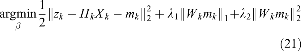
Regarding the weighting matrix Wk
, we propose to use some key parameters, somehow representative of the measurements quality, provided by most GNSS receivers, namely the carrier-to-noise density ratio

where
And the satellite elevation that is a second important parameter can be considered as

where e is a given satellite elevation expressed in degrees. The multipath of low elevation satellites tends to replace the blocked direct signals and cause large position errors. It is common to reduce the effects of low elevation satellites by defining an elevation mask of 5° before positioning solution. However, due to limited view of the sky in urban environments, we propose to preserve the largest number of satellite measurements, including low elevations. As a consequence, we take different elevations of satellites into account and consider penalizing satellites whose elevations are lower than 5°.
In order to appreciate the impact of low elevation satellites considered in weighting matrix, we tested the performance of the proposed method without penalizing satellite elevations, and the cumulative distribution functions corresponding to the position error are displayed in Figure 2. It can be seen that the weighting with elevation constraint provides a more accurate position solution.

CDFs of position errors by using the C/N 0 and elevation weighting or without elevation constraint. CDF: cumulative distribution functions; C/N 0: carrier-to-noise density ratio.
The final weight for a given satellite introduced in the improved elastic net approach is defined as the product of the two previous functions, that is

where
In order to obtain a formulation similar to equation (20), it is interesting to note that the minimization of equation (21) with respect to Xk for a fixed mk admits the following least-squares solution

After replacing this expression of Xk in equation (21), we can reexpress equation (21) as follows
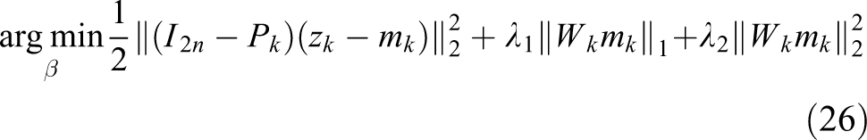
where


The original problem (equation (21)) reduces to
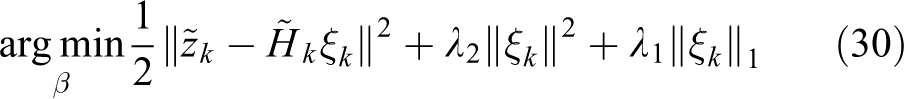
The proposed multipath mitigation method requires the following steps. First, transform the GNSS observation model into the sparse estimation problem (equation (30)). Based on the carefully selected weighting matrix and parameters, we can estimate the unknown sparse vector

Flowchart of the proposed multipath error modeling method.
Simulation results
To appreciate the efficiency of the proposed method, this section studies several experiments conducted with simulated data. It is assumed that the synthetic data are generated using a reference position according to equation (1), and with noisy measurements resulting from equations (6) and (10). In the simulations, the sample size that we apply is K = 200 and have generated artificial additive biases, modeling multipath conditions, affecting pseudoranges and pseudorange rates between time instants
Currently, the Chinese BeiDou navigation satellite system (BDS) has launched over 40 BDS satellites and begun offering services to customers in the Asia-Pacific region, which make it easy to observe eight satellites in urban environment at one time. In addition, with the joint cooperation of GPS, GLONASS, and GALILEO system, over 12 satellites can be observed to obtain more accurate positioning results. Hence we consider performance of 8 and 12 observed satellites, respectively, in the following experiments.
Synthetic data with eight observed satellites
Firstly, we consider performance of eight satellites to be observed. Figure 4 shows the estimated pseudorange and pseudorange rate biases for three representative channels. It can be seen from these two figures that additional multipath biases are capable of being extracted with accuracy between the disturbed time instant 60 and 140. The positioning root mean square errors (RMSE) of the GNSS state vectors including position, speed, clock bias, and clock drift by using different methods are displayed in Figure 5. This positioning conclusion is confirmed by the results of Figure 6 showing the impact of multipath mitigation method on localization errors. Since the parameter α has an effect on the performance of the proposed method, we compared the performance on different values of parameter α in the proposed method. In this experiment, the performance of EKF, lasso (

Estimated bias (continuous line) and ground truth (dotted line) for pseudorange and pseudorange rates with eight satellites.

RMSE of estimated bias for state vectors. RMSE: root mean square errors.

Estimated errors in the east, north, and up directions versus time for the different methods with eight satellites.
Due to the limit of the sparsity assumption in practical applications, the performance of the proposed method when different number of satellites affected by multipath is further illustrated in Figure 7. As can be seen, in the case of eight observed satellites, the proposed sparse method can estimate multipath errors accurately when the number of multipath-contaminated satellites is less than five of eight. However, the performance of the proposed method deteriorates if the number of multipath-polluted satellites is more than six of eight. Because the number of satellites affected by multipath increases gradually, the sparse assumption for this scenario is not appropriate.

The position RMSE for different number of satellites affected by multipath. RMSE: root mean square errors.
Synthetic data with 12 observed satellites
In the case of observations of 12 satellites, the pseudorange and pseudorange rate measurements consisting of the reference and estimated value are depicted in Figure 8.

Estimated bias (continuous line) and ground truth (dotted line) for pseudorange and pseudorange rates with 12 satellites.
The simulations conducted with different values of α in the proposed method and EKF methods on localization errors are depicted in Figure 9. As can be seen, all of these results show that the proposed method outperforms the EKF regardless of different values of the parameter and the proposed method with

Estimated errors in the east, north, and up directions versus time for the different methods with 12 satellites.
Quantitative results for the position RMSE in the east, north, and up directions.

RMSE: root mean square errors.
Real data
In order to further evaluate the presented multipath mitigation method, a static scenario was considered between two-side buildings, where GPS signals subject to multipath severely causing positioning accuracy reduced. The noisy L1 pseudoranges and pseudorange rates were used as measurements to the proposed algorithm. The raw GPS data were provided by a u-blox ZED-F9P receiver, and a laptop was used for data logging. The coordinates of the receiver are precisely known by applying the real-time kinematic (RTK) data. Figure 10 shows the number of observed GPS satellites by the receiver during the test, and Figure 11 compares the performance of the proposed multipath mitigation method when

Number of observed GPS satellites by the receiver.

Position errors for EKF and proposed method. EKF: extended Kalman filter.
Conclusion
In this article, a multipath mitigation method exploiting the sparsity estimation is proposed for vehicular positioning in urban environments. We have shown via experiments conducted on synthetic and real data that the improved elastic net method can estimate the multipath bias effectively and outperforms the EKF estimation for improving the GNSS-based positioning. In addition, the computational time for solving the sparse problem of the proposed method is fast, which can allow real-time positioning results. The performance of the proposed method in different number of satellites affected by multipath is also evaluated; the analytical results show some limits for the proposed method when the number of channels affected by multipath is more than six of eight. As future work, more sophisticated solutions such as incorporating with multiple sensors are expected to be designed and evaluated to enhance positioning performance in urban environments.
Footnotes
Declaration of conflicting interests
The author(s) declared no potential conflicts of interest with respect to the research, authorship, and/or publication of this article.
Funding
The author(s) received no financial support for the research, authorship, and/or publication of this article.