
Abstract
Africa is at present one of the most dynamic continents. It will play a key role in the next decades in relation to the growth of cities, and environmental conditions will be of primary importance. The structural lack of water and sanitation infrastructure affects the development of growing African cities. This paper analyses the status of the sanitation and drainage systems of Dar es Salaam (Tanzania), a city with a structural lack and general deterioration of the existing infrastructure, and with high annual growth, which has contributed to increasing water demand and strained the water and sanitation system. In particular, the paper describes the water and sanitation conditions of the city, and examines three areas in the city that highlight the relation among the evolution of the city’s growth, sanitation system, and type of settlement. The analysis leads to three main findings. Firstly, urban planning and water management must find common ground and work closely together. Secondly, both on-site (boreholes, wells, on-site latrines, etc.) and off-site (pipes) systems should be considered for the provision and safe discharge of water. Finally, local governments need to take a major step in the water and sanitation sectors in relation to the city.
Keywords
I. Introduction
The process of urbanization is inextricably connected to the water system. Even if this system is, in the words of Kaika and Swyngedouw, “covered, banalised and relegated to an apparently marginal, subterranean urban world”,(1) it is the backbone of the settlement of the 19th century city and, with minor changes, of the present city. Cities nearly always rely on a locally available water supply, heavy and costly to transport. As Swyngedouw considers, “the very sustainability of cities and the practices of everyday life that constitute ‘the urban’ are predicated upon and conditioned by the supply, circulation and elimination of water”.(2)
The primary relation between the city and its water and sanitation systems changed when technology first allowed humankind to obtain and discharge water without being directly responsible for the process, by means that were invisible, economically feasible and safe. For sub-Saharan African cities dominated by colonial powers amidst the incredible technological and scientific discoveries of the 19th century, this technological evolution not only influenced them physically but also divided the different social groups inhabiting the urban areas. The pipes’ position, their presence (or absence) and the way these systems were conceived greatly influenced territorial configuration, social biases and development.(3) Today’s lack of services has its origins in the foundation of these cities for a number of reasons. Among them is the unequal geographical distribution that favoured the wealthier classes through concentration and good provision of services. Also, as these cities were founded at the time of the Industrial Revolution in Western countries, the piped paradigm(4) was imported not only as a means of progress but also as a symbol of control,(5) reaching only a few elite neighbourhoods and intentionally leaving behind large built areas. Another relevant element that impinges on the relation between water and sanitation systems and the African city(6) is their date of origin. African urbanization boomed in the 1960s, when most of the colonized countries obtained independence from their colonial powers. Unlike Western urbanization patterns, marked by slow and relatively steady urban growth spread out over a century from the Industrial Revolution to after the Second World War, the growth rate in Africa has burgeoned in a few decades. London, New York and Paris, just to name a few cities, had over a century to develop and implement the necessary infrastructure and services in order to reach their growing population. The public administrations and governments of African cities were unprepared to manage the kind of population growth and the consequent need for services that they faced over just a few decades.
Between 1950 and 2010, the African population grew from 230 million inhabitants to 1 billion, and by 2050 this population is expected to double to reach 2 billion inhabitants.(7) This growth is not accompanied by consistent improvement in water and sanitation services. In fact, only about 66 per cent of all Africans have access to “improved” resources for water and only 33 per cent have improved sanitation systems.(8) The situation, particularly for sanitation, does not seem to be about to change abruptly in the coming years. As of 2010 in sub-Saharan African cities, water supply in urban areas was estimated to be 83 per cent improved and sanitation facilities 43 per cent improved. Coverage is worse in rural areas, where 77 per cent lack improved sanitation.(9)
With population growth and inadequate infrastructure, water and sanitation services in African urban areas are overstretched and they service only part of the population. Without primary networks that reach everyone, urban populations depend on different technologies; piped water provision and discharge exist in tandem with other systems, which sometimes serve the same areas and even reach the same users. Although the planning ideal is to aim for a large-scale piped network that serves all, in fact these kinds of piped services reach the minority in urban Africa.(10) For water provision, while 40 per cent receive piped water, about 25 per cent rely on public standposts, 24 per cent on wells and boreholes, and 8 per cent on lakes, ponds and springs.(11) The great majority of urban Africans also rely on so-called “on-site” sanitation systems – in other words, solutions that involve some decentralized means of managing the waste. This means that, while formal planning for infrastructure usually follows the model of large-scale centralized systems, in fact the city is evolving with a distributed model (boreholes, wells, on-site latrines, etc.).
In her report on African infrastructure, Foster noted that:
“in urban areas, population growth rates averaging 3.6 per cent per annum are leaving infrastructure service providers severely stretched. As a result, urban service coverage has actually declined over the last decade, and the resulting gap is being filled by lower-cost alternatives, such as boreholes and pit latrines, both of which are currently expanding at a much faster rate than improved alternatives, such as piped water, stand posts, improved latrines or flush toilets”.(12)
Estimated figures by the recent Joint Monitoring Programme survey for Tanzanian water and sanitation conditions confirm this trend.(13) In fact, estimated water coverage has decreased in the country from 55 per cent in 1990 to 53 per cent in 2012. In particular, the coverage of “other improved resources” for water (i.e. excluding piped water) has decreased, most notably in the urban areas, where the 94 per cent improved water coverage in the 1990s had dropped off by 2012 to 78 per cent. Sanitation coverage has not declined over the same period, but the situation remains dramatically inadequate – overall, Tanzanian sanitation coverage in the 1990s was 7 per cent and it had risen to only 12 per cent by 2012. Urban areas moved over the same period from 9 per cent improved sanitation coverage to 25 per cent, but this percentage is still so low that the improvement cannot be considered a success. With poor government capacity and limited funds available to invest in new infrastructure, urban expansion continues to rely on unconnected informal networks for water provision and discharge, creating de facto a new model for the relationship between water and the city.
This paper is the result of a year of research in Dar es Salaam. Research activity was divided into field surveys focused on the entire city, and then on specific surveys within selected case study areas. Data were collected from different institutions, such as municipalities and utilities, as well as from interviews with both stakeholders and citizens. Urban growth affects the city both through densification and through sprawl into new areas. The case study areas were selected from both informal and formal settlements within the current boundaries of the city and the new areas of expansion. Three sites were chosen after focused discussions with stakeholders that highlighted the typology of services, or the changes that had occurred in settlements in relation to their water systems. Citizens were interviewed to collect information on water delivery and quality, on stormwater drainage reliability, on latrine use, maintenance and management, and on waterborne diseases. The material was analysed and collated to allow for the description of city conditions in four domains (all in relation to the water sectors): evolution in the built environment, establishment of different infrastructural services, impact on health, and evolution in the management system.
The paper proceeds with a description of the different water and sanitation systems in place in Dar es Salaam. It then describes three areas of the city that demonstrate the different relations among urban growth, the shape of the city, and water and sanitation conditions (in terms of both infrastructure and governance). The case studies discuss the different water and sanitation services, the different management systems, and the challenges that grow out of the relation between urban growth and sanitation in each site. The last part of the paper considers the possible impact of the different systems and of the governance challenges on the urban structure of the present and future city.
II. Water and Sanitation Systems in Dar es Salaam
Dar es Salaam is the major metropolis in Tanzania in terms of population, income and economic growth. The city’s population in 2012 was 4,364,541 million, with an annual growth rate of 5.6 per cent.(14) The city is divided administratively into three municipalities: Kinondoni, Ilala and Temeke. Each municipality is divided into wards and sub-wards and works as a semi-autonomous authority, reporting directly to the Prime Minister’s Office – Regional Administration and Local Government (PMO-RALG). The municipalities are in charge of the provision of basic services, primary health care, waste management, water kiosks, local roads and urban planning. Water supply and sanitation are the responsibility of the Ministry of Water. Through the ministry, 19 urban water and sanitation authorities (UWSSAs) are in charge of the maintenance and development of the water and sewerage infrastructure in all of the country’s main cities. The authority designated by the Ministry of Water for the Dar es Salaam, Bagamoyo and Kibaha regions is the Dar es Salaam Water and Sanitation Authority (DAWASA), which is in charge of infrastructure and planning; the Dar es Salaam Water and Sewerage Corporation (DAWASCO), a parastatal authority, is in charge of operations and water services.
Water management has always been a complex issue. After independence, the Ministry of Water and Power took direct responsibility for water supply and distribution in Dar es Salaam, through the Dar es Salaam Water Supply Department. At the end of the 1970s, Dar es Salaam Supply became a parastatal organization, Dar es Salaam Water Corporation Sole. This organization was financially and managerially independent, although controlled by the Ministry of Water. In 1981, the Urban Water Supply Act established the National Urban Water Authority (NUWA), a parastatal, autonomous authority whose goal was to provide technical and financial support in all the urban areas. Although NUWA was in charge of all the urban areas in the country, apparently it only took active responsibility for Dar es Salaam, although with poor performance.(15)
In the 1990s, the water sector was further reorganized, and the management of water in all the urban areas became part of the activities of the independent and newly established urban water supply authorities. Dar es Salaam, Kibaha and Bagamoyo were all merged into a single urban authority, DAWASA, which also incorporated the Dar es Salaam Sewerage and Drainage Department. For the first time in Tanzania, a single body was in charge of both water provision and discharge, although on-site sanitation was and remains the partial responsibility of the health department of the municipal councils. In 2003, the Ministry of Water decided to split the functions of infrastructure development and the actual operation of water and sewerage services. A private operator, City Water Limited, was appointed for the water and sewerage operations, with a 10-year contract. After only two years, the company was dismissed, having failed to provide the services, and in 2005 DAWASCO was given responsibility for the operations. A third component, the Energy and Water Utilities Regulatory Authority (EWURA), an autonomous multi-sectoral regulatory authority, is responsible for the technical and economic regulation of the electricity, petroleum, natural gas and water sectors in Tanzania. During the survey, representatives of municipalities, private institutions, non-governmental organizations (NGOs), community-based organizations (CBOs), EWURA, and the Drilling and Dam Construction Agency (DDCA, under the Ministry of Water) all concurred that there is considerable fragmentation in the overall organization of planning, implementation, fund allocations, revenue collection and management of the facilities, and overlapping responsibilities, with implications for the improvement of water and sanitation services. The city, then, suffers from not only a lack of infrastructure and a general deterioration of what infrastructure exists, but also a need for better management and coordination among the various institutions over the responsibilities for the provision of services.
The city’s main source of water is the Ruvu River, 80 kilometres from the city centre.(16) Other sources include groundwater (withdrawn by boreholes and wells) and potentially the future exploitation of a large aquifer south of the city. A centralized water system (in other words, a system of pipes, treatment plants and pumping stations) mainly serves the centre and the northern part of the city where the former colonial settlement was located, while the rest of the city relies on deep or shallow wells and water kiosks. Water vendors serve the city both in places unreached by any water service and in the case of temporary failure of provision of water from pipes or kiosks. Dar es Salaam’s capacity for water provision is estimated at a total of 300,000 m3/day.(17) The demand of closer to 500,000 m3/day is based on a population of 3,500,000 people within the premises; the system has been assessed as being able to serve only 58 per cent of its inhabitants.(18)
Three systems serve the city’s sanitation needs: a centralized piped sewerage system; connections to oxidation ponds; and on-site systems such as pit latrines and septic tanks. The stormwater drainage system that serves part of the city is also used for domestic sewage or informal garbage disposal. All three systems work in combination and there are areas served by multiple systems at the same time. In 2010, 23,873 households were connected to the sewerage system, meaning that only 3.7 per cent of the city’s households use the piped system. Another 7 per cent are served by improved septic tanks that discharge into the waste stabilization ponds spread across the city.(19) The remaining 90 per cent of the population, or 3,928,000 people, resorts to on-site sanitation systems or other kinds of domestic disposal.
Stormwater drainage in Tanzania is connected to the road network system, which is the responsibility of two authorities: municipalities are in charge of local roads, while the Ministry of Infrastructure, through the Tanzanian National Road Agency (TANROADS, established in 2000), is responsible for regional and main trunk roads. In Dar es Salaam, infrastructure covers the city centre and the main arterial roads that connect the city to the surrounding regions. The municipalities have 825 kilometres of stormwater drainage network, mostly uncovered,(20) of which about 50 per cent is in good condition.(21)
III. The Relation Between Urban Growth and Water and Sanitation Services
a. Three different areas of the city
Today, the city is overwhelmed by rapid transformation, while holding fast to the dream of a piped paradigm. It evolves, expands and grows vertically. Urban growth, as noted, takes the form of increases in density, in informal settlements and in sprawl. These conditions affect water and sanitation in terms of volume and performance; environmental and health impact (providing clean water and discharging waste water safely); and management (guaranteeing the provision of services, reaching the entire population, and not exacerbating social differences.) The three case study areas selected within the city’s borders represent different ways of dealing with different sanitation systems, different growth conditions, and different ways to manage water and sanitation in relation to the changing built environment.
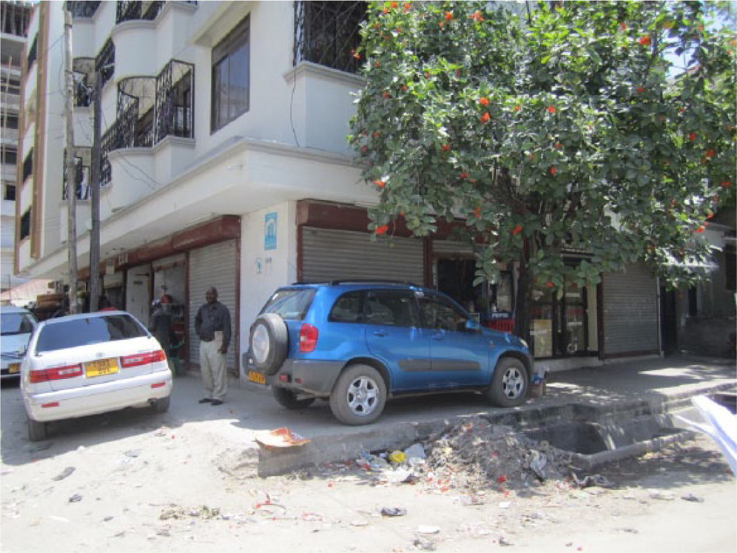
Kariakoo – city centre
Water provision and discharge in the city centre is primarily through old pipes that date back to colonial times. The population growth over recent decades has created instability in the infrastructure, which is unable to cope with increased demand in terms of both water supply and discharge volume. Pressure problems, low pipe capacity, sewer overload, and the backlog of stormwater drains are all expressions of the widening gap between water demand and effective infrastructural capacity. In a short period of time, multi-storey compact buildings have replaced much of the existing building stock, usually with domestic technological upgrades that require higher-capacity services (in both volume and performance).
All of this applies to Kariakoo, the first planned African settlement within Dar es Salaam (Photo 1). It was designed during the German colonial period, when the grid structure was established. Apart from commercial activities, this part of the city hosts residential facilities, small handcrafts, trade and some institutional activities. Since 1950 it has undergone a process of renovation, with the construction of buildings two–four storeys high. In 1999, 87 per cent of buildings were still one–two storeys high.(22) The more rapid rate of vertical growth (with buildings from 10 to 20 storeys high) since then has still relied upon generally old and low-capacity infrastructure, built in the 1940s and intended for a low-density, horizontal city. This change in the urban landscape has created water and sanitation backlogs and necessitated modification of the existing infrastructure because of the stress caused by lack of infrastructure on the newly built environment.
Storm water drainage system in Kariakoo
Until 2002, only some portions of the southern part of Kariakoo were served by a piped sewage system, with 7 kilometres of sewers.(23) The DWSSP,(24) in an effort to rehabilitate the sewerage, included Kariakoo and the Central Business District (CBD) as priority areas for sewerage upgrading. New pipes have been laid down in the past five years, progressively serving more of the northern parts of the settlement. The transition from on-site to piped sewerage systems happened for several reasons. The increased density related to vertical expansion meant that septic tanks were overloaded. Plot size in Kariakoo is small, and land is valuable; hence on-site systems are not an efficient land use solution. An existing piped system was already in place, specifically one that collected the sewage from the CBD, Kariakoo and Upanga and discharged it directly into the Indian Ocean. This facilitated the implementation and expansion of the system. Finally, Kariakoo is a sufficiently affluent area to allow for revenue collection, so that expenditure on infrastructure can be recovered with a long-term return on investment.
The stormwater drainage system has been installed by a combination of actors. Some of the ditches are actually dug and connected by the municipality; others are dug by private investors for the benefit of individual buildings; and some areas have no drainage facility. The situation mirrors the condition of the road system, which has tarmac in some areas, while portions remain unpaved. The fragmentation of stormwater drainage into different management areas is also visible in the variety of drain system types. Some ditches are covered, while others are open, functioning as a separation between the road and a pedestrian path to create a safe zone from the busy transport network of the settlement, or informally covered with wooden planks or even exhibited goods by the various shops that face them. Covering the ditches has a number of benefits, particularly when the drain section is in a high-traffic area: people can put up stalls and use the space as a display area or pedestrian path, as well as reducing the smell from stagnant water and the risk of falling in, particularly at night.
In 2002 only 40 per cent of Kariakoo was served by a drainage system, and there is no evidence of significant improvement since then. For the city centre and one of the busiest areas of the city, this represents a significant health and safety hazard, particularly during the rainy season.(25)
Water still occupies physical space in Kariakoo in the shape of tanks and pipes. These spaces must be carefully considered in relation to the built pattern, as privately driven developments, in the absence of specific urban codes, tend to maximize private occupation at the expense of infrastructure. This condition has two consequences. The first is some sort of “forced” commitment by the public authority to provide the service (necessarily underground). The second is the progressive removal of public and shared facilities (public kiosks) and the missed provision of new services like public toilets, which should be a priority given the circumstances of heavy daily commuting to the centre. Given the level of ongoing construction in the area, there are no precise figures as to the numbers in Kariakoo who are currently served by piped infrastructure.
Tambukareli – an informal settlement upgraded by the Community Infrastructure Upgrading Programme
Informal settlements, usually accounting for 60–70 per cent of the African urban population,(26) are spread over the city in both central and peri-urban areas. These kinds of settlements impact water provision and discharge in multiple directions. In central areas, the mushrooming of buildings on small plots and the overcrowded conditions leave limited space (when it is available at all) for the provision of water supply and sewerage. In peri-urban areas, settlements are usually less densely built. The built environment is affected by orographic conditions (geographical conditions of mountains) as well as position with respect to existing agricultural plots and proximity to the main road system. Pipes for water and especially sewerage cannot reach these areas unless they are placed in the immediate surrounds of existing infrastructure (for example, old pipes or reservoirs that connect water treatment plants to the city). These areas rely on other water distribution and collection and wastewater systems, such as water vendors, wells and pit latrines. Improvement of informal settlements is usually via upgrading programmes, mainly related to infrastructure provision.
Tambukareli is located in the Azimio ward and is one of the 31 sub-wards included in the Community Infrastructure Upgrading Programme (CIUP)(27) for upgrading. It is around 40 hectares in size, with almost 10,000 people living on the premises, a density of 250 people/hectare. Tambukareli has about 1,600 metres of water main pipes; there are three private kiosks and no DAWASCO kiosks. Although a treatment plant is fairly near the ward, the area has a high percentage of private wells; only 12 per cent of households have a piped connection, which provides water once a week.(28) The water table is high; hence private wells are mostly shallow, often with a high level of salinity and, particularly in the rainy season, contaminated by human waste. The site does not have a piped sewerage system; only 5 per cent of households have septic tanks, which means that out of 10,000 people, 9,500 are using on-site sanitation systems. The toilet and shower (this usually means a pit latrine, with a bucket of water and small pot within the toilet premises) are built close to the house. During the CIUP consultation process, 30 per cent of all households reported damage by recurring flooding, while 90 per cent expressed the need for stormwater drainage improvements.(29)
The upgrading of the settlement through CIUP has been successful with regard to the introduction of streets, stormwater drainage facilities and street lighting. In particular, stormwater drainage (Photo 2), which is a municipality responsibility, impinges on people’s lives in three ways. First, it changes the relations among settlement, road and public space. Second, it impacts the sanitation system, as adequate drainage lessens the amount of water that pit latrines have to accommodate (which particularly in the rainy season easily become full, due to the higher water table). Finally it impacts health; if properly maintained, drains prevent the accumulation of stagnant, muddy water – breeding sites for malaria mosquitoes and generally unhealthy. There is also unfortunately a fourth impact: in some cases drains are also used for sewage or as a dumpsite. In contrast to storm drainage, water and sanitation remain left with a total lack of coordination between the different authorities. In fact, CIUP should provide water and sanitation through a memorandum of understanding signed with DAWASA. DAWASA and DAWASCO, however, prioritized different sites in the city for the provision of water kiosks through their Community Water Supply and Sanitation Services programme.(30) As a result, water kiosks are implemented through the municipality, but managed via CBOs.
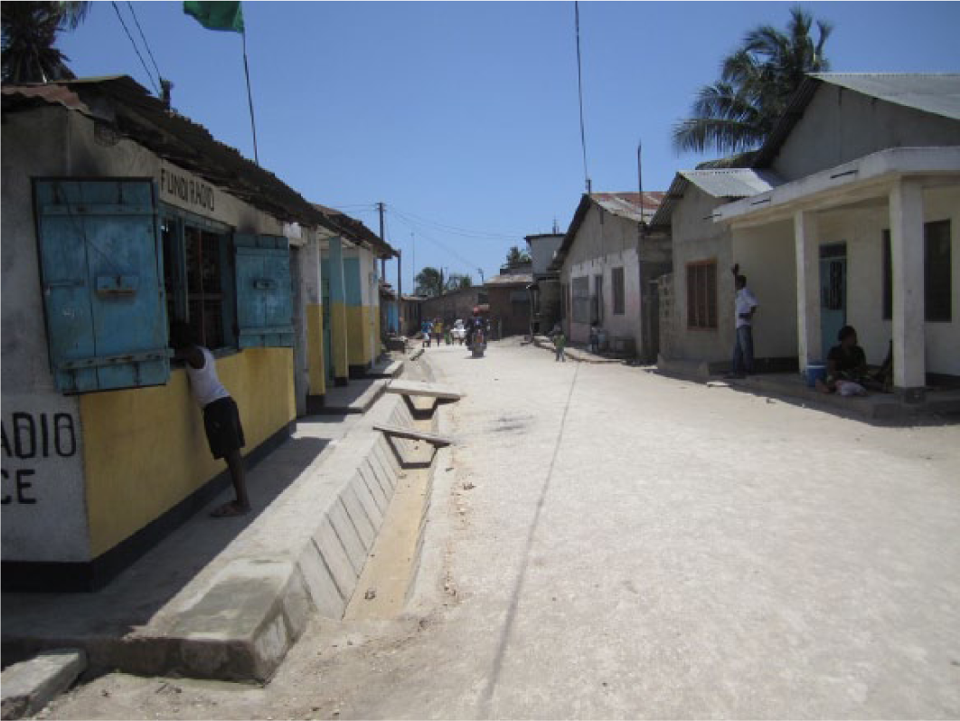
Stormwater drainage system, Tambukareli Ward
The first challenge apparent from this case regards the empowerment of local authorities that coordinate the different projects, to select the areas to be upgraded and manage the different funds. A decentralized system must coordinate and have the authority to prioritize different projects. In this case, CIUP identified 31 areas to be upgraded through infrastructure provision.(31) DAWASA, during the same period, chose 50 areas that required water supply systems.(32) The selection processes did not generate the same priority areas. This discrepancy split the overall upgrade of the settlements into two half-completed systems that in the long term will probably deteriorate because the infrastructure is not properly managed or is incomplete (i.e. the presence of water without proper storm drainage increases flooding, while storm drainage without water leads to storm drains being used as a sewage system, thus increasing disease and lowering quality of life).
The other challenge regards the prioritization by the engaged communities of different needs: the list of priorities reported by the participants in the consultation process (in order: roads, footpaths, stormwater drainage, solid waste, water kiosks, street lights, public toilets) basically put water and sanitation last.(33) Water and sanitation are, in informal settlements, essentially a family issue, eventually shared with the neighbours who form clusters based on their building positions (usually sharing the toilet and tap and washing clothes and dishes in common space), and not part of a collectively managed system that provides and manages the service. Understanding the cluster typologies (including building shape and type, number of buildings composing the cluster, and number of inhabitants) in relation to the settlement’s conditions can make it possible to define a range of on-site water and sanitation solutions to be implemented progressively and collectively. These will substitute for the kinds of privately managed latrines and shallow wells that have a negative effect on both the quality of community interaction and the environment.
Kigamboni – the New City development
The third form of city expansion is through the gradual yet continuous occupation of undeveloped areas, by either formal or informal settlements. Formal settlements with a low likelihood of short-term return on investment, or where connection costs are high, are simply not prioritized and those that are built are left with wireless, on-site and informal connections. Informal settlements, particularly with low-density conditions, have the same challenges as formal settlements. It is assumed that areas far from main transmission pipes will be reached by water connections in the long term, and in the meantime they rely on privately accessed water sources for many years. The case is different for satellite centres, or “new centralities” (smaller metropolitan areas near large metropolises). The power of investment in these new planned settlements affects work prioritization by the water authority. Revenue and cost recovery, based on private investments, together with the possibility to create new piped areas and a new sewage system from scratch, are considered an unmissable opportunity for the water authorities, thus reducing the resources that are available for the water and sanitation infrastructure and service provision for the entire city.
This is the case in Kigamboni, an area of 6,492 hectares within Temeke Municipality (Photo 3). In Kigamboni there is an ongoing master plan for the development of a “New City”, and the process is based upon the availability of relatively unexploited land to produce a new urban area. The project has been sponsored directly by the Ministry of Lands, Housing and Human Settlements Development (MLHHSD) of Tanzania, which, with little involvement of the municipality, appointed a Korean firm, Korea Land and Housing Corporation, to reach foreign capital investment in the real estate sector. The project is intended to accommodate 500,000 people,(34) with high-income-targeted housing and new facilities. It includes a new central business district, with a new government complex, the strengthening of tourism activities, and real estate speculation. The area currently hosts 82,808 people,(35) or 13,883 households. Calculations based upon the actual population and population growth projections have justified the estimate of 500,000(36) residents in 2030, with an estimated 83,400 new housing units.
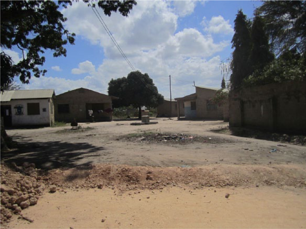
Low-density settlement and water distribution by standpipe, Kigamboni Ward
This area has not developed as rapidly as central parts of the city for two reasons. The first is its location south of the harbour, which de facto separates the land, contributing to a perception of Kigamboni as an island. The second is the absence of water provision: there is no pipe connecting the peninsula. Water is distributed by water trucks in planned residential areas and resorts; scattered settlements buy water from water vendors. Shallow wells, if used, have a high level of salinity and are generally polluted, as the whole area has a high water table.
To sustain the feasibility of the project, the area will benefit from the provision of new groundwater resources (Kimbiji and Mpera sites for water extraction), prioritized by DAWASA, which will serve the new settlements. This highlights the connection between the power of the type of settlement, designed for higher-income residents, and the consequent prioritization of this project over others for the provision of piped water for the whole city. Water demand has been calculated on the basis of actual demand by high-income households in Tanzania (250 litres/person/day). Loss is estimated at 20–25 per cent (in Tanzania in 2010, loss was actually reported to account for 52 per cent of supply), using overseas examples (Yemen, Oman, Algeria, Korea), for a total demand of 181,500 m3/day. This is more than all the water currently supplied every day in DAWASA’s service area, which is 164,000 m3/day.
The sewerage system must also be built from scratch, as no existing pipe or pond is located in Kigamboni. Data for the provisional dimensions of the sewage system include the population projection (500,000 people), the estimation of industrial wastewater and the percentage of water accounted for in the sewage system (80 per cent). Two treatment plants are planned to treat a daily sewage output of 140,000 m3/day (including industrial wastewater).
The relation between water and urban form in Kigamboni New City is noteworthy for two main reasons. The first is the power of foreign investment for the prioritization of development in specific areas. Revenue and cost recovery, based on private investment, together with the possibility to have other new piped areas and a new sewage system from scratch, have been considered an opportunity and have made Kigamboni a top priority for the exploitation of new water sources. This has negatively impacted on the rest of the city in terms of financial impact, water balance and consequent availability. The second regards the blurred situation in relation to implementation and management strategies, and the question of overcoming the possible lack of coordination among authorities, municipalities and the MLHHSD.
The size of the project seems to justify the establishment of a new agency for the project area (Kigamboni New City Development Agency or KDA), whose task is to coordinate all the activities related to the implementation of the project. In these undefined conditions, responsibilities for water and sanitation are even more uncertain. The two main actors involved in water and sanitation are DAWASA and KDA. DAWASA is in charge of the plants (two sewage treatment plants, along with water extraction facilities at the Mpera and Kimbiji sites), while KDA would be responsible for water distribution, the sewerage network, and reservoirs. While DAWASA is responsible for the distribution and discharge of water throughout the whole city in the form of pipes, sewage, oxidation ponds and reservoirs, in the Kigamboni City Project, it seems that all responsibility will fall on the to-be-established new agency, presumably public. Realistic scenarios include the privatization of branches that will distribute water in this sophisticated and secluded part of the city, thus enhancing the separation of this enclave from the rest of the city.
IV. Multiple Water and Sanitation Solutions for the City
Large centralized systems cannot cope with this scale of change in the short term. They are made up of pipes that are expensive and quickly obsolete, with a life span of perhaps 50 years, representing capital sunk into the ground. This kind of infrastructure does not evolve or adapt as quickly as cities do. It does not hold the same resilience (either technical or financial) as the city. The contemporary African city relies mostly on household-level systems – on-site sanitation solutions, and water purchased or collected outside the centralized network – that are more resilient and apt to change with the city. Urban growth, mostly uncontrolled, along with the terrific pace of population growth in post-colonial cities and their different economic and governance conditions, create a new terrain for the implementation of water and sanitation services.
Unlike the concept of the city in the early 20th century as a tabula rasa to be connected with relative ease, the present city cannot be considered bare land. The city appears to be an archipelago of different, mostly unconnected areas, mainly allied with informal or local networks that strengthen the bonds within communities but not the connection to the city. The actual size of cities, the founding elements that characterize contemporary African urbanization and the incremental level of urbanization, coupled with urban sprawl and low-density conditions, prevent the application of a “city as a whole” model from the hydraulic point of view.
The model of “city as a whole” lacks specificity in terms of infrastructural, economic and management models. A major issue holding back the laying of pipes and sewers in the contemporary African city is the extent of field-specific conditions. Although it is necessary to hold a vision and strategy for the city, there is an urgent need to plan water and sanitation schemes at the municipal level. A possible solution is to consider the different types of settlements and implement different water and sanitation systems that can best match a number of variables, i.e. distance from main pipes, position in relation to the city, possible development of the area, orography, and distance from streams and rivers. The specificity of the site must be taken into consideration in order to implement the best possible solution in terms of economic feasibility as well as future development.
One of the most pressing issues in improving water and sanitation is the need for accountable, effective local government. This is critical to guaranteeing a long-term strategy for the provision and discharge of water. CBOs or NGOs can promote primary access, stormwater drainage and small sewerage at the neighbourhood level within the short term, but there is a need for the responsible regional authorities to work on the strategic water development of the city, in combination with planners, while local governments can work at the municipal level and implement solutions in accordance with specific field conditions. In the same way, the financial aspects and laying of pipes require specific studies and easier paths for implementation, and typically the central government acts as a bottleneck both in funding and realizing new systems and in maintaining and renovating old ones.
The different projects, needs, priorities and activities can be monitored with mapping systems and should be monitored at the municipal level and then transferred to the metropolitan level for strategic coordination. The municipal level should include settlement information, including information about the different utilities and the areas being prioritized by different programmes. This system could enhance coordination among the different institutions and allow synergies among the various programmes.
As mobile phones and social networks are widely used in urban areas, it is possible to engage communities to deliver data that, through proper management, can provide useful information on water and sanitation issues (higher prices at water kiosks, malfunction of services, low water delivery by pipes). The various NGOs and CBOs, typically knowledge carriers in specific areas, can support these initiatives and function as intermediaries between the municipal level and citizens.
As noted earlier, an important factor to consider regarding water and sanitation systems in relation to the development of cities in sub-Saharan Africa is the time horizon. In Dar es Salaam, the population in 1949 was 70,000 people, while in 2010 it was 3,300,000, with 80 per cent of the city living in unplanned settlements and relying on informal economic activities. DAWASA was established in 1997, DAWASCO in 2005. In the last decade the two institutions have had to work on the consolidation of skills and on building knowledge, data collections and databases through which to implement new policies, priorities and technical works – not just on building physical infrastructure. When evaluating and analysing the water and sanitation sector, in order to choose the proper service, it is therefore necessary to consider how much has to happen in these regards over relatively brief periods, and to take account of the different starting conditions that determine the current situation.
Negotiating public vs. private control is another possible challenge that the water and sanitation sectors face. Again, Dar es Salaam exemplifies this condition. Urban water authorities were established in Tanzania in the 1990s, and DAWASA, established in 1997, incorporated the sewerage department for the first time, thus becoming responsible not only for the water provision system, but also for water discharge. In 2003, a failed attempt at privatization resulted in the splitting of the function between infrastructure and service provision. DAWASCO, a state-controlled company, was established in 2005 in order to carry on the operations and service provision. The separation of the competencies between provider and operator has come, de facto, from a failure of privatization. The two institutions coexist today in an uneasy relation, and in the future DAWASCO may be privatized or DAWASA and DAWASCO may be merged. Moreover, planning activities remain a shared and often overlapping responsibility between the central government and local planning authorities, while water authorities are still struggling to plan for long-term conditions in terms of responsibilities, capacity building and identity.
V. Conclusions
Many African countries have experienced overall development, but with the consequence of growing inequity among different locations. Rather than solving the problem, centralization of water management and the overlapping of responsibilities appear to have contributed to a backlog in the provision and maintenance of infrastructure.
The continued trend of population growth and rapid urbanization strained a deteriorating water and sanitation infrastructure. Population growth and sudden urbanization are scaling up the challenges of the city, which is expanding and building entire settlements in further areas, usually unconnected by any service. Both formal and informal development are sharing the same complex economic conditions. There are two separate models of growth here that have the same complex economic conditions. The first, the more formal model, attracts foreign investment and builds new neighbourhoods that either replace old central settlements or establish new real estate on unexploited land. The second, based on the informal market, uses informal labour to build informal settlements, and shapes the future conditions of the contemporary metropolis.
Water and sanitation reflect these biases. The only approach to the formalization of the city, in terms of services, comes with large technical systems, usually working at the city scale (a scale as large as that of major European metropolises), while few projects consider the small to medium scale, or the necessities of ordinary maintenance or rehabilitation of the infrastructure. Large systems are not only considered the preferable solution by authorities; they also receive the largest amount of funds from international donors.
The analysis of the settlements described demonstrates that a number of characteristics combine to define the relation between the urban environment and the water and sanitation services. All the different parameters mentioned above – orography, distance from water pipes, income conditions, land value, proximity to main watercourses, management of resources, and climate conditions, among many others – determine in remarkable ways the settlement’s level of service in terms of water and sanitation infrastructure, and more generally, the quality of life within the city.
The planning discipline needs to reconnect city development to the understanding of water and sanitation in order to overcome the sectoralization and technocratization of the water and sanitation sectors and to implement innovative strategies for the development of the contemporary city, considering both piped provision and its alternatives as possible solutions to the provision of water and discharge.
Footnotes
1.
Kaika, M and E Swyngedouw (2000), “Fetishizing the Modern City: The Phantasmagoria of Urban Technological Networks”, International Journal of Urban and Regional Research Vol 24, No 1, pages 120–138.
2.
Swyngedouw, E (2004), Social Power and the Urbanization of Water: Flows of Power, First edition, Oxford University Press, Oxford, 209 pages, page 1.
3.
Graham, S and S Marvin (2000), Splintering Urbanism: Networked Infrastructures, Technological Mobilities and the Urban Condition, First edition, Routledge, London and New York, 477 pages, page 12; also Harvey, D (1985), The Urbanization of Capital: Studies in the History and Theory of Capitalist Urbanization, The Johns Hopkins University Press, Baltimore, 289 pages; and Swyngedouw, E (1993), “Communication, Mobility and the Struggle for Power over Space”, in G A Giannopoulos and A E Gillespie (editors), Transport and Communications Innovation in Europe, Belhaven Press, London, 370 pages.
4.
The piped paradigm is characterized by use of pipe networks as the sole source of urban domestic water and distribution via centralized off-site systems. See Braadbaart, O (2012), “North–South Transfer of the Paradigm of Piped Water: The Role of the Public Sector in Water and Sanitation Services”, in J E Castro and L Heller (editors), Water and Sanitation Services: Public Policy and Management, Routledge, London, 392 pages.
5.
To deepen the concept, refer to Foucault’s theories on biopolitical control such as Foucalt, M, (1993) Surveiller et punir: Naissance de la prison, Gallimard, Paris, 364 pages.
6.
Among these: Abidjan (Côte d’Ivoire), Addis Ababa (Ethiopia), Bamako (Mali), Banjul (Gambia), Brazzaville (Republic of Congo), Cotonou (Benin), Dar es Salaam (Tanzania), Freetown (Sierra Leone), Harare (Zimbabwe), Ibadan (Nigeria), Kampala (Uganda), Khartoum (Sudan), Kinshasa (Democratic Republic of Congo), Lomé (Togo), Monrovia (Liberia), Nairobi (Kenya), Sokoto (Nigeria) and Yaoundé (Cameroon).
7.
United Nations, Department of Economic and Social Affairs, Population Division (2014), World Urbanization Prospects: The 2014 Revision, CD-ROM edition, accessed 2 August 2014 at ![]() .
.
8.
The WHO/UNICEF Joint Monitoring Programme provided in the 2000 Global Assessment the definitions of improved resources: an “improved” drinking-water source is one that, by the nature of its construction and when properly used, adequately protects the source from outside contamination, particularly faecal matter. An “improved” sanitation facility is one that hygienically separates human excreta from human contact. Accessed 31 January 2015 at ![]() .
.
9.
10.
Collignon, B and M Vézina (2000), Independent Water and Sanitation Providers in African Cities, International Bank for Reconstruction and Development/World Bank, Washington DC, 68 pages, page 5.
11.
Minges, M, C Briceño-Garmendia, M Williams, M Ampah, D Camos and M Shkratan (2009), Information and Communications Technology in Sub-Saharan Africa: A Sector Review, AICD background paper, 10 pages, accessed 3 September 2014 at ![]() .
.
12.
Foster, V (2008), Overhauling the Engine of Growth: Infrastructure in Africa, Africa Infrastructure Country Diagnostic executive summary, World Bank, 24 pages, pages 3–4; also Banerjee, S, H Skilling, V Foster, C Briceño-Garmendia, E Morella and T Chfadi (2008), Ebbing Water, Surging Deficits: Urban Water Supply in Sub-Saharan Africa, Africa Infrastructure Country Diagnostic Background Paper 12, World Bank, Washington, DC, 83 pages; and Morella, E, V Foster and S Banerjee (2008), Climbing the Ladder: The State of Sanitation in Sub-Saharan Africa, Africa Infrastructure Country Diagnostic summary of Background Paper 13, World Bank, Washington, DC, 9 pages.
13.
WHO/UNICEF, Joint Monitoring Programme for Water Supply and Sanitation (2014), “Estimates on the use of water sources and sanitation facilities”, Country Report, Tanzania, accessed 27 March 2015 at http://www.wssinfo.org/documents/?tx_displaycontroller%5Bregion%5D=&tx_displaycontroller%5Bsearch_word%5D=tanzania&tx_displaycontroller%5Btype%5D=country_files.
14.
See National Bureau of Statistics (2012), “Population of Dar es Salaam by Sex, Number of Households, Average Household Size and Sex Ratio”, 2012 Online Census Database, accessed 2 September 2014 at ![]() .
.
15.
Kironde, J M Lusugga (2000), “Rapid Urbanization in Tanzania: The Government’s Coping Strategies”, in S Ngware and J M Lusugga Kironde (editors), Urbanising Tanzania: Issues, Initiatives and Priorities, Dar es Salaam University Press, Dar es Salaam, 156 pages, cited in Kjellén, M (2006), From Public Pipes to Private Hands: Water Access and Distribution in Dar es Salaam, Tanzania, Stockholm University, Stockholm, 329 pages, page 85.
16.
Water is stored in reservoirs and pumped to the city through pipes.
17.
EWURA, Water Utilities Performance Report for 2009-10 (EWURA, 2010), 180 pages.
18.
See reference 17.
19.
See reference 17.
20.
At the city level, 27 per cent of the stormwater drainage is covered, but the three municipalities show slightly different percentages: Kinondoni 5.6 per cent, Ilala 35 per cent and Temeke 4.4 per cent. ![]() , Dar es Salaam Infrastructure Development Programme, Dar es Salaam City Council report, 36 pages, page 13.
, Dar es Salaam Infrastructure Development Programme, Dar es Salaam City Council report, 36 pages, page 13.
21.
Kironde, J M Lusugga (1994), The evolution of land use structure in Dar es Salaam 1890-1990: A study in the effects of land policy, Doctoral thesis, University of Nairobi, page 90.
22.
Directorate of Human Settlements Development, Ministry of Lands, Housing and Human Settlements Development, in collaboration with Dar es Salaam City Council (2002), Kariakoo Area Development Plan, 49 pages.
23.
See reference 22.
24.
Dar es Salaam Water Supply and Sanitation Project, a US$ 165 million World Bank-funded project through DAWASA, was designed to rehabilitate and extend the water and sewerage systems in Dar es Salaam (2003–2010).
25.
See reference 22.
26.
27.
CIUP is a programme developed in the three municipalities, funded by the World Bank through the Dar es Salaam City Council. Its main scope is to address and upgrade informal settlements through provision of roads, streetlights, stormwater drainage and solid waste collection. The programme has been divided into two phases: the first started in 2005 and was completed in 2010; the second started in 2007 and ended in 2012. The number of sub-wards included in the programme is 31, and the total population engaged in the upgrading is about 330,000 people, in about 20 per cent of the total unplanned settlements in Dar es Salaam. ![]() , Mid-term review of the Local Government Project.
, Mid-term review of the Local Government Project.
28.
29.
See reference 28.
30.
This programme, by DAWASA, aims to connect different low-income communities unreached by DAWASA through a system of water kiosks.
31.
32.
33.
See reference 28.
34.
Calculations do not consider temporary residents (resort visitors, daily commuters, etc.).
35.
Korea Land & Housing Corporation (2010), Three Dimensional Masterplan for Kigamboni New City, Main Report, 320 pages, page 27.
36.
It is necessary to highlight that the increase in population will not include the present population, as it “will be displaced to resettlement areas within the planning area or other areas outside the planning areas”. See reference 35, page 78.