
Abstract
Building Information Modeling (BIM) was created to address the Architecture, Engineering, and Construction (AEC) industry’s lack of collaboration among consultants. Advances in cloud BIM have led to the easy exchange of data and real-time collaboration among consultants from conceptual design to the detailed construction drawing stage and through the project life cycle. This is critical in the development of smart cities. Cloud BIM also facilitates visualization of the city and data exchange for internet of things (IoT). Smart city development involves incorporating data from sensors and hardware attached to existing infrastructure. This article studies cloud BIM technology as a means of project integration in smart city development. To do this, a case study of digital modeling for the development of a smart city was done. Benefits include seamless communication, monitoring real-time progress, and visualization of files. Problems encountered include governance problems, problems preserving work sets, the integrity of drawings, and difficulty specifying coordinates on-site.
Keywords
Introduction
Smart cities have been touted as the bedrock of the future. Developing a smart city involves the linking of buildings to infrastructure of the city using sensors, internet of things (IoT), and other technological tools. IoT involves incorporating data from sensors and hardware attached to existing infrastructure. Health care, transportation, education, and energy requirements of communities are becoming more efficient through smart city development. Implementation methods on development of smart cities should be defined. Cloud BIM is one of the technologies that can be used for integration that is required in smart city development.
Building Information Modeling (BIM) was implemented to solve collaboration problems among consultants in the Architecture, Engineering, and Construction (AEC) industry. Advances in cloud BIM have led to an easy exchange of data and real-time collaboration among consultants from the conceptual design to the detailed construction drawing stage and through the project life cycle. This is important in the development of smart cities with several buildings in a city. BIM 360 enables seamless exchange of drawings between consultants, facility managers, civil engineers, and other stakeholders in the project. It also facilitates visualization of the city and data exchange for IoT. This article studies cloud BIM technology as a means of project integration in smart city development. To do this, I completed a case study of digital modeling of a smart city for an institution. Advantages include seamless communication, monitoring real-time progress, and visualization of files. Problems encountered include governance problems, problems preserving work sets, loss of information in drawings, and difficulty in specifying coordinates on-site.
Cloud BIM also creates an environment for easy file management and easy access to drawings: Drawings can be assessed easily on field when they are stored in the cloud. Furthermore, the development of the Industry Foundation Classes (IFC) schema has improved interdisciplinary collaboration in the construction industry across the globe. Consultants can use IFC files to exchange drawings created by different applications. Also, the BIM server document management system has been used to manage projects.
These technologies have emerged as a means of resolving collaboration issues among consultants in the construction industry. Despite these advantages, there are some challenges facing cloud BIM such as interoperability of cloud BIM services, administration and governance of cloud-based BIM, shortage of expertise, and dependency on internet connections. Concerns about the administration and governance of cloud-based BIM are a serious issue. Because all consultants have access to the drawing files, rules must be placed on the ownership of drawings and who checks drawings for preservation of quality. For a smart city to be designed and developed, drawings have to be upgraded to be on the same master model. Losses of data and work sets during upgrades were also identified as issues.
The intent of this article is to review the application of recent technologies in BIM collaboration and to review cloud BIM as a means of collaboration and project integration in smart city development using the Master Plan of Georgia Institute of Technology. A limited number of studies have been carried out on cloud BIM and smart city development, but instruments, procedures, and methods for digital modeling of smart cities have not been clearly defined. Thus, this research is an experimental analysis of digital smart city modeling using a case study. The aim of this study is to investigate the use of cloud BIM, Revit, Autodesk Infraworks, and other modern technologies for digital modeling of a smart city. This study evaluates the instruments for developing a digital model and identifies the challenges encountered while using the products. The article also creates methodologies for developing smart cities using cloud BIM. Finally, a proposed digital modeling workflow for smart city development is recommended.
Literature Review
A literature review of three collaborative technologies in use in the AEC industry was conducted: cloud-based BIM technologies, IFC, and BIM server. Data exchange was formerly done manually and then through IFC. However, recent technologies developed to improve collaboration include cloud-based BIM and BIM server. Challenges encountered in cloud BIM implementation and integration will also be discussed. There will also be a review of the utilization of cloud BIM for smart city development. The use of IoT such as sensors, chips, and actuators for smart city development are also discussed.
Several studies have been done on the development of smart cities. Benchmarks used in evaluating smart city development were studied by Leonidas (Anthopoulos et al., 2015). Han evaluated the construction of smart cities based on big data (Han & Wang, 2018). A conceptual framework for evaluating digital cities was developed by Duarte (Duarte et al., 2014).
Cloud-Based BIM Technology
Cloud–BIM integration is the second phase of BIM growth in the AEC industry that will create another wave of change in the construction sector (Wang et al., 2014). The development of cloud BIM promotes collaborative BIM data generation and consumption (Afsari et al., 2016). Combining cloud and mobile technologies will lead to technological advancement that can easily be assessed at the site. Porwal suggested that the incorporation of cloud computing in the BIM process could promote efficient planning over the life span of a project (Porwal & Hewage, 2013). Ease of access, storage manageability, and high-performance computing abilities are the benefits of using cloud BIM technology for managing and storing BIM data (Alreshidi et al., 2018). Types of cloud BIM applications include BIM Explorer, BIMcloud, Autodesk’s A360, BIM 360, BIMServer, ONUMA System, Trimble Quadri, and Trimble Connect (Afsari et al., 2016).
Wang undertook a study that determined cloud BIM technology, regardless of geographic location, would provide real-time tracking of construction, collaboration, clash monitoring, and sharing of information among members of the construction team (Wang et al., 2014). However, they noted that most of these solutions concentrate on the design and development phases of a project while the use of cloud BIM for operation, facility management, energy analysis, and other postconstruction activities has not been established. Cloud BIM can assist with sharing as built drawings for remodeling of projects. The use of cloud BIM has also led to collaboration in other fields. Xu proposed the idea of city information modeling (CIM) with the intent of significantly improving urban development and urban management. The model facilitates the exchange of knowledge, multiservice, and multifield cooperation to create a digital city (Xu et al., 2014). The main benefits of cloud computing are accessibility from any location, scalability, and, most importantly, cost-effectiveness (Das et al., 2014).
Several studies have indicated that integrating mobile devices like tablet personal computers, smart phones, and personal digital assistants with cloud BIM will enhance the ability to track real-time on-site data (Matthews et al., 2015). Cloud technologies are used for web interface. which can use a server to handle large BIM information (Logothetis et al., 2018). Cloud BIM can provide multiple users with online real-time services and, at the same time, allow the distributed storage of big data using multiple servers, conduct parallel analysis and computing, and display all online BIMs in a 3-dimensional (3D) visualized way on standard web browsing (Chen et al., 2016). Cloud BIM is also used for costing, real-time quality checks and for site diaries. BIM 360™ Field can be used effectively for project management at the site.
The major hurdles facing cloud BIM adoption include the lack of clarification on who is responsible for ownership of cloud BIM models (Wang et al., 2014). Interoperability is the secret to efficient execution of the cloud services. The problem, however, is that it will be challenging for cloud BIM solutions developed by vendors operating on different cloud platforms to interoperate (Afsari et al., 2016). Thus, although cloud BIM has many benefits, there are also many challenges to its adoption.
Taxonomy of Cloud-Based BIM Technology
The essential idea of cloud computing is to manage and schedule uniformly network-connected computing resources and to constitute a pool of computational resources that can provide a user service according to their needs and requirements. The network that provides resources is referred to as a “cloud.” The resources in the “cloud” can be extended infinitely and can be accessed at any time, used as needed, and paid for (Jain & Gujral, 2014). Cloud computing architecture can be separated into four layers: hardware, infrastructure, platform, and application (Zhang et al., 2010). Cloud computing is described as a model for allowing ubiquitous, convenient, and on-demand access to a connected pool of configurable computing resources. These resources include networks, servers, storage, and software applications, which can be easily provided and released with minimal delay or interaction between service providers (Clohessy et al., 2014). Different kinds of architectures are available for cloud computing, and the choice depends on data model requirements. Each architecture arranges the information collected in a different way (Chamoso et al., 2018).
Cloud-Based BIM Governance
Collaborative governance was established as a modern governing approach in recent years. This approach attempts to bring various stakeholders to a shared platform to reach a consensus (Alreshidi et al., 2018). Collaborative BIM servers have various technical requirements, such as “a central model repository linked to other federated data repositories; a variety of spaces for public and private models; global unique identifier (GUID) for object identification; information delivery manuals (IDM)-based specifications; [and] secure access to the model” (Singh et al., 2011, p.141). However, in addition to the cloud infrastructure, a governance framework should be created to support the processing of data created during construction. Socio-organizational and legal standards for project management should be established as cloud BIM provides various stakeholders with exposure to project data (Alreshidi et al., 2018).
Challenges to Cloud BIM Implementation
Mahamadu et al. (2013) investigated challenges to cloud–BIM integration, which include access authorization to users, information sharing boundaries, and legal and contract limitations. These challenges have made it difficult for consultants to trust cloud BIM as a means of collaboration. Alreshidi et al. (2018) identified cost of initial set up, maintenance, and training involved as a major challenge to the adoption of BIM. Another hurdle in cloud BIM adoption is its dependency on internet connection, which is especially difficult in developing countries where internet connection is not always available.
While the role of technologies in implementation of a smart city cannot be overemphasized, access to the cloud BIM platform and the use of various technologies make full integration of all data collected difficult. A lot of technologies such as handheld scanners, geospatial artificial intelligence, unmanned aerial vehicles, and geospatial augmented reality applications are used for smart city development (Shirowzhan et al., 2020). However, data from these technologies must be integrated and this is a complicated task.
As with any new technology resistance to adoption is a major issue with the cloud BIM technology. Several principles, such as market readiness to use emerging technologies, technology acceptance, and implementation mechanisms, are major deterrents to the use of cloud BIM (Shirowzhan et al., 2020). Further research should be done on this.
Industry Foundation Classes (IFC)
A criterion for defining the object representations for AEC projects was developed by the International Alliance for Interoperability (IAI). According to Autodesk (2019), “the model schema developed by the IAI is defined in the EXPRESS language in accordance with ISO STEP (Standard for the Exchange of Product Data) and has become known as IFC (Industry Foundation Classes).” IFC contains object specifications, also known as classes, that provide a useful framework for data sharing between applications (Renaud et al., 2008). IFC files were the first files for collaboration in the AEC industry before BIM servers and cloud BIM were introduced.
IFC offers the universal standard for data exchange. For instance, you can export the Revit-developed building model to an IFC-certified software that uses the IFC format. Likewise, one can import an IFC file in Revit, generate an RVT file, and develop the model in Revit (Autodesk, 2019). IFC is ideal for resolving the problem of interoperability between applications.
Shi stated that “With the growth in popularity of the IFC format used in construction industry, it often requires an effective IFC comparison method to keep track of important changes during the life cycle of construction projects” (Shi et al., 2018, p.53). “Globally unique identifier (GUID) is a unique identifier for object instances across applications and systems” (Shi et al., 2018, p.54). Many commercial BIM platforms, such as Autodesk Revit, Navisworks and Graphisoft ArchiCAD, follow the GUID-based comparison.
According to Fischer, “IFC’s enabled interoperability between 3D geometric and non-geometric data such as thermal values, construction assembly, and material properties” in different programs (Fischer & Kam, 2002, p.27). They noted that while there were some obstacles in the implementation of IFC on HUT-600 pilot, it revealed the potential advantages of data interoperability throughout the AEC industries (Fischer & Kam, 2002). The benefits observed in this project included “expedited design and improvement in the quality of interdisciplinary collaboration” (Fischer & Kam, 2002, p.26).
Mitchell performed a collaborative analysis using IFC and found that establishing the semantics of each entity in the model correctly is a necessary aspect of design precision, but this can take a lot of time (Mitchell & Plume, 2007). They also emphasized “the need for building elements to include property data that will support specific analysis” (Mitchell & Plume, 2007, p.34). All building components should have a material specification to allow for thermal, acoustic, sustainability, or cost-efficiency calculations.
BIM Server
Mitchell and Plume (2007) defined BIM server as a collaboration platform that maintains a repository of the building data and allows native applications to import and export files from the database for viewing, checking, updating, and modifying the data. BIM servers provide a platform for exchanging 3D models with attributes and embedded intelligence. According to Singh, “BIM servers are expected to allow the exchange of information between the various applications involved in a building project life cycle including design tools, analysis tools, FM tools, and document management system” (Singh & Wang, 2011, p.134). To accomplish the aim of shared product data models across a building’s life cycle, technical, method, and standardization issues need to be addressed (Beetz et al., 2010). Developing cost-effective and user-friendly model server technology is key to advancing the industry (Beetz et al., 2010). Exporting IFC should be the first choice because it is a standard that is supported by major BIM tools. However, this format is not suitable for efficient real-time queries. The exchange of information through the IFC file format has several limitations in the actual collaborative design.
According to Minho, to resolve issues of interoperability from IFC, “BIM Server can directly manage the information produced by the BIM Modeler and BIM Checker, it is possible to store and manage all information generated during the collaborative design in an integrated manner” (Oh et al., 2015, p.202). “The BIM Server consists of a Database Management System (DBMS) in which BIM data are stored, the Server Manager, which supports multiple access for project participants, and the Server Access Control to control data accessibility by user” (Oh et al., 2015, p.202). The Server Access Control defines the extent of information sharing between parties, considering security concerns in legal contracts and copyrights (Oh et al., 2015).
BIM and Smart City Development
BIM has been used for collaboration in large-scale planning and sustainability in all aspects of building projects. It has been used for energy efficiency, sewage planning, water demand, assessment of carbon dioxide emissions, and other environmental factors. It has been touted as the instrument for interconnectivity of buildings and external services in smart city planning. For this to happen, the building has to be in the correct geographical position. The position of the building in relation to other services has to be established. The technique to achieve this has not been studied extensively. This involves interdisciplinary collaboration between the urban planner, architect, civil engineers, mechanical engineers, and other stakeholders in the project. Cloud BIM has provided an avenue for interdisciplinary collaboration for the different programs. For effective coordination, there should be a BIM coordinator who is conversant with the different programs.
Kim et al. (2015, p.98) stated that “Integration of data included in the BIM from different disciplines enables the quick and accurate extraction of information from the components and evaluation of the performance metrics.” The advantages of cloud computing include “elasticity or flexibility, as users are free to request the number of resources they need from the cloud. Cloud computing is more user-friendly and on-demand, as the services are tailored to individual requirements” (Wang et al., 2014, p.285). Cloud technology allows smaller companies who could not afford all the specific applications to work together.
IoT and Smart City Development
The composition of a simple IoT architecture can be used to map out a smart city development. This architecture starts from the hardware layer to the communications layer to the data analytics layer and finally the service layer. Rhee (2016, p.2) implied that This simple IoT architecture can serve as an initial template to map different smart city solutions to build consensus on their technical interoperability, which is essential in addressing the challenges in accelerating the market momentum for IoT and smart cities.
Positioning the hardware layer is important for the development of a smart city framework. The hardware layer is located at the bottom of the structure and it contains tangible hardware elements such as sensors, actuators, chips, and radios. The elements in this layer often communicate directly with the environment, other hardware elements, and sometimes users or consumers (Rhee, 2016).
In the design of smart cities, the relationships between the hardware layer and the external infrastructure must be determined. This is necessary for the communications layer, which connects the hardware and data analytics layers. These data are then used to provide services for a smart city. For all this to be done, methodologies for the design and development of smart cities should be mapped out. Cloud BIM technology has made it possible for this to be developed.
Shahrour et al. stated that “different tools have been developed for the digital modeling of urban systems such as the Geographic Information System (GIS) for urban infrastructures, Building Information Modeling (BIM) for buildings, the Civil Infrastructure Modelling (CIM) for civil engineering infrastructures” (Shahrour et al., 2017, p.1). The different tools have to be integrated for the efficient development of a smart city. This article investigates the use of cloud BIM for the development and integration of digital models in a smart city.
Research Methodology
To examine BIM as a means of collaboration and project integration in smart city development, a case study of a project utilizing Revit, BIM 360, and Autodesk Infraworks for the master plan of the Georgia Institute of Technology as a means of developing a smart city was done.
This project involved existing buildings in the Atlanta Campus of the Georgia Institute of Technology. A total of 66 individual Revit building models were used for the project. Existing Revit models were updated for the project. Observations from active participants in projects were documented.
For this study, the smart city development process was evaluated. The study uses BIM 360 as a cloud BIM program and Autodesk Revit for digital modeling. The scope of the smart city is the Georgia Institute of Technology campus in Atlanta. Requirements for digital city modeling include instrumentation for data development, data interconnection, and software intelligence (Anthopoulos et al., 2015). The concepts of connectivity, accessibility, and communicability are also essential for smart city development (Duarte et al., 2014).
The methodology consists of six steps: developing individual models in Revit, creating the existing master plan in AutoCAD, and placing buildings in the correct geographical location, storing individual Revit models and master plan in BIM 360, linking individual models to a master plan in the correct geographical position, and exporting individual buildings and master plan to Autodesk Infraworks.
Task technology fit theory is used for this research. Task technology fit is one factor that has been shown to affect the use of information systems and their performance impacts (McGill & Klobas, 2009). When viewed in terms of linear conceptualization, the output is directly proportional to the input. Task technology fit is the association between task requirements, the functionality of technology, experience of technology, and knowledge of tasks. This means that the technology must support the methods needed to perform an assignment. For BIM and Cloud BIM, this is especially true. This study investigates the use of cloud BIM for smart city development and assesses its efficiency as a tool for digital modeling of a smart city. Parameters used for this study are based on volume, speed, accuracy, information management, visualization of information, and stakeholder participation. Parameters were determined from the literature review of the subject matter. This study is an experimental analysis of an ongoing project.
Case Study
A case study was conducted using Revit and BIM 360 for collaboration in preparing a digital master plan of the school for a smart city project.
Instrumentation for Model Creation
Existing AutoCAD drawings, topographies of the site, and Revit drawings of individual buildings were linked together on the master site plan as shown in Figure 1. The existing AutoCAD file of the campus master plan had to be moved to the right coordinate system in user coordinate system (UCS). The AutoCAD file is imported into Revit to create the Revit master model.

Existing Revit files on masterplan.
Individual building models had to be upgraded to the same version of Revit before they could be attached to the master model. Each building is saved as a central file. To position the drawings, the following steps were taken: Coordinates are acquired from the AutoCAD file linked on Revit. The coordinates of the existing building as shown in the AutoCAD master plan are retrieved with “Reporting Shared Coordinates” on the location panel. Revit building models are then linked using shared coordinates, and new coordinates are specified. This positions the building at the correct geographical location. The models are uploaded to BIM 360 to allow for collaboration with the Facilities Management department. The LL 84 coordinate system is used to link models to existing infrastructure in Autodesk Infraworks.
Data Interconnection/Storage
Once models are in the right location, Revit models are uploaded to the cloud (BIM 360) for collaboration. Individual models are stored in the document management system as shown in Figure 2. The individual Revit buildings are linked to the master plan from the cloud. After drawings are placed on the master site plan, data are imported into Autodesk Infraworks to link with the existing infrastructure. BIM 360 is used for cloud storage. The buildings are interconnected through existing infrastructure. Data from each building model can be linked to the city model laying the foundation for smart city development. Architectural; mechanical, electrical, plumbing (MEP); and structural drawings are stored in the same folder for easy access.
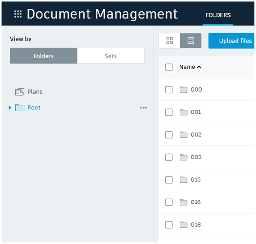
Individual files uploaded to BIM 360.
Communicability
These models can be used to capture data from sensors in the hardware layer. The relationship between the sensors and the environment can also be visualized and recorded. This will aid city planners and the government in the effective development of the city. Electrical plans from individual buildings can be linked to the electrical network of the city. Individual building plans and the masterplan are stored in the same location. They are linked together in a master model providing a basis for data interconnectivity. The master plan is connected to the existing infrastructure in Autodesk Infraworks as shown in Figure 3.

Autodesk Infraworks for existing infrastructure.
Challenges Encountered
Several challenges were encountered in the research. Mapping out the process to be used for the execution of the project took a long time. Collaboration on the project started with the BIM server. Problems with the administration of governance led to migration to BIM 360. BIM 360 facilitated the execution of the project. However, several problems were encountered.
The large size of the master site slowed down the pace of work. Individual Revit models had to be unlinked to facilitate the process. Linked files disconnected after some time, leading to data loss. Drawings had to be upgraded to the same version of Revit. This created issues with preserving work sets and the integrity of drawings.
Coordinates could not be specified on the cloud (BIM 360). Drawings had to be downloaded locally and uploaded back after coordinates were specified. This increased the time spent on the project. Systems had to be put in place for drawings to be checked during the project. Governance problems encountered included ways of tracking changes made to the drawings.
Findings and Discussion
BIM 360 facilitated seamless communication between stakeholders of the project.
Volume
Drawing files were uploaded and accessed using BIM 360 cloud services. Sixty-five Revit files, the Revit master plan, and Autodesk Infraworks files were all uploaded to BIM 360. The cloud services were adequate for the volume of work.
Speed
The size and number of drawing files reduced the speed of execution of the project. Some of the Revit drawings had to be turned off for proper execution of work.
Accuracy
Project location and accuracy of drawings were monitored with Revit. Clash detection from drawings on the master plan could easily be detected with BIM 360. Clash on drawings from different disciplines was detected easily. This increased the accuracy of drawings on the site plan. Changes in drawings were updated immediately in BIM 360.
Information Management
BIM 360 provided easy file management for drawings. Folders were created for each drawing and the master site plan. The document management system was very efficient and easy to use. This can be used for large-scale drawing and smart city development. Figure 4 describes the proposed workflow for digital modeling of a smart city developed from the case study. The documents were filed in a database and each drawing could be visualized.

Proposed workflow for cloud BIM computing in smart city development.
Stakeholders’ Participation
All stakeholders were able to monitor the real-time progress of the project using BIM 360. Initially, there was resistance from the managers but once they started using cloud BIM, they uploaded more files to BIM 360. It was easy for them to monitor when the files had been worked on through a change in the name of the files. For smart city development, different aspects of the Government involved in the smart city can monitor progress in real time. The city infrastructure can be coordinated with data from individual buildings.
Visualization of Information
Visualization of the project output was clear and authentic with the use of BIM 360. The use of BIM 360 cloud technology allowed us to visualize several Revit files for individual buildings in the master plan. This also helped with data interoperability. With the use of BIM 360 cloud services, the hardware layer of IoT technology from the buildings could be easily linked with external data for the development of a smart city.
Conclusion
Several studies have been done on BIM as a means of interdisciplinary collaboration. Studies have also been done on BIM and sustainability, energy management, and services integration. Cloud BIM is an excellent program for interdisciplinary collaboration. However, studies should be done on how to integrate geographical locations in cloud BIM to achieve the interconnection of buildings, services, and infrastructure. This study mapped out a workflow for digital modeling of the smart city using Revit, AutoCAD, BIM 360, and Autodesk Infraworks. Digital city modeling is an essential part of smart city development. It is necessary for the connection of the hardware layer to the communications and data analytics layer. This will enable the provision of services that can be developed from smart cities.
Achieving the interconnected highway between the buildings and the external infrastructure in the city requires collaboration from different disciplines. There is a need for BIM specialists who are conversant with programs from different disciplines to coordinate the master-planning process. Cloud BIM has facilitated document exchange and collaboration for smart cities; however, processes, methodologies, and frameworks on how cloud BIM collaboration can be used for the development of smart cities are yet to be mapped out.
Future Research and Recommendations
Future research should be done on the integration of IoT and cloud computing for smart city development. Other areas for future studies are the use of digital models to capture data from sensors in the hardware layer. Implementation mechanisms for cloud BIM should be studied further.