
Abstract
Exploring residential segregation in the Gateway City with photographer Bryan Travis.
St. Louis’s struggles with race and place are nothing new. In 1916, the city passed the nation’s first residential segregation ordinance. The law prohibited individuals from living on city blocks where 75% of the population was of another racial group. Within a year, the NAACP was able to overturn the ordinance, but the White population’s response was social closure in the form of homeowner’s associations that promoted restrictive covenants (curtailing the use of land by certain racial groups). The Marcus Avenue Improvement Association, for example, created four racially segregated census tracts bordering Marcus Avenue (one census tract at 49% Black and three census tracts at less than 1% Black).
When, in 1948, these sorts of restrictive covenants were deemed unconstitutional in the landmark case Shelley v. Kraemer, the law again proved insufficient to prevent racial discrimination in St. Louis’s neighborhoods. The case featured Black families from St. Louis and Detroit and highlighted their inability to purchase homes in White neighborhoods. In many ways, it also symbolized civil rights gains that caused the U.S. to recognize the promise and peril of the Thirteenth and Fourteenth Amendments. Even as it stopped the enforcement of restrictive covenants, it could not prevent racial discrimination from being written into housing deeds—a process that would not be deemed illegal until the 1968 Fair Housing Act.
U.S. residential segregation peaked in the 1960s, but its decline, especially from 1980 to the present, has been slow. Blacks—still the most residentially segregated racial group—have seen average neighborhood racial composition rates that, in 2010, still looked like it was 1940. U.S. cities have experienced suburbanization, White flight, and gentrification, and yet, like St. Louis, they remain hyper-segregated.
In St. Louis, Delmar Boulevard carves a well-known divide. It runs east and west throughout the city, dividing the city into north and south. Delmar divides neighborhoods by race, socioeconomic status, and resources, all of which structure residents’ social, economic, and health opportunities.
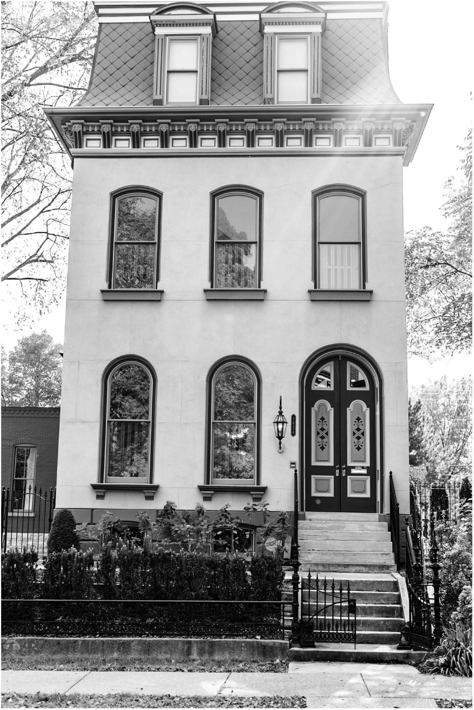
The Shelly House: the house that helped end racially restrictive neighborhood covenants.
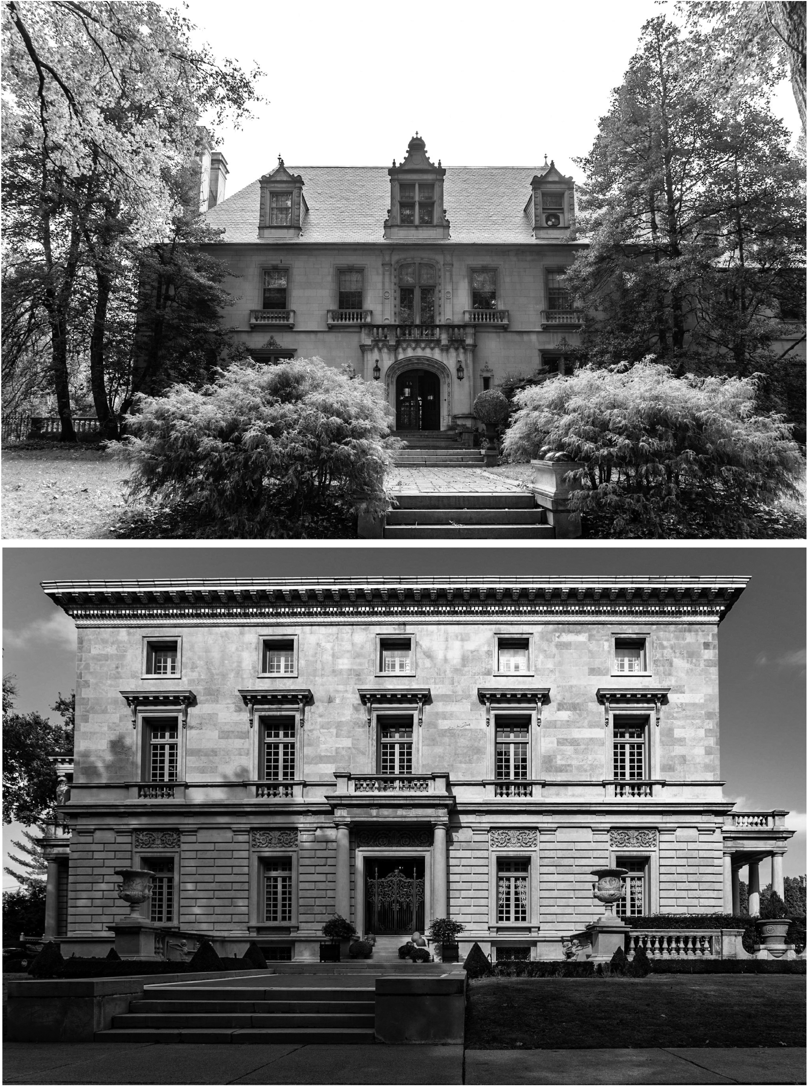
A home in Lafayette Square.
These images help to re-focus the neighborhood’s resilience and what is right, rather than what’s wrong or decaying.
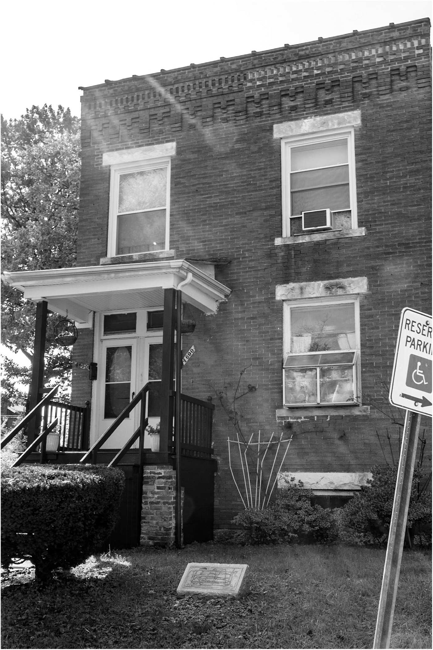
The legacy of restrictive covenants in St. Louis has narrowly confined Black living spaces to older housing stock near the city center and riverfront. North St. Louis was particularly solidified as a Black space after 1957, when Mill Creek Valley, a central-city enclave for Blacks, was demolished. Nearly 20,000 Blacks moved north, many into the Pruitt-Igoe homes and other housing projects. At the same time, White residents were retreating out into St. Louis County, establishing suburbs with private capital and federal welfare program resources.
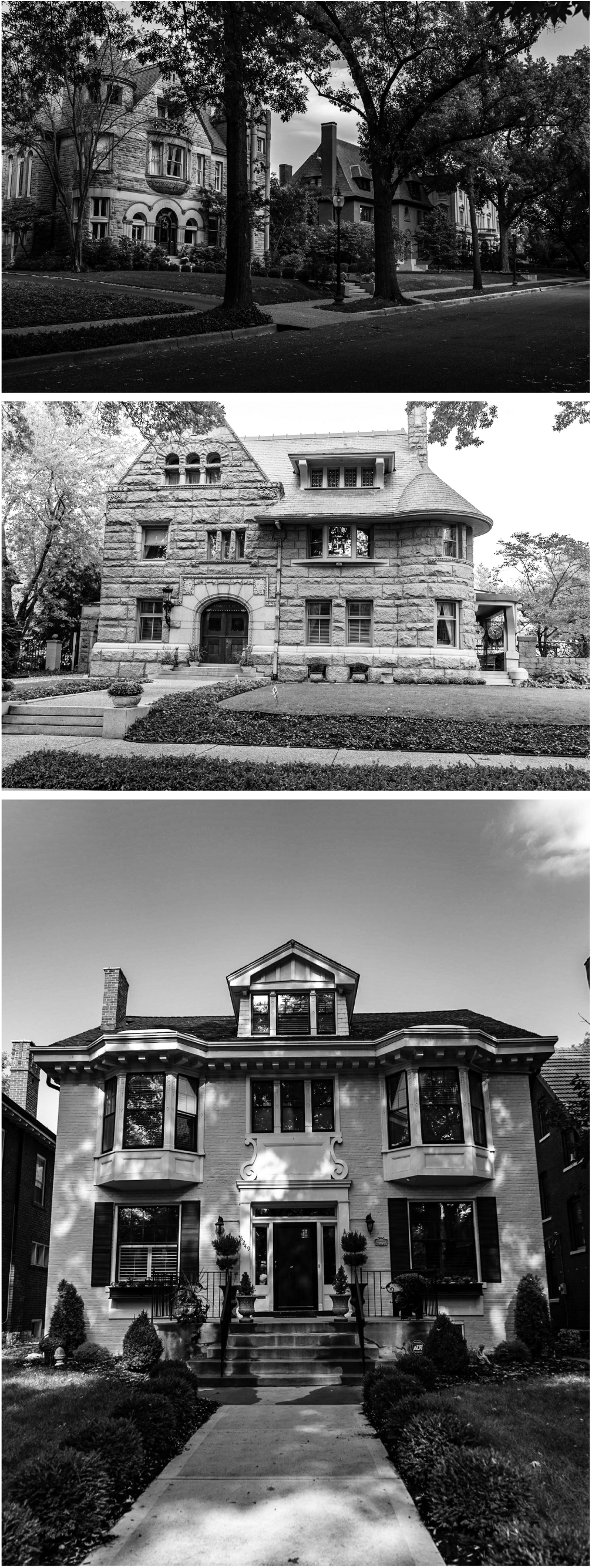
Today, St. Louis’s predominately Black north neighborhoods have the city’s highest rates of poverty, unemployment, low educational attainment, and the lowest life expectancy. The neighborhoods south of Delmar, such as The Central West End, were created after the 1904 World’s Fair. They were formed predominantly by White families and also attracted wealthy businessmen, doctors, and Washington University graduates. The city’s wealthier residents moved from one wealthy neighborhood to another, such as The Central West End. Lafayette Square, closer to downtown and the Mississippi River, was built around a 30-acre park. It served as the city’s first historic district and one of the earliest enclaves for urban elites. Lower rates of poverty and unemployment, higher rates of educational attainment, and higher life expectancies mark both The Central West End and Lafayette Square.
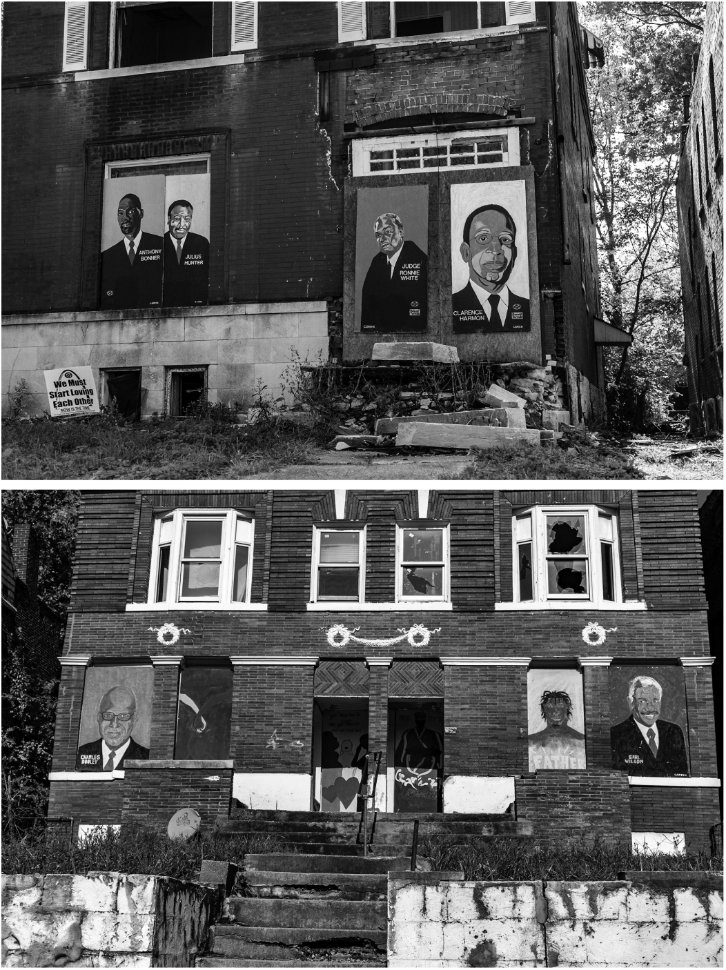
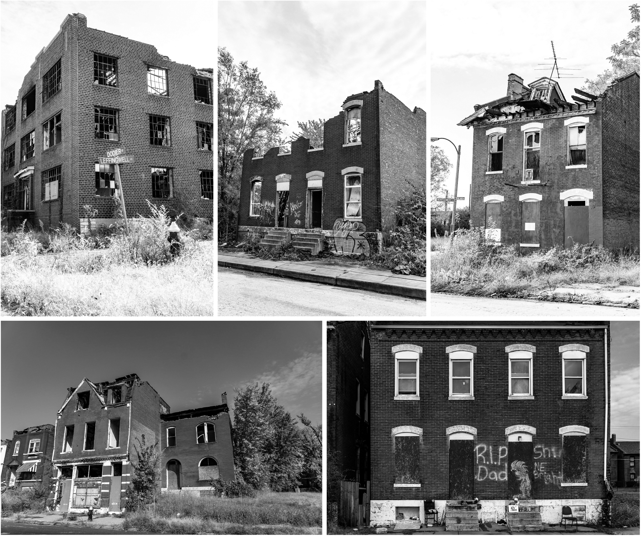
When driving through St. Louis’s lower income communities, visitors are confronted by fast food chains, liquor stores, check cashing places, and “corner” (convenience) stores. Some communities in north St. Louis, such as those along Martin Luther King Jr. Drive (MLK), have turned blight to beauty, showing pride in Black civic and business leaders and local artists. Images covering the blight demonstrate the vibrant and viable community behind the decay. Still, it is easy to characterize an economically-depressed area by sight: vacant lots, abandoned buildings, crumbling houses, and exposures to environmental toxins via close proximity to highways, bus depots, and superfund sites with contaminated soil and water.
A Central West End home, in a neighborhood with gates and private security.
A gated entrance within many affluent St. Louis neighborhoods boast private access to protect the homes within.

Sumner High School, a prominent Black high school in The Ville neighborhood, symbolized educational excellence.
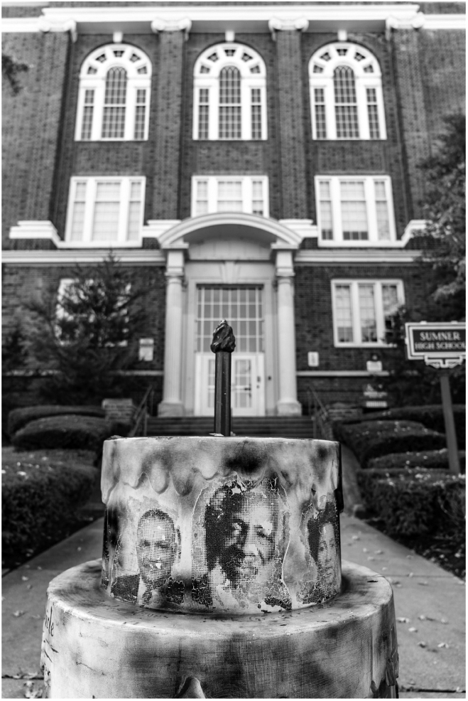
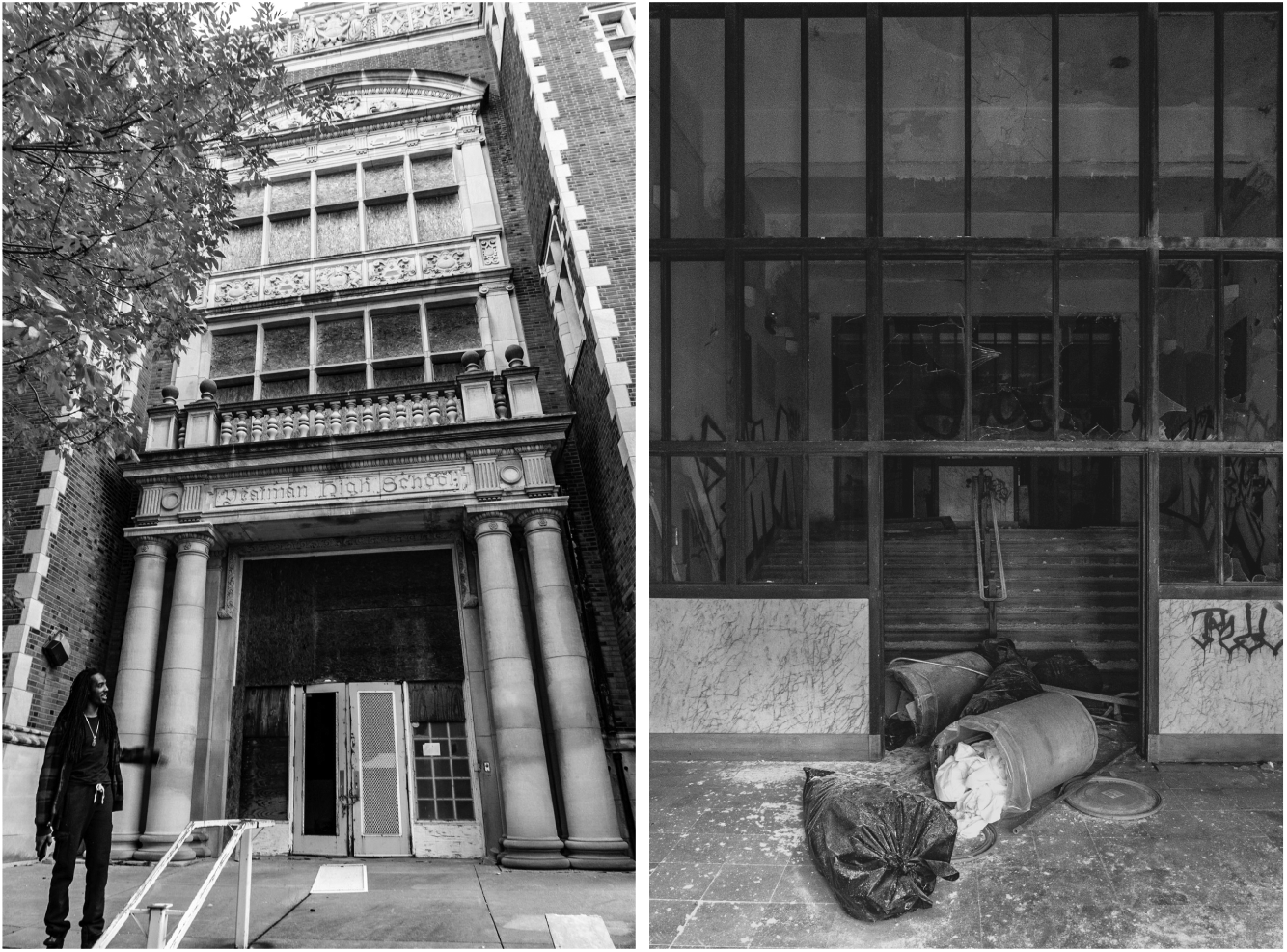
The effects of de-population include closed and abandoned schools and vacant properties across the city.
When we drive through the affluent south side of Delmar, past Forest Park and the Chase Park Plaza, we see, instead, affluent neighborhoods with sprawling parks, high rise condominiums, hospital complexes, and long-since shuttered warehouses repurposed as businesses, loft apartments, and restaurants. There is new construction on vacant lots. Some neighborhoods have clear physical barriers—large brick walls, gates, street barricades, and re-directing traffic patterns—that give passersby only glimpses of the affluence beyond. This form of social isolation may be viewed positively in terms of property values, but for day to day life, it all serves as a reminder that, if you are poor and/or Black, you’re not wanted here.
Within many north side neighborhoods, there are blocks of dilapidated homes and businesses that have not been torn down to make way for new development.
Homes in a quiet and secluded neighborhood, adorned by large trees and protected by gates and private security.
Black spaces, such as those along MLK in north St. Louis, are avoided by White residents, and visitors and new residents are advised to avoid these northern neighborhoods. These are the areas that bear the brunt of public scrutiny, media disdain, and over-policing. Just as insidiously, they harbor health inequities that place Black communities at higher risk for cardiovascular disease, diabetes, and asthma. The supportive structures that maintained Black communities during the height of racial segregation are sorely needed. During segregation, Black neighborhoods such as Elleardsville (commonly known as The Ville) became a cultural and economic epicenter for Black residents. Health care needs were addressed within the neighborhood by anchor institutions such as Homer G. Phillips Hospital. One of the last all-Black hospitals, it closed in 1979, after years as a national training site for Black health care professionals. Its viability, like so many other symbols of resilience, hope, and prosperity (yes, Sumner High School, too), withered after desegregation. Despite the passage of civil rights laws, the “separate but equal” doctrine persisted as Blacks were relegated to receive health care in “Negro” wings of other hospitals. Consequently, Blacks were subjected to more discrimination, less access to doctors and pharmacies, and a diminished quality of care compared to that once received in Black facilities and provided by Black healthcare professionals.
Social and physical isolation prevents the distribution of various forms of capital that might help address health inequities. This isolation creates traps of poverty and traps of wealth that reproduce racial inequality. For St. Louis and nearby suburbs like Ferguson, these traps produce inescapable contrasts. When racial discrimination and the blood of a young Black man’s body stain these neighborhoods, they flow with decades of housing discrimination, over policing, lower educational attainment, and poor health outcomes.