
Abstract
This article stages a dialogue between the two distant sites of our respective research, located in India and Georgia, both of which are at the centre of major infrastructural transformations. From these two sites of Kutch and west Georgia, the authors have noticed that local vocabularies are testaments to material economies of place and often contain traces of histories and relations that are erased by the global script through which infrastructural developments are justified and narrated. In striving to build a different kind of narration of the transformations that have invested them they place their incommensurability in focus through our exchange. Instead of comparison, this bringing together of two worlds is shaped by acknowledging a shared interest and common concerns. Borrowing from De La Cadena (‘Uncommoning nature’, 2015), the authors define their effort as a form of ‘uncommoning’ that shapes possible alliances to resist extractive projects, while allowing for divergence and differences in how the world is viewed (or written).
Empty places shrunk to marks on a map, names which can never have any more meaning than a hot afternoon in a droning room. (Meaghan Morris, 1996: 148–149)
Intro (un)commoning infrastructures
Sites of infrastructural transformation are locations where boundary-making projects of knowing and naming the world are enacted as corporations and states busying themselves with the task of making the complexity and unknowability of places legible to investors (Appel, 2019:171; Tsing, 2000). Their efforts stack onto a centuries-long project of writing and re-writing earthly relations to turn ecosystems into valuable resources (Bobette and Donovan, 2019). Renewed through subsequent projects (Barry and Gambino, 2024), efforts to extract profit out of territories infuse well-rehearsed scripts with a sense of newness and possibility (Tsing, 2004). In the current moment, investment in infrastructure is hailed simultaneously as a solution to the climate crisis and as a developmental strategy through which previously peripheral states can position themselves within emerging trade routes (Schindler and Kanai, 2019). This article stages a dialogue between the two distant sites of our respective research, located in India and Georgia, both of which are at the centre of major infrastructural transformations. Our conversation unfolded over several years as we attempted to make sense of the layering of projects that have invested the sites of our long-term ethnographic research. The sites of Ishita Sharma’s research, Kutch, are submerged intertidal zones and the border region between India and Pakistan. This area has been drawn into a plan of port-led logistical development since 2001, after an earthquake that devastated the region. Evelina Gambino’s research has been focusing on a 40 km span of the Rioni River in west Georgia where new and old hydropower projects are layered onto one another. From these two sites of Kutch and west Georgia, we have noticed that local vocabularies are testaments to material economies of place and often contain traces of histories and relations that are erased by the global script through which infrastructural developments are justified and narrated. Situated, yet attentive to the planetary scope of the processes it seeks to counter, this article brings these vocabularies in dialogue as a means to unearth how ‘geography is made and lived, through and beyond practices of domination’ (McKittrick, 2016: 92).
The places we speak from are not just geographically distant from each other. Their cultural, social and environmental histories are incommensurable. In striving to build a different kind of narration of the transformations that have invested them, our aim is not to minimize or exacerbate their differences for the purpose of comparison, rather we place their incommensurability in focus through our exchange. Instead of comparison, this bringing together of two worlds is shaped by acknowledging a shared interest and common concerns. Borrowing from De La Cadena (2015), we define our effort as a form of ‘uncommoning’ that shapes possible alliances to resist extractive projects, while allowing for divergence and differences in how the world is viewed (or written). As philosopher and chemist Isabelle Stengers (2011: 55) writes: Affirming closeness, in this sense, is not the same as affirming similarity. It is not a question of comparison. What relates modern practices and the many practices and forms of life that were already destroyed is that all are equally subject to eradication.
Uncommoning thus responds to this necessity to build connection without succumbing to reduction. In doing so, we respond to this themed issue’s exhortation to incorporate in practices of mapping, the lesson from indigenous thinkers, that we live in ‘a world of many worlds’ (De la Cadena and Blaser, 2018). We recognize that a silencing and erasure of these multiple worlds is one of the strategies through which infrastructural transformation for the purpose of extraction has been made historically licit and is renewed in the present.
This article teases connections between our two sites by focusing on words used to describe people’s relation to water and the ground: წყალი (tskali), water in Georgia; the rann in Kutch. These are ways of naming environmental relations that mark a meaningful difference to the extractive grammars mobilized to describe the sites of our work. De la Cadena (2015) suggests that modern practices of defining nature and culture serve different grammatical ends. They create boundaries, creating a division between subject and object. This division manifested between nature and culture, as well as between different properties of an indivisible natural world, is what we term extractive grammars. These grammars bring together forms of writing (Chari, 2019; Friess and Jazeel, 2017; Jazeel, 2019), seeing (De La Cadena, 2015) and thinking about the earth (Knox, 2020) that bring the incommensurability of places into focus. In becoming intelligible to potential investors, the sites of our research have been adapted to this globalized grammar. Its script hops and jumps its way across continents, unifying spaces of wealth and capital concentration across the colony and postcolony (Ferguson, 2005). Critiques of globalization have pointed to how imaginaries of ‘the globe present us with an abstract ball covered in the lines of longitude, latitude and other computed lines of measurement and classification through which we can easily compare’ (Jazeel, 2019: 8). This ‘generalised space’ as Morris (1996: 139) has argued in relation to representations of Australia’s alterity at the hands of European explorers, ‘solicits an act of repetition which is always a rediscovery of the same.’ As many have noted, the entanglements between such flat earth-ism and projects of domination and accumulation are not incidental, as the pursuit of profit benefits from modular and repeatable forms (Appel, 2019: 152). In our respective sites of work, we have encountered meaningfully different ways of thinking and labouring through ecological relations. We believe the gap between different ways of seeing and, crucially, naming the fault lines between diverse elements of an ecosystem to be a site from which different relational taxonomies can be gleaned. Bringing them together is an exercise in ‘taking seriously’ other grammars, and the material forms of knowing/thinking/living within ecosystems contained within them. To do so, we begin by acknowledging the presence of ‘interests in common, that are nevertheless not the same interests’ (De la Cadena, 2015: 2).
The article will unfold over four sections; in the first section we move away from comparison as a mode of working across sites; instead we think with Naoki Sakai’s (1997) heterolingual address and De la Cadena’s (2015) a-grammatical relations to elaborate counter grammars of extraction. In section two and three we focus on vocabularies and grammars that highlight the relationship between people, labour and place in our respective sites of work. Our analysis builds on the conversations we have had with key interlocutors that we introduce in our respective sections. In introducing these conversations as part of this text, we felt that it was important to maintain their intimate character, while moving away from the formality of relations that academia prescribes. In line with this, we refer to ourselves by our first names.
Finally, in section four, we think together across both sites highlighting some learnings from such a dialogue.
Countering extractive grammars: moving towards heterolingual address
In diverting from accepted modes of comparison, (un)commoning figures ‘a language to be learned’ (Larkin, 2013: 337) and gestures to the need of doing ‘translational work’ (Jazeel, 2019: 14). By exploring terms in the idioms of our sites – Georgian and Kutchi and Gujarati – we place both language and translation at the core of our effort. But, more than collecting words, attention must be given to how our dialogue is to take shape, and what work is needed to make terms in different places and vocabularies speak to each other. This, in turns, demands attention to the politics and work at stake in translation. In ‘Translation and Subjectivity’, Naoki Sakai (1997: 3) asks, ‘what sort of social relation is translation in the first place?’ Similar to other forms of writing the earth, translation structures the situation in which it is performed. Sakai distinguishes between two modes of translation: homolingual and heterolingual. In homolingual translation ‘the addresser adopts the position representative of a putatively homogeneous language society and relates to the general addressees, who are also representative of an equally homogeneous language community’ (p. 4). In this mode, terms are related to each other through equivalences and resemblance that in turn gives rise to a possibility of extracting an infinite number of distinctions between the two (p. 16). In this type of translation, similar to dominant forms of earth-writing, comparison is sought at the detriment of difference (Sakai, 2013: 1). What if, rather than eschewing difference, one was to build a model of translation based on the acceptance of nonsensical interactions?
‘The heterolingual address does not abide by the normalcy of reciprocal and transparent communication, but instead assumes that every utterance can fail to communicate because heterogeneity is inherent in any medium, linguistic or otherwise’ (Sakai 1997: 8). Navigating rather than eschewing the nonsensical, this kind of translational work rests on a will to communicate despite an awareness of its difficulty. This resembles what Isabelle Stengers (2011: 53) calls an engaged practice that ‘shares and acknowledged common concern’. Sakai (1997:4) makes a further important distinction between the two verbal designations ‘to address’ and ‘to communicate’. Unlike communication that anticipates its accomplishment, address is a proposition that remains open to the possibility of failure and/or rejection. Address is an attempt at communication across difference ‘an instance of continuity in discontinuity and a poietic social practice that institutes a relation at the site of incommensurability’ (p. 13, emphasis in the original).
In counteracting extractive grammars, heterolingual translation opens instead a space for what De la Cadena (2015: 3) themes ‘a-grammatical relations’ which are entanglements that cannot be described through an ordering in subject/object relations. An example of such entanglements are the indigenous epistemologies that testify to kinship between humans and bodies of water (Gomes-Barris, 2017; Todd, 2014). But the a-grammatical is not just the domain of indigenous ontologies, rather, as we show, plurality between different earthly agents is present everywhere. Sakai highlights how translation, like all social relations, is laboured: work is central to make different utterances intelligible. Translation necessitates all manners of efforts, ‘bodily gestures, affective exchanges, rhythmic expressions, and the sharing of pain, sufferance, and joy are also at work in this labour of translation, which is again always enmeshed with capital, state, and law’ (Mezzadra and Neilson, 2013: 276). In our sites we have observed how work is at the heart of relations between humans and their environments. The words through which communities address their localities are the result of their labouring and living on the land, in this sense they are both malleable and layered terms that accommodate the shifting entanglements that come with working within mutable ecosystems. Translation, as Meaghan Morriss (1997) points out in her foreword to Sakai’s work, becomes an inescapable condition of practice that operates at different levels, both within and across the different contexts of work and dialogue that this article occupies. Starting from the following section, we show the interplay between extractive grammars and a-grammatical relations in the sites of our work.
Water/lands: Rioni Valley
Georgia is rich in water (see Figure 1). Coming down from the Caucasus Mountains, water makes up about 60 percent of the country’s territory (Shukakidze et al., 2023:12). The abundance of water is equally central to traditional modes of understanding people’s relations to the land, as well as contemporary histories of extraction. The interplay between water and land sits at the heart of Georgia’s relation to their own territories in ways that are both taken for granted and contested. In Georgian, one of the words for homeland is mitsa-tskali (მიწა-წყალი) literally meaning – land-water (Tsotoria and Gogua, 2020). As Alexandra Aroshvili (2024) argues, paying attention to the Georgian language it appears that ‘water’ acts as a root for several other words: the word ‘Grace’ (წყალობა) in Georgian reads as ‘Watering’ and refers to doing good, helping, and caring – this semantics is inherent in the word as it implies providing water to others . . . . ‘Graceless’ (უმოწყალო) refers to someone who lacks the ability to provide water (empathy) or someone who misuses this ‘water’. The word ‘Miserable’ (საწყალი) signifies a person in misery, pitiable, or unfortunate – literally someone who is in need of water. The term “’ნიშან-წყალი’ refers to the absence of any signs of life, meaning there is no evidence of its existence, no water as proof of its presence or life.
The fact that water and life are entangled to the point that the word water is taken to stand for life itself, is certainly not unique to Georgia, and connects this country’s traditions to those of the Christian faith and its association between water and holiness. Yet the specific trajectories that Georgia’s water-based vocabulary has taken are testament of the layered histories of this territory and of the conflicts that have marked them.
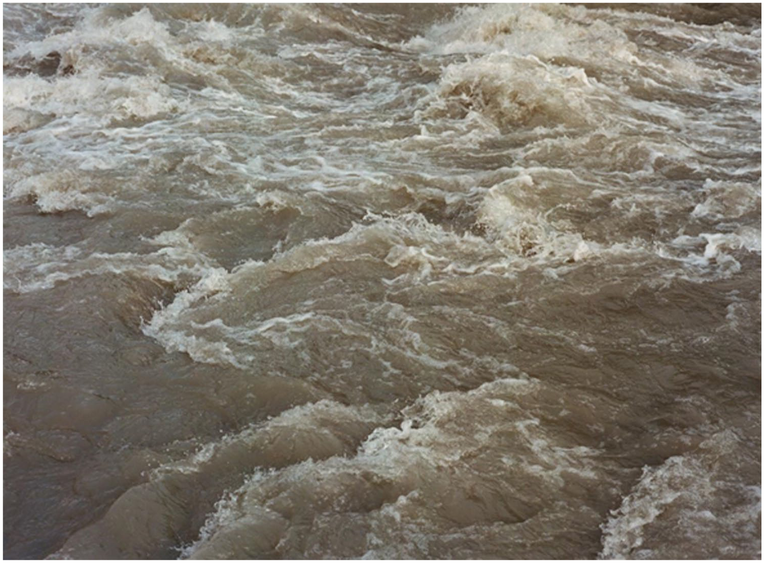
The Rioni river. © Photograph: Jess Gough, reproduced with permission.
As a mountainous country, Georgia is rich in fast-flowing rivers. Observing them flow, the abundance (Tskaloba) and sheer power of water is explicit. Already under the Russian empire, Georgia’s rivers had been identified as the most prominent and valuable resource to be extracted from this territory, which came to be commonly known as ‘white coal’. 1 As Ryan Wyeth (2022) argues, during the Soviet Union, Georgia came to be known as a ‘white coal nation’. This is a notable characterization and one with lasting impact on the specific characterization of Georgia and its rivers: on the one hand, as Wyeth argues, this term poetically connects water/hydropower with feelings of national pride. However, Wyeth continues, in evoking fossil fuels, ‘white coal’ enables the conceptualization of hydropower ‘not as a series of complex relations between physical processes and laws – evaporation, precipitation, gravity, geography, geology – but rather as a “reserve” . . . . a substance that exists in a precise, measurable amount (and a large amount, no doubt) out there in the world’ (p. 76). Defining water as white-coal constitutes an ‘interpretive and epistemic moment where biological material becomes purified of its own spatial, contextual and singular histories’ (Tsing, 2005: 94, in Jazeel, 2019: 13). A materialized and embodied labour of translation propaedeutic to extraction. 2 After Georgia’s independence from the Soviet Union, this process of translation intensified so that the making of water (წყალი) into an exploitable resource and the making of Georgia into an independent land (მიწა) have become intertwined (Aroshvili, 2023).
This tendency reached its peak through the ‘policy of maximum utilization of hydro resources’ adopted in the mid-2000 as a developmental strategy supported by the European Union and international banks such as the EBRD (Rekhviashvili, 2023a: 104). Under the current regime of maximum utilization, hundreds of hydropower plants of different scales have been built and planned, these figure rivers to exist exclusively at the service of energy production. The map below (Figure 2) is a stark example of this labour of translation. It shows a projection of potential and theoretical hydropower capacity across Georgia’s rivers. Whilst dots on the map are not meant to correspond to actual projects, but merely show potential, the map is a visualization of the extractive desire that has descended on Georgia’s rivers, attempting to capture their flows. Here extraction is given a visual grammar. This grammar separates water from all other relations, writing it exclusively as ‘white coal’: a reserve waiting to be tapped into. Going back to Aroshvili’s watery glossary, the map can be understood as a projection of a ‘merciless’ (უმოწყალო = someone that misuses water) future. Zooming into one of the seemingly infinite dots on this map will help tease out some of the ways in which different grammars of water come into conflict.
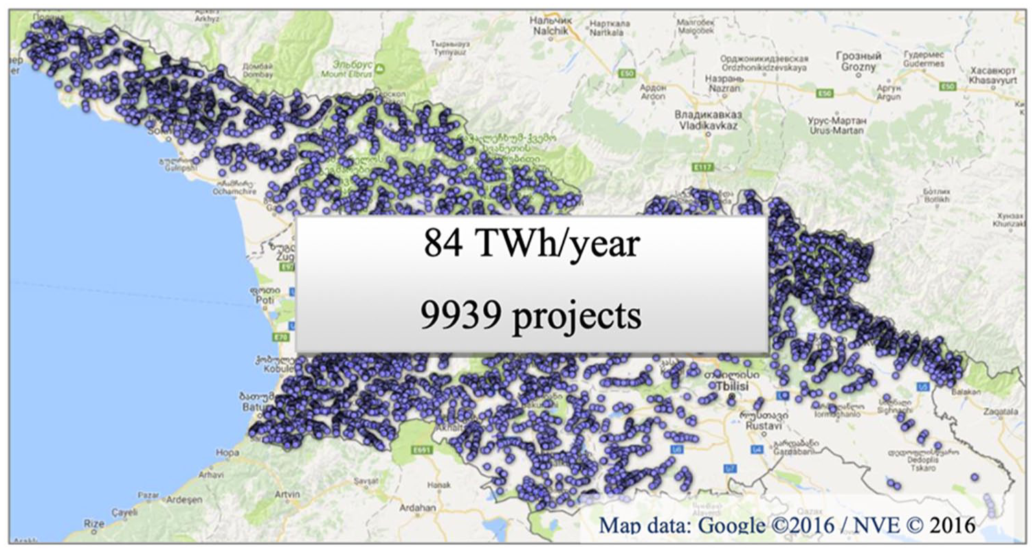
Map of Georgia’s HPP potential, filtered and theoretical produced by the Georgian Ministry of Energy and Environmental Agency in partnership with the Norwegian Water Resources and Energy Directorate.
Labouring the valley
The Rioni River is the second largest river in the country, it starts high in the Caucasus Mountains, flowing for 300 km through Western Georgia and eventually makes its way to the Black Sea. As the river descends from the mountain region of Racha it reaches the Rioni Valley where one of the most prominent and contested hydropower development is planned: the Namakhvani HPP. This stretch of the Rioni already has three large dams: the Rioni HPP (1933), the Gumati HPP complex (1956–1958) and the Lajanuri HPP (1960). Built during the Soviet Union, these dams have almost halved the river load (Macharashvili, 2023). The construction of the Namakhvani HPP, a 400MW planned dam complex, was halted in 2021 after fierce opposition from inhabitants of the valley and their supporters (Rekhvaishvili, 2023b). The cancellation of the project, however, is just a temporary victory, the government is already searching for new investors.
At the heart of the opposition to Namakhvani there are contrasting grammars. This is most visible in the prosaic taxonomies of the valley that each side enacts. Documents produced by ENKA, the company in charge of developing the dam, arrange the valley into a grid of objects both above and below the ground: the river, the villages, the plots of land cultivated by the villagers who need to be compensated, the Lajanuri HPP and other dams closer to Kutaisi (see Figures 3 and 4). To these, prices and hazards are attached (Shubladze, Social Justice Centre, 2021). To calculate risks and costings, equivalences are made between incommensurable elements and the interplay between abundant waters, life and potential destruction is fixed in place and time (Verran, 2010). Onto these snapshots, the different components of the Namakhvani HPP complex – including bridges, tunnels, canalizations, pumping stations, and the reservoir, are over-imposed. In this extractive grammar, distinctions are laboured into existence in order to turn the water of the Rioni River into a profitable resource (Wyeth, 2022). Conversely, those who work these lands see the river as ubiquitous. Their preoccupation with the dam’s impact blurs the distinction between the river and its surroundings, rather showing the murky entanglement between water, air and the ground and the histories and affects that allow people to make sense of their environments.
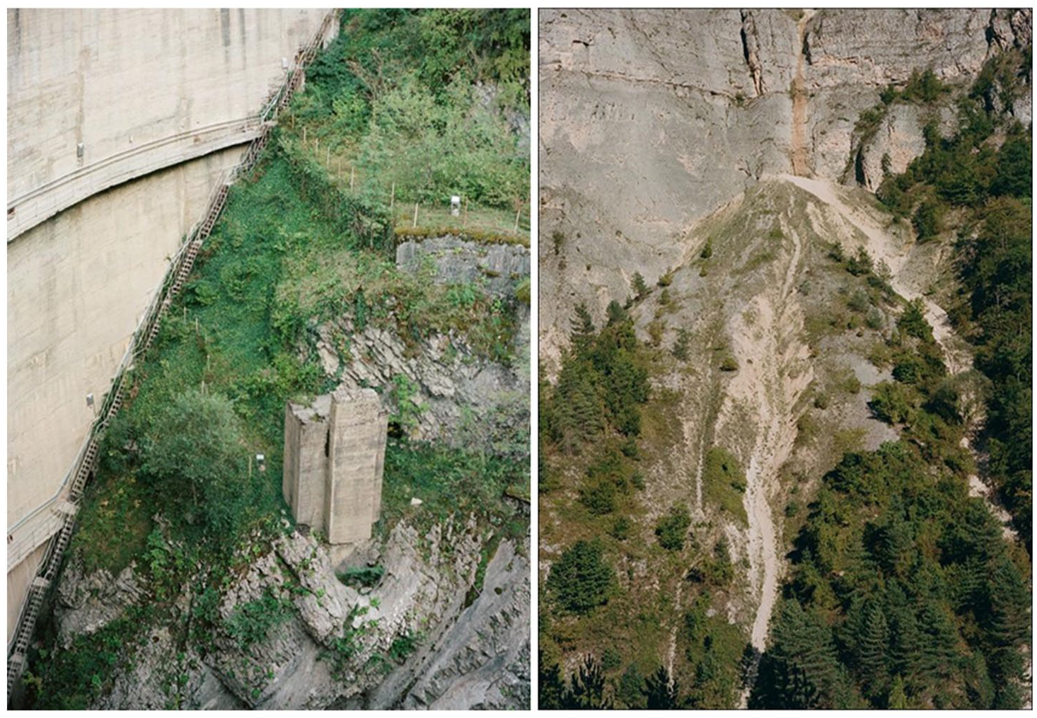
The Lajanuri HPP and a recent landslide on the Rioni River. © Photographs by Jess Gough, reproduced with permission.
Maka Suladze is a retired nurse and one of the leaders of the anti-dam movement known as ‘Guardians of the Rioni’. Many villagers, like Maka’s family, are wine producers, and the dam, they fear, would permanently alter the valley’s terroir that is necessary for the production of a particular variety of grape unique to this region. The forms of cultivation that Maka and her neighbours are engaged in take place within porous, mutable, worlds. As winemakers across the world know, Terroir can be defined as an interactive ecosystem, in a given place, including climate, soil, and the vine root-stock and cultivar (Van Leeuwen and Seguin, 2006). Working with grapes – one of the most ancient occupations in Georgia – entails being attuned to this fragile entanglement which the dam is likely to permanently upset. The Rioni River, which in the extractive grammar is characterized by its raging pressure, is instead seen by local wine-makers as seeping into the air in the form of tiny particles of humidity and dissolving into the aquifers under the ground (Ballestero, 2019).
Ultimately, in the controversy over the Namakhvani HPP, what emerges is a sense of the valley that cannot be accounted for by the dualisms proper of modernity and the extractive grammar that have emerged within (Bobette and Donovan, 2019: 355). Notably, the villagers’ relation to the valley and its ecosystems should not be cast exclusively in post-humanist terms (Zeiderman, 2019). At the beginning of her research in the valley, Evelina often spoke to Maka about why she was opposing the dam. There were many reasons that played different roles at different stages of the struggle, but the first was always that her mother, and now, sadly her father, are buried in a cemetery above the house where Maka and her family live and that would be flooded by the reservoir. Submerging the cemetery felt to Maka as unspeakable violence. If, in speaking about terroir, we have highlighted how wine-makers have become attuned to what Ballestero (2019: 21) would define as ‘the inseparability of figure from the ground’, in coming to terms with Maka’s refusal to allow buried bodies to be submerged, the same argument cannot be made. She stubbornly, desperately, opposes the image of her mother’s memory being dissolved into the ground. Once submerged, there will be no sign (ნიშან-წყალი) of life left in the valley (Aroshvili, 2024).
Maka is deeply religious. Christian faith has been a key point of contact unifying those who oppose the dam in the valley and beyond. At the same time, the relationship between the Guardians of the Rioni and Georgia’s Orthodox church has been the site of controversies and violent episodes that are beyond the scope of this article (Rekhviashvili, 2023b); however, Maka and other villagers’ faith matters in understanding their relation to the environments in which they live. The murkiness that marks their approach to their environments is imbued by a kind of animism often found in Christianity across Georgia’s mountainous regions (Gurchiani, 2023). As historian Luka Nakhutsrishvili (2021) writes, peasant Christianity constituted a central element within the struggles that converged in the 1905 revolution, one that was then erased by Soviet historians (see also Antadze and Gujaraidze, 2021). Hybridity and ambivalence are thus at the heart of Maka and others’ practices of faith. Especially for those of Maka’s generation, who grew up in the Soviet Union, where official religion was banned, yet still practised, religious beliefs and elements of Soviet ontologies coexist and paradoxically reinforce one another. This is the case with Maka and others’ understanding of labour that appears to be at once imbued with ritualistic connotations and belonging to the familiar grammar of Soviet productivity. One remark made by Lali, one of the members of the movement and Maka’s close friend illustrates this overlap. Whilst we were driving out of the valley to reach a protest in the nearby region of Racha, Lali directed Evelina’s attention towards the vineyards along the slopes: ‘Look! This is so beautiful’, Evelina agreed, ‘Do you know why this is so beautiful?’ – she continued – ‘it is because of labour! It is people’s labour that makes the valley beautiful.’
The heterogeneous layering of elements that make up the villagers’ rejection of the extractive taxonomies that justify dam-building – that include contradictory elements such as an appreciation of Soviet science and Christian faith – are bound together through the villagers’ daily activities on the land. When Evelina last visited Maka she showed her the diary that her mother had been writing in the months before her death. A series of short, neatly written accounts of her days and feelings. It stopped some weeks before her death, by then she had become too weak to write. Maka directed Evelina to the pages where she had described her last grape harvest, only a few pages before the end of the book. That year the whole family had come. The eldest son had carried his grandma to the vineyard and supported her as she cut some of the grapes. She describes the different types of grapes they cut and how they separated them into buckets, one for the juice and the other to make wine (see Figures 5 and 6). It is a surprisingly moving account, yet it simultaneously almost solely concentrated on the work the family did together: their bond expressed through their collective work in the small garden they grew up in. Despite being a habitual activity, working the land became a special act when done collectively by the entire family during Maka’s mother’s last season. Maka, her mother, her children have come to know and value this environment through work. After all, it is through work that our particles mix with those of the ecosystems we inhabit. As sweat drops from our pores into the river, our hands and feet become wet, mud lodges itself under our nails, in our cavities and folds. Speaking to them it is clear that the forms of cultivation they are engaged in binds the family to the valley’s ecosystems present and past. In turn, their own bond as a family is inscribed in those laboured ecosystems.
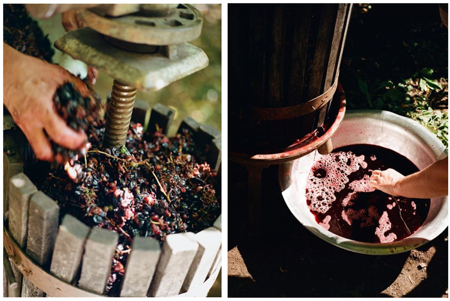
Maka making wine. © Photograph, Jess Gough. Reproduced with permission.
Submergence and the desert
The rann 3 (see Figures 7 and 8) forms more than 50 percent of the region of Kutch. Known as the Rann of Kutch, the association between the two has determined the social, political and material histories of the region. Seen as a ‘marginal environment’ (Damodaran et al., 2021) by colonial authorities and backward by the post-colonial state, both Kutch and the rann, a word that refers to desert in everyday Gujarati, are associated with an absence of water – as arid, as drylands. Like other deserts, the rann, as a singular landscape, is characterized as remote, as backward, barren and unproductive. It is a semantically dense term (Hastrup, 2007), laden with many meanings. But, in a wondrous coincidence of geography, these deserts of Kutch are adjacent to and originate from the sea. It meets the sea not at, but through the formation of deltas, a product of the ‘interrelation between different waves of sedimentation occurring on the earth’s surface and tectonics’ (Khan, 2019). Together they form a unique landscape with strong seasonal and temporal changes, transitioning between the properties of wet and dry. Because of this shifting property, the Rann of Kutch is referred to by names, a swamp, saline desert, wetland. Not just the ranns, but the whole region is defined by its watery edges. Partially an island, this watery geology is reflected in the name Kutch itself. Kachua in Sanskrit refers to the amphibious tortoise and also indicates marshy land or coastland. These roots point to the region’s connections with the sea and its qualities of being composed of water and silt, of the aqueous and the igneous (Bhattacharyya, 2018). These multiple properties have meant that the Rann is classified as a ‘wasteland’ in revenue department records and is considered a singular uninhabitable landscape with no equivalence. While ‘wastelands’ are of different types, for example, gullied, ravined, eroded, waterlogged, the Rann is its own classification.
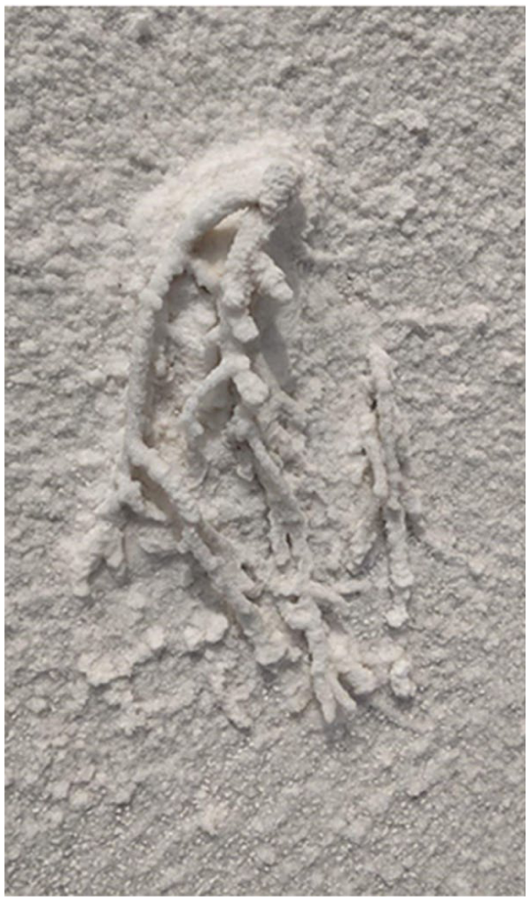
Fossil in the rann, image by Ishita Sharma.
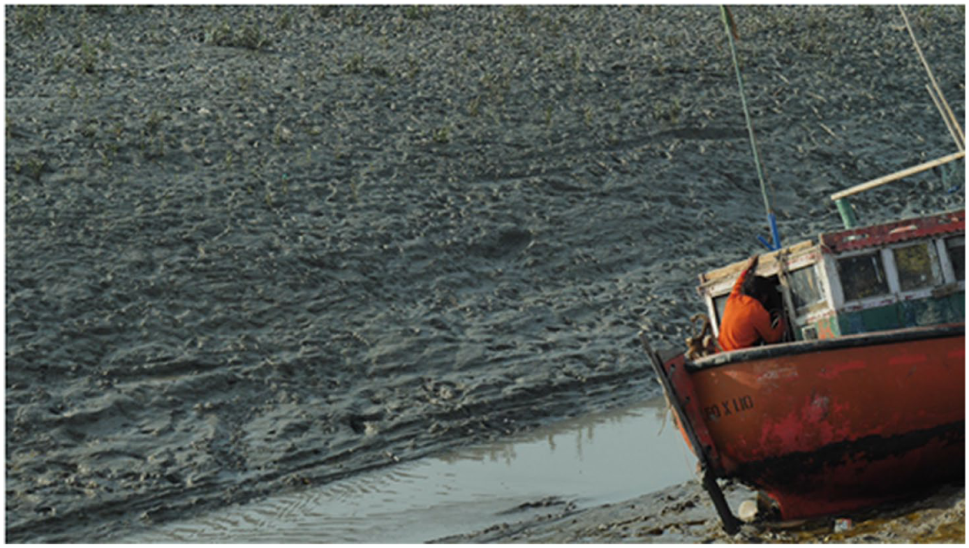
Fishing boat near the Gulf.
But like other grounds considered waste, the rann has been subject to multiple different efforts under an ethic of improvement. These developmental fantasies and desires are facilitated by government policy that have demarcated 51 percent of Kutch (namely the Rann) as ‘high saline unproductive desert’ and allowed industry to be set up on pastureland and 4,600,000 hectares of government-owned wastelands in Gujarat (Sud, 2021). Developmental and extractive projects historically have included reclamation, agricultural production, plans for the conversion of the Little Rann of Kutch into a fresh-water reservoir and the construction of roads, railways and transmission lines, expanding salt manufacturing, as well as the most recent construction of the largest solar power plant in India. As this suggests, the Indian state and Gujarat’s relationship to Kutch has turned upon the potential exploitation of the region’s resources and its incorporation into India as a border territory. Its material manifestation is an assemblage of industrial development and infrastructural projects that have allowed the entry of domestic and international, public and private capital into what were considered some of the most remote corners of the country. Accreting over decades, they have changed patterns of sedimentation and flow, blocking and redirecting the flow of water across different parts of the rann. These accretions are formed slowly over time. As Anand (2015) suggests, infrastructures are not just material, ‘rather they are constitutive of diverse political rationalities, past and present’. These attempts continue up to today, bringing together modernist formulations of productivity with scientific technologies that seek to create a new kind of land from which economic benefit can be gained.
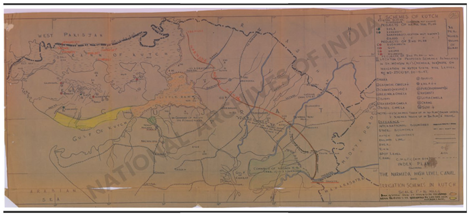
Constructed, planned and potential schemes of hydropower in Kutch in the 1960s.
One of these formulations has been the drive to harness water flows to guarantee food security; in this, the ephemeral and perennial rivers of Kutch, including those that feed the ranns were seen as not being river-enough. In the planning documents created soon after independence from British rule, the intensive re-creation and retooling of the landscape through harnessing and redirecting its water capacities is evident. While plans for reclamation of the rann failed due to the lack of fresh water to remove salt from soil, the free flowing ‘water wealth’ of the region was seen as an ‘immense waste’ (Ali, 1947: 2) to be redirected towards agricultural use. The map in Figure 9 from the 1960s represents a past, present and future hydrological imagination. Water flows and rivers are mapped either as data in the form of numbers or as potential pathways for the extension of canal irrigation systems. Water is not only a material element but determines the social production of space. It creates and sustains connections and hidden relations, it also implies a distribution of power (Bear, 2015; Boelens et al., 2016; Gandy, 2004; Swyngedouw, 2009). Water and the right kind of water become fundamental to the productivity (and creation) of the rann grounds as territory. Today, irrigation projects exist on major rivers flowing south in North Gujarat, Saurashtra and Rajasthan, as well as smaller check dam projects. Collectively 30 small and medium dams/check dams have been built, including 20 minor irrigation projects on the Banas River that store almost 69 percent of Banas River, one of the main river systems flowing into the ranns till today. Runoffs, stored in dams and checkpoints, have reduced the flow of water specifically into the rann by 48 percent (Dixit et al., 2016). These have critically changed the balance of tidal and river waters and the environment that sustains livelihoods in the ranns.
Circulations of sweet and salt
Geographies such as the ranns that are seen as non-productive and the communities who inhabit them are bound together in a narrative of marginality that traces its roots to colonial legacies of property making in the South Asian subcontinent (Gidwani, 2021: Whitehead, 2010). The ranns are inhabited by agriculturalists, fisher people and traditional salt pan workers from different communities. Across rural areas in India, lower caste and non-landed (and those with small land holdings) communities subsist on small-scale or subsistence agriculture, collecting forest resources, buttressed by periodic work in the informal economy as labour (Gopal, 2013; Keshri and Bhagat, 2012; Pattenden, 2018). Fishers and salt pan makers are part of similar economic cycles. Artisanal salt-makers called Agariya belong to denotified and tribal communities such as Kolis and Miyana, while fishers are primarily from the Miyana community, belonging to different ataks or subgroups (Pradhan 2011). Alongside fishing and salt-making, they carry out subsistence and rain-fed agriculture, collect firewood, have a few sheep or chicken, and do informal and daily wage labour or own small businesses in neighbouring towns. 4
Salt pans near the Surajbari village. © Photograph: Ishita Sharma. Reproduced with permission.
Siddiq and his family are Miyana fishers who, for generations, have survived on the Surajbari prawn that is endemic to the rann at the mouth of the Gulf of Kutch. In contrast to extractive grammars that are based upon separation, blocking, bunding and leaching of water, prawn fisheries are fundamentally created and sustained through the mixity of waters. Siddiq’s part of the rann is sustained through the flows of river water as they mix with tidal water of the gulf through the Surajbari creeks (Figure 10). As Siddiq explained, fishing takes place in the monsoon months and sustains the community across the year. Different forms of water create conditions that sustain this environment. Prawns use the creek systems to move into the rann when the west winds blow, increasing the circulation of tides. During the monsoon months of July to August, the water becomes sweet, forming a breeding ground for the prawns. River water mixes with marine water and crucially rainwater to create conditions conducive for the nurturing of prawns. If the mixing of different kinds of water creates the right kind of salty water, detritus brought by the rivers creates a rich density of organic materials that provide nutrition to juvenile prawns. Not just flow, but also stagnation is an important phenomenon in the creation of delta spaces and its socio-material transformations (Camargo, 2021). Prawn fisheries exist because of a balance of flow and the stagnation of waters in the flat morphology of the rann. Fishers work in this receding and ascending watery landscape. Like other communities who are dependent on shared natural resources, the Miyana also have their own system or customary arrangements that distribute the fishing areas (Fernandez, 2018). The creeks of the rann are divided into 12 different creeks and divided between the different subgroups by the customary village head. Known as ‘haq’ or rights on particular creeks, this divided continues till today. Creeks were named on the different ataks – the Sama creek, Bhatti creek, Saicha creek, Manek creek and Mullah creek. Never wholly ‘natural’, these geographies have seen different forms of human intervention over time (Carse, 2012). As Siddiq showed me, when the length of a creek might be small, it would be extended by hand to create more depth and space for the prawns to come in for breeding. These efforts that are undergirded by an attention to sedimentation, flow and circulation also allude to depth and volume (or magnitude of flows) as a property of these watery grounds.
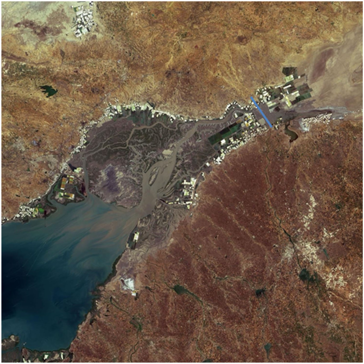
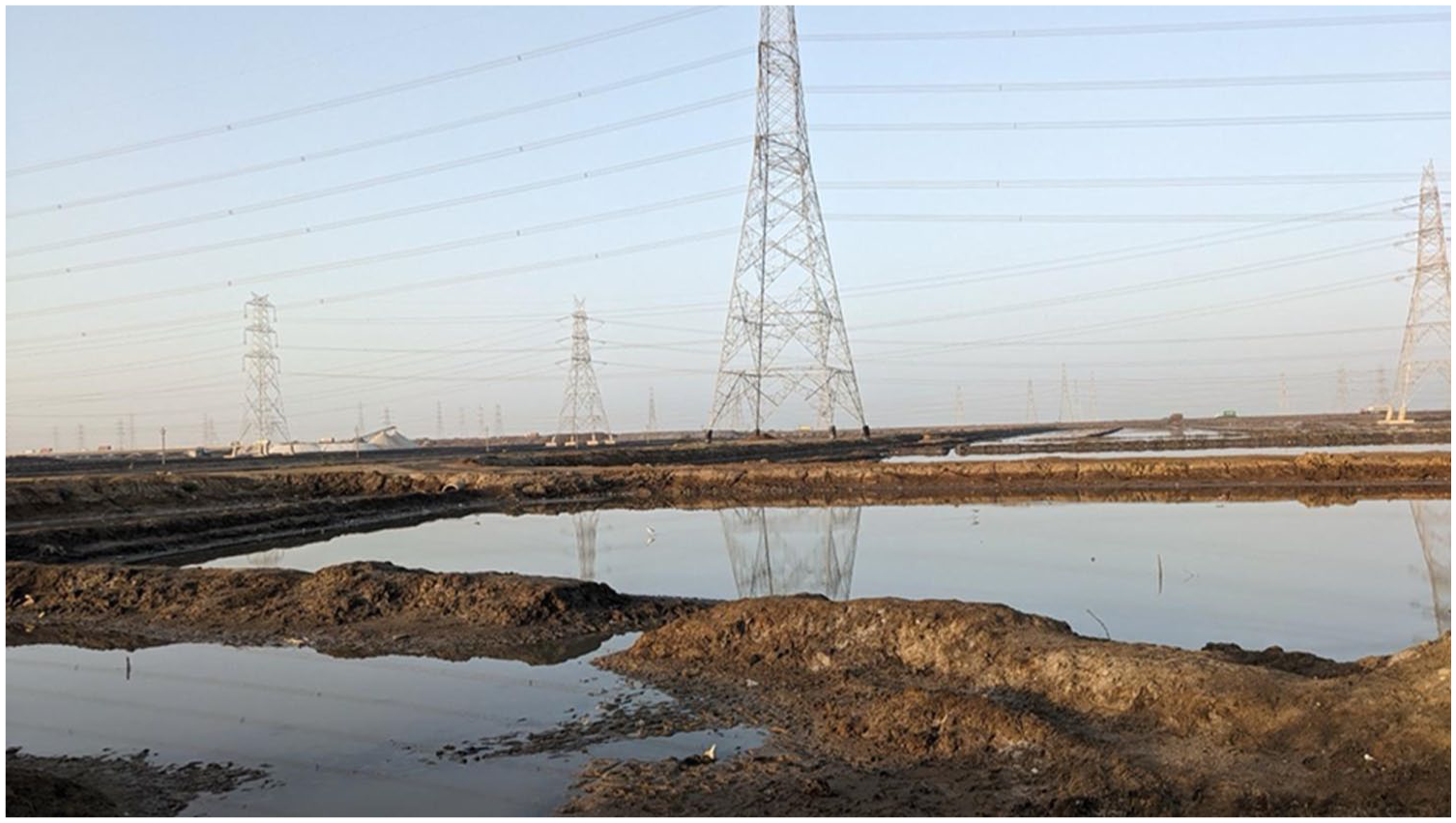
Gulf of Kutch, the blue line marks the approximate location of the Surajbari bridge and railway embankment.
Siddiq, who is also fisher leader and former village head, sees his part in the rann as bountiful and highly valuable, as these geographies have nurtured the Miyana community through the fishing of prawn. 5 Referred to locally as soniya, a word that literally translates to gold, indicating the value that it has for the community, this prawn species is endemic to the unique waters of the gulf. Soniya is also used as a form of endearment and affection. This affection is evident in the way that the fishers talk about the lives of prawns, water flows and their patch of the rann, in their casual acquaintance and intimacy with the intricacies of the climate, environment and water. Affection is also for people like Siddiq, tied into, as he says, virodh or resistance. Articulating it as such, injustice is material and emotive. Siddiq calls himself the man who fights salt. In a landscape that has had a strong tradition of cooperation and interdependency between different communities, Siddiq says that the fishers and the salt-people (namak wale), cannot be bhai-bhai (brothers) – theirs cannot be a relationship of brotherhood between them – even though they are both actors in the same landscape, trying to make their livelihoods. While upstream dams have reduced the entry of river water into the rann, the expansion in marine salt making has picked up pace since 2012. In Kutch, where fishermen have been fighting many battles to protect their access to the seas and their livelihoods, the manufacture of marine salt is a new entrant that is causing immediate harm See figure 11. Between 1977 to 2013, the area under salt production has increased six times, from 7,646 ha to 44,655 ha. A total of 21,601.41 has been given on lease in Kachchh and Rajkot districts. Out of an estimated 29,000 ha of fishing area, 18,250 is lost due to salt works (Dixit et al., 2016). Siddiq and others are cognisant of the kind of harm that is produced in the difference between capitalist and artisanal forms of salt production, and intimately aware of how they manifest differently.
During one of my walks with Siddiq behind his house, he pointed out to me a glistening mud bank. Looking at it, it was for me, just another feature of the landscape, much like the keechad in other places. But for Siddiq it was something out of place. Sediments are deposited by the wind, but these sediments were new, deposited here because of the dredging and bunding created for the salt pans. Such new banks that were forming blocked the creeks used by prawns. Hearing Siddiq, I was struck by how my seeing had no discernment. As I told him this, he laughed and replied that even the officers in charge of the area couldn’t tell. This lack of knowledge and willingness about the landscape in officials and bureaucrats results in very real injustices going unrecognized. Even if told, they fail to (or don’t want to) recognize the changes taking place. This incident reiterated that seeing is not uniform and that muddy grounds, like the desert, require more intimate forms of knowing. Injustice also manifests as material changes in the ground that have ripple effects on other organisms and livelihoods, it is not evident or always visible, but requires perspective, communication and translation to perceive (Figure 12).
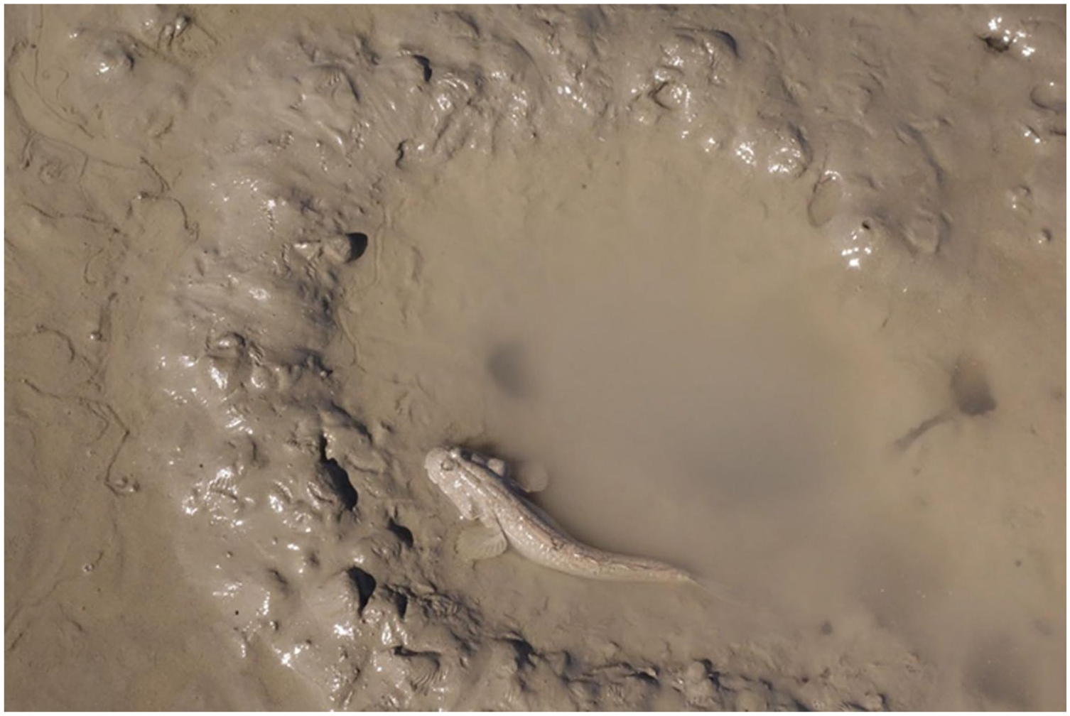
Mudskipper, called Levta in intertidal areas of the Gulf of Kutch. © Photograph: Ishita Sharma. Reproduced with permission.
This translation is about both language, labour and intimacy, and a practice of listening, where assumed knowledge and categories are replaced by an unknowing or acceptance of fuzzy boundaries. It required centring the middle of the rann – the creek and water systems, rather than the dramatic surface qualities of dryness and salt. In a few different cases, I have asked people what the word rann means. This has always led to a moment of pause and confusion, and then to humour me, a description of its qualities as a place with keechad (water and silt), a salty ground where nothing grows, etc. What this indicated (perhaps), was that, rather than a singular landscape, geographical expanse, or ecological object, the rann is a quality of the ground. An adjective not a noun. In current parlance, the rann has been ‘thingified’ (Barad, 2003, 2007: 249), implying the reduction of lively, emergent, intra-acting phenomena into passive, distinct resources for human use and control. Siddiq does not make a very clear distinction between the white Rann and the gulf, he speaks of the creeks, of the bandars, of sweet water ground (Khusk), and saline parts of the ground (Keechad). Within this landscape of sweet and salt, other names such as Didli and Dhoro refer to smaller patches of muddy ground, unique stretches of gullied mudflats and mangroves that are based upon an identification gleaned from intimacy and use. Some of the fishers and pastoralists used the word rann to refer to both the areas demarcated as salt desert, as well as intertidal mudflats. This mixed usage is quite critical. It points to the shared quality of both these geographies, one more wet and one more dry, constituted via temporally different circulations of water in the atmosphere, where degree and seasonality transmute its obvious surface qualities. Intimate ways of describing and naming places also gesture to how the rann is not a singular landscape but is made up of different shifting components that hold affection, usage and rights together (Figure 13).
Conclusion: heterogenous vocabularies
Ethnographers have shown infrastructures to be sites where different ontologies gather, clash and accrete (Anand, 2015; Harvey and Knox, 2015; Knox and Gambino 2023). In both Rioni and Kutch, these accretions are visible. Different forms of extraction attempt a separation of relations, a cutting of figure and ground (Ballestero, 2019). In both sites, the future potential of water is prioritized over its present use. In both cases, water has to be controlled, contained and released according to a different calculation. This is made possible by different technologies, such as the representation of the ground as grid, of water as countable units and as commodity (Verran, 2010), of measurement in tonnes, megawatts and horsepower, and through visible and invisible infrastructures built both above and below the ground. But, in doing so, many uses and relations are lost.
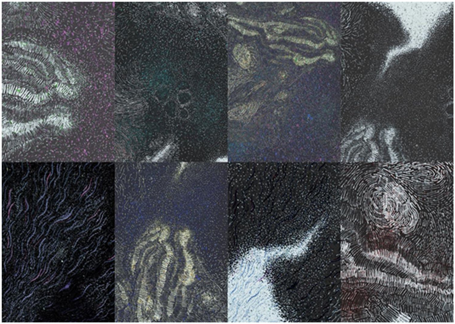
Iterations of watery grounds of the rann. © Varun Kurtkoti and Ishita Sharma.
Our accounts of Kutch and Rioni, show how specific properties of the rann and the Rioni Valley’s terroir are mediated via different grammars. Both sites show that there are different ways of knowing the world and that these choices further shape these worlds we inhabit. In writing our sections we did not adhere to a set format but found that the acknowledgement of shared interests oriented us in similar ways. We acknowledge our shared interests and find a way within which exchange is possible without a reductionism, which necessitates the abstraction of some properties so as to make comparison possible. Consequently, similar themes emerge that speak to an (un)common grammar: for Maka and Lali in the Rioni Valley, labouring the land forms the foundation of their understanding of self and environment. ‘Labouring the land, where roots are growing’ – as Lali told Evelina – ‘shapes the person.’ Watery and porous when worked, thus, the valley is also the site into which the accreted, personal and collective history of its communities stretches. For Siddiq and other fishers in Kuch, Ishita observed a similar rooting. Their relationship with the environment is built across generations through the practice of fishing. These were and are undergirded by an attention to flows of water and silt. Both Siddiq and Maka’s relation to the ground and environment, their histories, their love and affection, and their resistance to extractive grammars are their ways of knowing the world. The endearment and value that soniya for example, contains, implies such different relations that it blurs the boundaries between subject and object.
Jazeel (2019:14) writes: ‘it can be useful to think of ethnographic and historical work as itself an act of translation insofar as it always by necessity involves the effort to learn the poetics of another form of life’, even as it involves the labour of learning new languages and textualities. Staging a dialogue amongst our (un)common experiences, as we had indicated at the beginning, a labour of translation. This translation is both a language, a seeing and a sensing, that sometimes yields unexpected results and sometimes also fails. For example, Ishita’s inability to perceive the out-of place mudbank or her perhaps misdirected effort to translate as language or a singular word, the meaning of the rann. Translation, as Sakai (1997) writes, is a process of communication, a minimum making sense of the world around us, together. It is also a building of a relationship. Siddiq, Maka and Lali might not define themselves in the vocabulary of environmentalists or lawyers, yet they have come to form alliances with some in their effort to oppose the infrastructural transformation of their homeland. This work of translation, as is our communication with them, entails a recognition of the plurality of our world and strives to find connections across this multiplicity. Both Maka and Siddiq are also engaged in processes of translation as they engage in movements and in legal processes that utilize different languages and vocabularies.
As we foregrounded in the introduction, we believe the gap between different ways of seeing and, crucially, naming the fault lines between diverse elements of an ecosystem to be a site from which different relational taxonomies can be gleaned. By placing in dialogue our distant field sites, we have learnt from our respective sites that better grammars and vocabularies exist that show how people and their environments are inextricably linked, which attuned us to pay attention to how the ground is constantly in motion as climate and sand interact to create these (un)common watery geographies across geological time. Thinking through the complexity of sand, salt and freshwater unmoors, ungrounds and unsettles. It does not allow a fixing of the relation between water and ground in place but rather treats the earth as lively – itself an a-grammatical relation. It enables us to pay attention to not just the surface, but rather to circulation and depth as qualities that underwrite relations of inhabitation. Following different grammars of watery grounds ‘demonstrate that what is taken as natural knowledge is produced, and if it can be produced in some way, it can also be produced otherwise’ (Bobbette and Donovan, 2019: 26). Paying attention to the heterogeneity and specificity of situated vocabularies questions the easy classifications of the natural and human world, as well as other analytic categories of scale. In opposition to reductive cartographies, as both our sites illustrate, communities have always made their own sense of the sites they inhabit. Both geographies also hold other imaginations that defy these extractive grammars and cannot be contained within them. In staging this dialogue, we believe that the new ways of thinking that we learn from our interlocutors and companions can be shared in order to build projects of solidarity.
Footnotes
Acknowledgements
We are grateful to our interlocutors in the Rioni Valley and in Kutch, above all Maka and Siddiq and Rehmat, for sharing with us snippets of their lives and for welcoming us into their homes and places of work over the years. The workshop Sited Logistics provided a framework for our initial discussions, and we are grateful to all of its participants for sharing their work with us. Initial drafts of this paper were developed for the workshop “Grounding Value in the Anthropocene”, we wish to thank its organisers and participants for their feedback. Evelina Gambino wishes to thank Jess Gough for giving permission to use the beautiful images she took during their trip to the valley in the autumn of 2023. Ishita Sharma wishes to thank Varun Kurtkoti for the use of images developed by them. Discussions with Andrew Barry have been foundational to understanding the valley and its relation to hydropower in Georgia. Discussions with Nishat Awan and Usman Gani Sherasiya were critical for the development of Ishita’s work in Kutch.
Funding
Initial research in the Rioni Valley was made possible by Evelina Gambino’s PhD scholarship by the ESRC and follow up trips were funded by a Cambridge Humanities Research Grant. Ishita’s research was part of her PhD scholarship from Topological Atlas, funded by the ERC (grant agreement no.758529).
I had originally met Siddiq because he had filed and won a case (Shri Sama Siddiq Usman Vs. Union of India 2022) against the Power Grid Corporation of India (PGCI). The PGCI had blocked the Surajbari Creek by dumping construction material in it.
Notes
Address: Girton College, Huntingdon Road, Girton, Cambridge CB3 0JG, UK. [ email:
Address: Delft University of Technology, Building 8, Julianalaan 134, Delft 2600 AA, The Netherlands. [ email: