
Abstract
This article explores the conceptualisation of intangible heritage through the placement of traditional practices, by providing a method for cultural heritage inventories on Indigenous territories. Landscapes of movements is the theory that allows the analysis of Indigenous cultures and territories in terms of context, inhabitants, heritage, policies, traditions, symbolism, landmarks and roads. The case study is Caspana, a Likan Antai community in the north of Chile, incorporated in the Inca roads. Through interviews over a tenure map built in co-labour with the community in study, it was possible to articulate a space signification in relation to people’s movement as a “ritual territory” and an “ancient territory”, one for the present and for past movement, respectively. This tenure map method becomes a tool for the Indigenous communities, who can now use it as argument for claiming their rights over land.
Introduction
Intangible heritage is understood as traditions passed through generations and vehicle for identity and social cohesion (UNESCO, 2018). It is protected today through safeguarding actions supported by UNESCO and by the states who ratified the “Convention for the Safeguarding of the Intangible Cultural Heritage” in 2003, which considers many actions such as the identification, documentation, research, preservation, protection, promotion, enhancement, transmission, revitalisation and creation of inventories of intangible cultural heritage in the countries’ territories (UNESCO, 2018). However, the main challenge of this international policy is to ensure the effectiveness of safeguarding at a regional level.
In Latin America, the Inca Route or the Qhapaq Ñan (main road) project was declared a World Heritage site in 2014 and is one example of how complex it is to locate and protect intangible heritage. The Inca route has an extension of 30,000 km between six countries: Ecuador, Peru, Bolivia, Colombia, Chile and Argentina who applied for UNESCO World Heritage status, under the category of “cultural itinerary” (UNESCO, 2014) and aligned with UNESCO vision of culture valuing as the only way to achieve a sustainable development (Brugman, 2012; VanHoff, 2012). A cultural itinerary means a communication path with a specific function and as a result of people’s movement, among other social phenomena (ICOMOS, 2008). The challenge of a cultural itinerary lies in the methodologies available for such a convoluted culture valuing, as it implies not only the material heritage conservation but also the consideration of the intangible heritage understood as a collective transition of knowledge through practices such as oral tradition, rituals, social uses, celebrations, use of resources and craft techniques (Brugman, 2012). In the official documentation of the Qhapaq Ñan, it can be evidenced that the focus on the nomination was driven by an archaeological conservation effort setting protection boundaries (UNESCO, 2014) and not by the intangible heritage within the existing Indigenous communities. It can be deduced that it is simpler to identify material than intangible heritage and that there is a lack of clear means for Indigenous consultation and inclusion into the decision-making mechanisms that determine the government’s decision. Considering the former situation, this article aims to present an alternative approach to address the conceptualisation of intangible cultural heritage as Indigenous territorial principles. In other words, placing cultural practices to protect them and not only safeguard the ritual but also the place where it is performed, materialising intangible places (Parker & Thomas, 1990).
A co-labour practice
The conceptualisation of intangible cultural heritage implies hearing the protagonists’ voices. Decolonisation principles are essential for developing perspectives from Indigenous epistemological approaches, questioning traditional methods of research (Chilisa, 2012; Leyva et al., 2008; Tuhiwai-Smith, 2012). Through “co-labour” with Indigenous communities, it is possible to understand and consider their spatial organisation and their perception and use of historical places, evaluating all the aspects that concern Indigenous sites, emphasising the preservation of cultural values (Leyva et al., 2008). Co-labour is different from co-creation and co-working; it is a methodology that incorporates decolonisation principles, integrating Indigenous and non-Indigenous researchers into the investigation and generating outcomes that benefit communities. Besides, it incorporates a commitment to their cause in terms of land demands or any other self-determination issues (Leyva et al., 2008). The co-labour research practice includes two essential aspects: first, commitment to the Indigenous group and any political cause they support and second, the returning of benefits to the communities after research and fieldwork (Leyva et al., 2008). This co-labour vision was essential for this investigation, as it helped to assert the position of the non-Indigenous researcher within the studied community. Through this collaborative work, it is possible to follow a co-labour guide that engages with regional management, which includes the Indigenous perception and the location of intangible heritage as key drivers for decision-making.
Conceptualising landscapes of movement
To understand the Indigenous voices, it is necessary to build bridges between academia and decolonisation principles. For this, it is necessary to implement non-traditional tools of enquiry in research, such as the study of societies’ territorial movement and the identification of mental maps across communities (Gole, 1993; Harris, 1997; Poole, 2003; Rambaldi, 2010). Landscape of movement is a concept and an analytical framework that aims to gather the present experience of the communities with the past use and understanding of space. This consists of the study of routes as a tool for understanding the past, the history of these communities and their social structure (Snead et al., 2009). The notion of “movement” is essential within a cultural itinerary and for the Andean and Likan Antai communities and also manifests in celebrations of religious parties, pilgrimages and procession rituals up hilltops as current practices that describe a “landscape of movement”. A landscape of movement seeks to understand the anthropological meaning of moving through the landscape, as ethnographies of the past, allowing for the analysis of a place by its context, inhabitants, heritage, policies, traditions, symbolism, landmarks and roads (Snead et al., 2009, p. xvi). They unfold traces of ancient paths, through which it is possible to understand the social complexity and the deep connection between communities and the landscape, providing pathways for understanding the meaning of their surrounding space (Snead et al., 2009). The primary function of roads of ancient times is connecting people to resources or connecting people to people (Darlin, 2009; Erickson, 2009; Grant, 2012). Another function of roads is the connection to “sacred places”, rituals, pilgrimages, shrines, deities and shelters (Ferguson et al., 2009). One important element of these roads are the “cairns”, a pile of stones on the side of the road where every traveller creates a memento throughout the trip by stopping and adding more stones to it (Ingold, 2012).
Meaning of movement for the Likan Antai people
The Inca route is an example of a landscape of movement. However, as it describes a continental-scale area, it has to be studied according to the different cultures and societies that inhabit it. Historically, Likan Antai peoples cohabited with the Inca with whom they reinforced the movement tradition over an extended territory comprised by the Andean highlands and the mid-level lands. The cult towards mallkus (spirit of the mountain) and the construction of platforms for rituals (Gartner, 1998; Pino Matos, 2016; Vitry, 2017), the formation of landmarks as stone piles next to roads to facilitate movement known as apachetas (landmark, stone pile) (Berenguer et al., 2005; Besom, 2009; Lynch, 1993–1996; Sanhueza, 2008) to outline social boundaries known as mojones (also stone pile) (Sanhueza, 2008) are some of the elements shared by the Andean cultures and the Inca legacy. In addition, The Likan Antai people developed their own rituality towards mallkus and roads to sacred places such as chullpa (funerary tower), a rectangular construction with the shape of shrines, where locals used to pilgrimage to (Berenguer et al., 1982; Castro & Martínez, 1996).
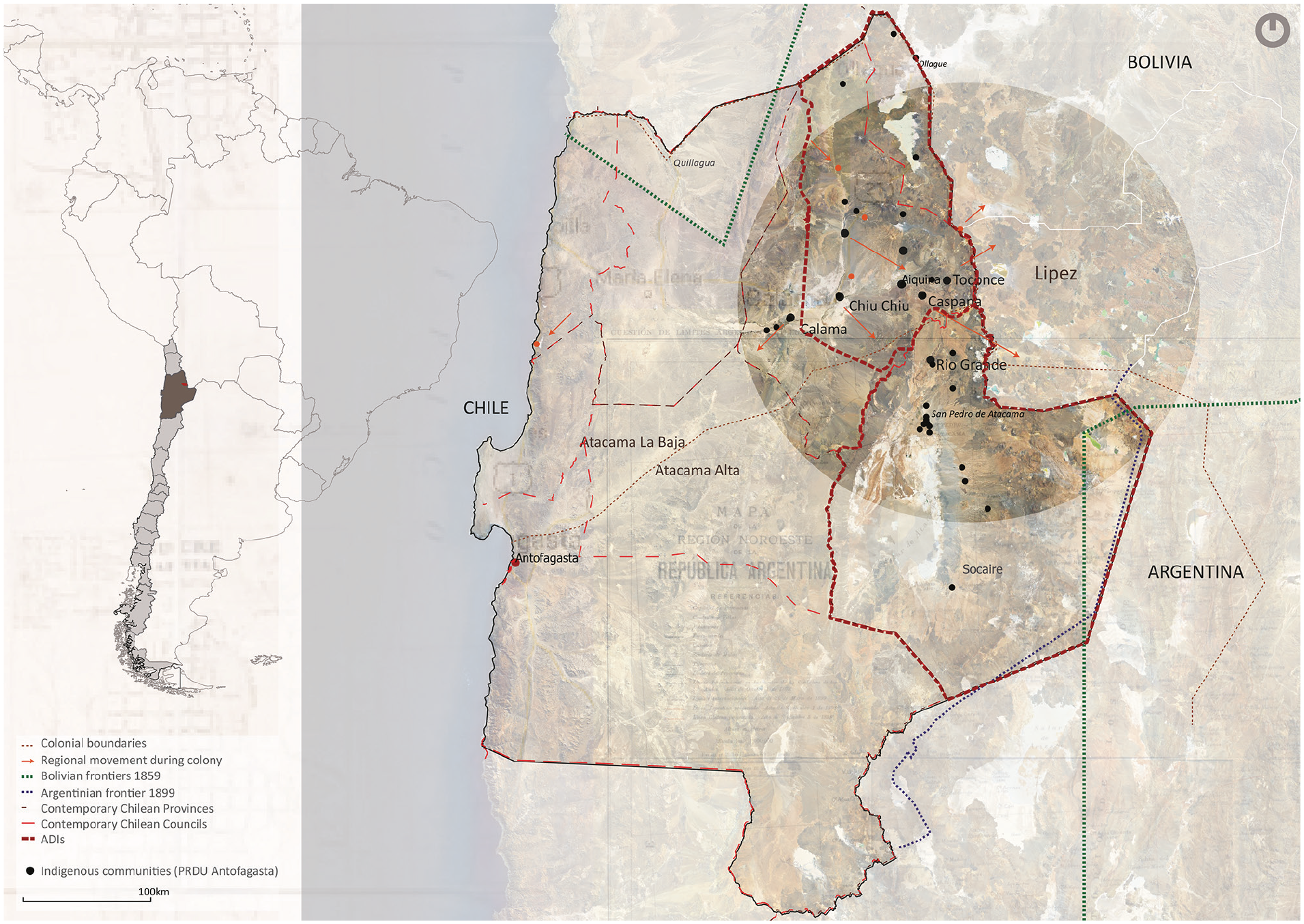
With the Spanish domain, Likan Antai people sought to maintain, to a certain extent, their traditions and movement to different areas towards Bolivia (Martinez, 1985) (Figure 1). However, it was after the emerging nation-state’s formation, and the power and domination imposed over these communities, that the regional movement was fragmented, broken and prohibited (MIDEPLAN, 2003). Archaeologists and anthropologists in the region have gathered an interesting amount of Indigenous territorial knowledge, which has helped this research to glimpse and explore some further spatial organisations in field. Nevertheless, further fieldwork research was necessary to support empirical evidence about the current spatial organisation, memory and rituality for the case study area.
Maps, frontiers and the regional movement during Colony and the States formation.
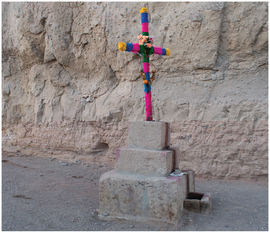
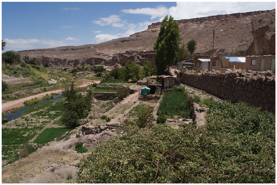
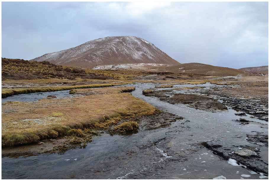
Caspana is the most traditional Likan Antai community which performs ancient rituals and ceremonies. The value of this case study lies in the local context that describes a particular intangible cultural heritage (Flyvbjerg, 2007). In Caspana, there is a “celebration” which comprises 3 days of ritual procession (Image 1) where the Candelaria virgin is moved, followed by hundreds of people towards specific altars in the territory (Image 2). The houses in Caspana are located above the crops in the ravine (Image 3). The families also raise livestock in the interior of the basin and in the lower lands of the nearest mountains. Due to job and education needs, most of the families are divided between Calama city and the family plots in Caspana, which is the reason why during most times of the year these villages seem empty.
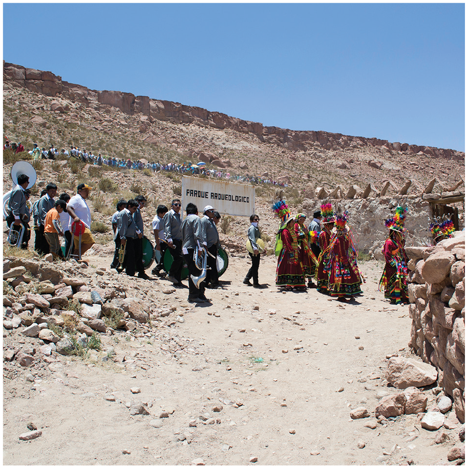
People’s movement for the Candelaria celebration on 1 February when the Virgin is carried to the top of the ravine.
Processions’ beginning in Caspana. Is in the middle of the old town and the new town.
Caspana.
Cultural mapping as method for a tenure map
The aim of fieldwork was to understand the territorial complexity and articulate a landscape of movement through the walkers’ perspective, motivations and the connection with the territory. Their understanding of space and the description of mental maps was accessed through cultural mapping methods. Therefore, qualitative research methods were used to analyse place meaning and spatial organisation and the principles of a landscape of movement using a “co-labour” methodology (Leyva et al., 2008), where the researcher gathers knowledge that the community desires to share.
Conducting fieldwork in Caspana has a challenge related with the destruction that archaeologists caused at their sacred burial sites during the 1980s (Ayala, 1999), and today there is a generalised distrust towards all kinds of academic representatives. This problem emerged after 60 buried bodies were removed from their original sepulchre (behind the cemetery on Image 1). Even though the bodies were from prehistoric times, for the Likan Antai people, they were their ancestors. After this disruption, the community has only allowed few researchers to work near those sites. They feel that researchers only want to extract knowledge and for their own benefit without asking for permission and compensating the community in any way. To deal with that situation, the researcher prepared a presentation letter introducing herself to the community and the authorities and explaining her interest and how the research would contribute the community. In that letter, the author committed to delivering all results of the research and to outlining future work together. In addition, a non-disclosure letter was signed as a commitment to the community. Based on previous experiences with archaeologists, the community was trying to protect their cultural heritage and make their own decisions about what they want to share. This letter included a declaration of no-publication of any territorial information regarding the specific location of sacred places and especially the extension of their territory, as they are still in the process of land recovery. After signing that letter, the community approved the fieldwork, which took place between January and February 2018.
According to Chilisa’s research guidelines on Indigenous communities, the activities should be designed with the participants, recognising their authority and asking for permission (Chilisa, 2012). For this case, the president of the community decided, along with representatives from local families, which activities they agreed with and the outcomes expected. Different types of qualitative research interviews were carried out during fieldwork. Six community members participated on the interviews (three male and three female over their 50s) and were focused on the knowledge about the landscape focused on movement as a cohesive phenomenon and as the catalyst of the cultural intangible heritage. For the community, this vision was interesting because with the mapping process they would gain a tenure map (Duxbury et al., 2015; Lee Peluso, 2011) locating and valuing places where their ancestors used to live and work, becoming a legal tool for that territorial claim. The criteria for the sample and recruiting participants were mainly defined by accessibility. One suggestion made by the community president was that the participants were adults with territorial knowledge beyond the limits of the village. While the tenure map was constructed, conversations about the use of certain spaces, values, roads, connections and dynamics were activating the memory of that place (Duxbury et al., 2015; Lee & Gilmore, 2012).
In addition to the cultural mapping and tenure map method, “participatory three-dimensional modelling” was used as guidance throughout the process. It was developed by a group of professionals led by Giacomo Rambaldi under the name of “Integrated Approaches to Participatory Development” (IAPAD). It consists of a three-dimensional (3D) model for participation, which is built with the community at a first stage of habituation with geographical information (Rambaldi, 2010). Several authors agree that conventional cartography does not help in the process of mutual understanding and engagement between researchers and communities (Johnson et al., 2006). Considering this, Rambaldi proposes working over a 3D model to decipher the collective understanding of landscape. He explains it facilitates the scaling process helping people to locate themselves more easily and it also helps memory development (Rambaldi, 2010, pp. 5, 6). By following these three stages over a 3D model, it is possible to catalyse the unconscious knowledge as associations hidden in the participant’s memory (Rambaldi, 2010).
The procedures for conducting the 3D mapping process were the following:
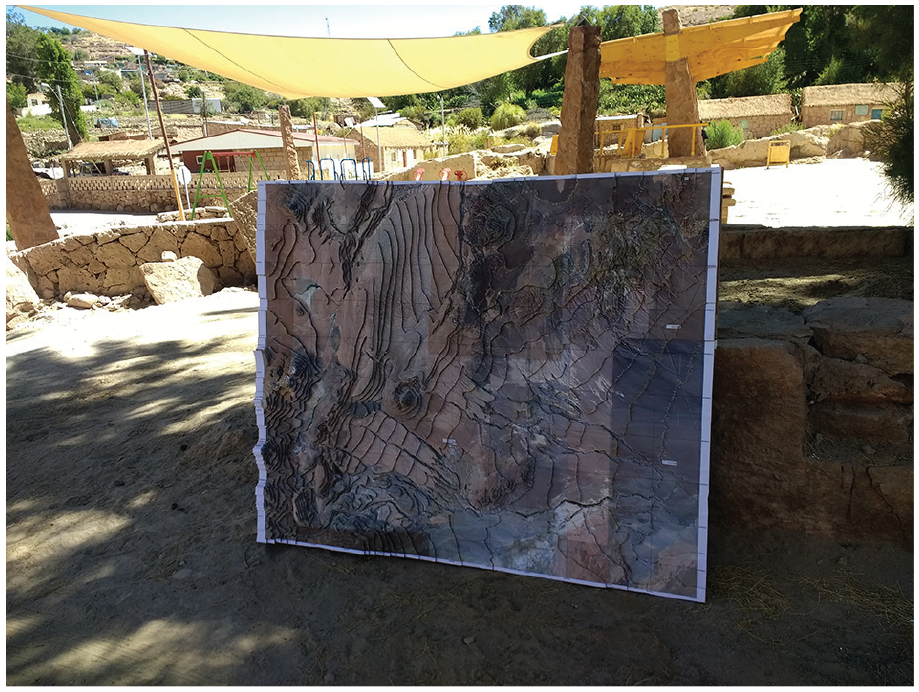
Selection of the area by the stakeholders (Rambaldi, 2010). Caspana had already been developing a tenure map at the time of this research, and therefore, it was easy to define the scope of the model. Key community interviewees provided the territorial outline (Image 4).
Preparation of the map legend with the community (Rambaldi, 2010). A participatory process had already been developed by the community for the tenure map in the approval process. The symbols they had already identified in the map are described in the following image: (Image 5)
Setting up the model. Rambaldi recommends using contour curves to build the model, tracing them and then cutting and pasting. For fieldwork, the researcher decided to use a satellite image as the base to help participants to locate themselves in the model, as in the image below: (Image 6)
Selecting participants for the model and the territorial description (Rambaldi, 2010). According to the methodology, a group of young people should help with the model manufacturing; however, as there is no high school in Caspana and most inhabitants work on the fields, it was not possible to have access to young people to help with the model making. Participants would approach to the cultural house where the map was being built and participate on the location of valuable places (Image 7)
Three-dimensional model prepared for a meeting with the community.
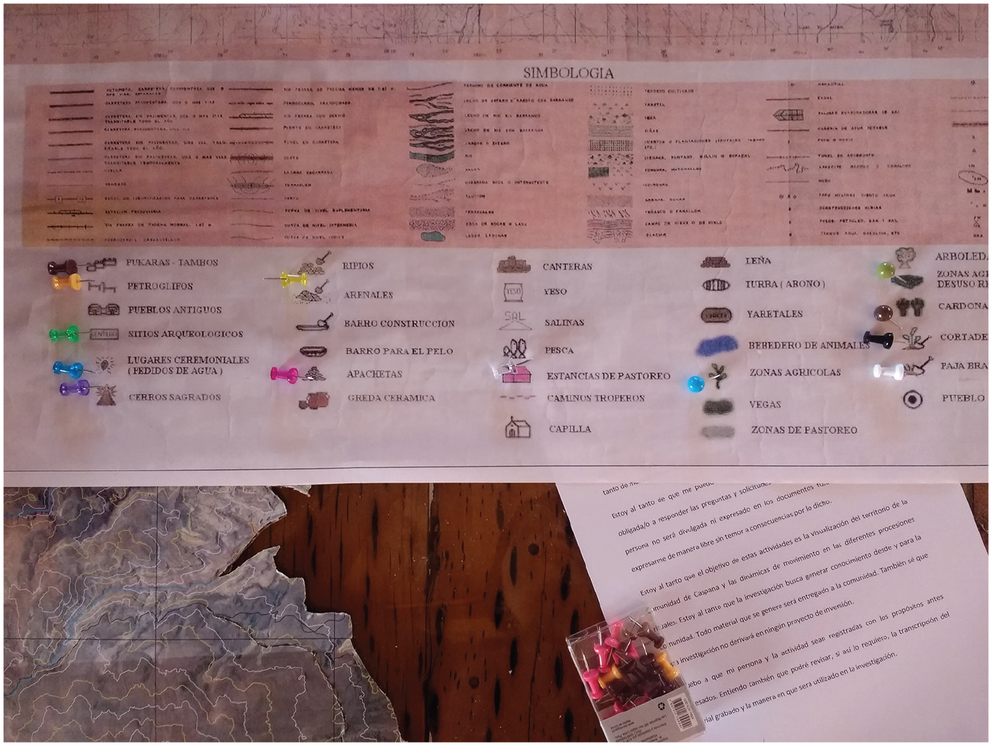
Legend of Caspana tenure map in process. It recognises Pukaras, Pictoglyph, Ancient Towns, Archaeological Sites, Ceremonial Places, Sacred Hills, Rubble, Sand, Mud, Apachetas, Pottery, Quarries, Plaster, Fish, Estancias, Heritage road, Chapels, Wood, Peat, Yaretas, Water for Animals, Agricultural Zones, Vega (Lowland), Cactus and Straw, among other elements in the landscape.
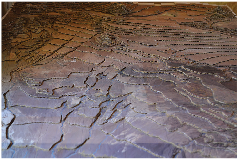
Model’s contour curves over a satellite image.
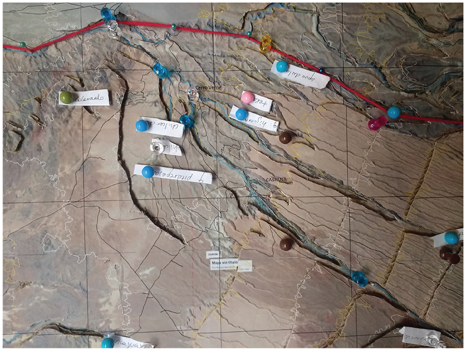
“Caspana’s inventory map” in process during the fieldwork.
The interviews conducted over the model transferred the location of sites from the tenure map in process to the new model, gathering the narratives and the memories of the participant regarding those lands. The interviews were open conversations which started by asking participants to locate themselves and the missing elements on the maps, to tell the stories they remembered and what the meaning of the places pointed out in the map was. Finally, every element from the legend was discussed during the interviews, some more than others, depending on the interviewee’s interest and knowledge about those places. From cactus to sacred places and from estancias (old piles of rocks used for cattle) to apachetas outlining the territory. Two new features were included into the map during the interviews: the toponymy (names of places) and the guaras (places where the water emerges), as the source of rivers and grazing areas.
Caspana’s space signification
Landscapes of movement as the theoretical framework informing the case study of Caspana highlight elements in the landscape that are normally not considered valuable heritage by authorities, such as cactus; estancias; barely visible pathways leading into the open field (road where ceremonies take place); toponymies (place names); pictoglyphs indicating directions and symbols in the landscape; apachetas and mojones; ceremonies and rituals along tierras compartidas (shared lands) as interconnected elements. This valuable heritage, not in the material presence but in their meaning for communities, is endangered by mining exploration projects. However, by empowering communities with self-knowledge in terms of the features composing these territories, a first-stage increasing protection by awareness is achieved.
The information gathered from the interviews was organised in tables that classified the data into two variables: movement performed by the local community (Caspana) or movement within the region (neighbour communities); and the purpose of movement, whether it is through “roads to resources” or through “roads to sacred places” joined by the category of “rituals”; labels that came from the theoretical framework of landscapes of movement (Figure 2)
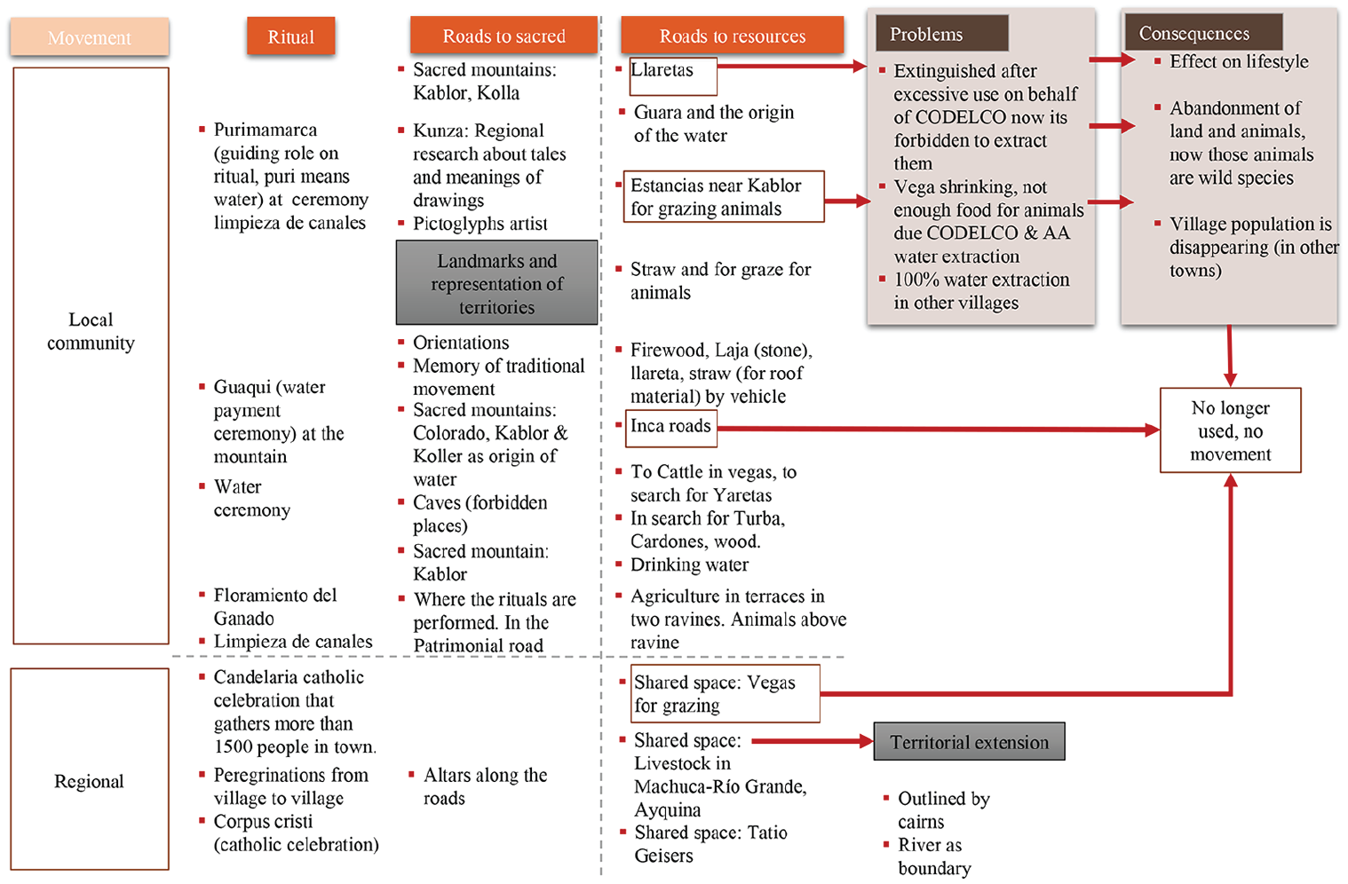
Table of concepts for the narratives of Indigenous community members.
The practice of movement allows to articulate two kinds of territories in the form of two labels, an “ancestral territory” and a “ritual territory” (Figure 3). This re-categorisation is part of the process of grounded theory applied to the analyses, aiming to integrate theoretical concepts throughout the data gathering and analysis to explain the social phenomenon under study (Corbin & Strauss, 1990). The “ancestral territory” is currently visited, and the “ritual territory” is not. In these two territories, there is a constant dialogue between the “roads to resources” and the “roads to sacred places”, as a representation of an Indigenous belief in relation to the land beyond extractive purposes and generating a deep bond with symbols along the landscape. Geographically speaking, the ritual territory is the walkable space nearest to the village, of approximately 15-km radius and concentrated in the two main ravines. The symbology arranged during the activity includes elements from both territories (Figure 4). The ancient territory is the vast space (extending approximately 50 km from east to west and 20 km from north to south) surrounding the ritual territory.
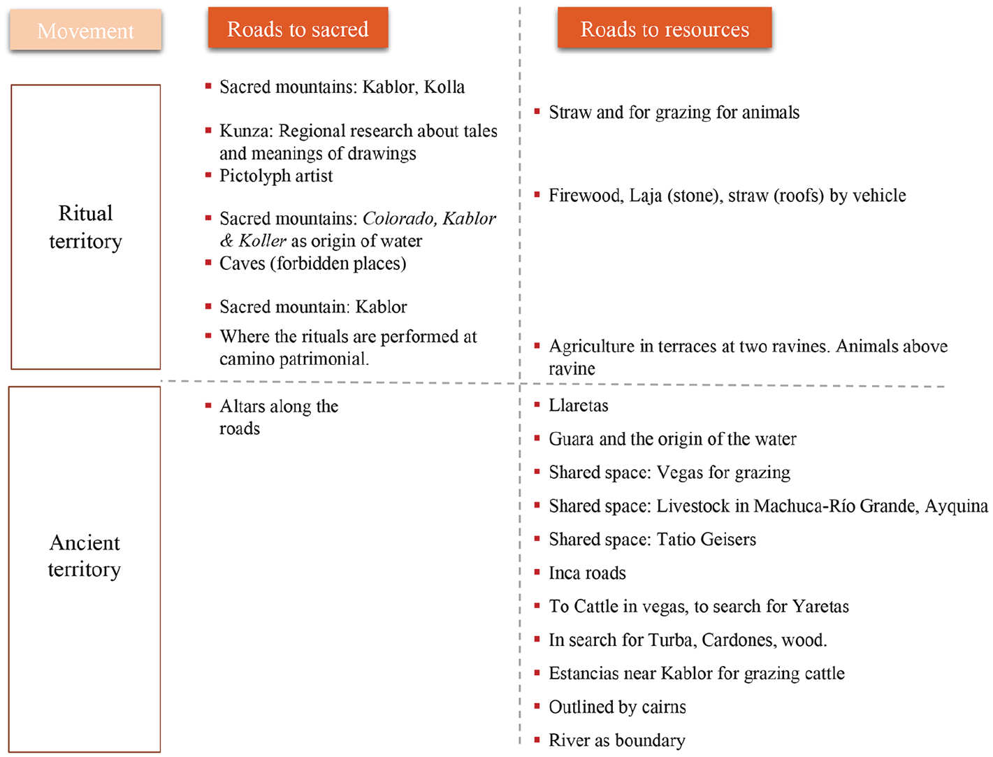
Table of concepts for the Narratives organised into “ritual territory” and “ancient territory”.
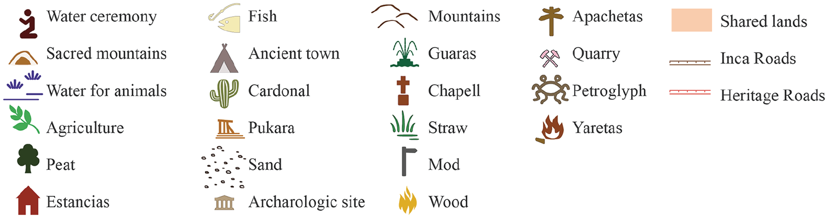
Tenure map legend.
The ancestral territory
The “ancestral territory” consists in the proper tenure map, the land the community owns due to ancestral patterns of use which is not visited these days because of different social changes in the Likan Antai society. The ancient territory describes places and landscape elements that are tangible in the landscape; however, there is no value in their material form, they only gain meaning when they are included in this mapping exercise holding the memory of previous generations. This space is no longer used or visited by the community; however, it is a space of memory, they know precisely where the estancias are located, and it is part of their ancestral territory claimed and supported by law (Oficina Internacional del Trabajo, 2006). Formerly, people visited these areas in search of yareta (flowering plant). This element, along with the water supplying vegas (flooding valley), was extinguished in the 1950s after excessive mining use. When the vega, an area for grazing, is in drought, then the turba (peat) appears, a sponge material, suitable for crops (Image 8). This space was used by previous generations who visited their estancias (grazing stay) where they had a second home. (Image 9): They lived there, they have the houses called estancias . . . . they had cattle of llamas, donkeys, goats, sheep and fed ducks, wild animals, many wild animals . . . . nowadays they do not occupy them anymore. (Interviewee E, male, 70)
Despite these areas are no longer used, the estancia’s value consists in proving the land ownership, providing proof for a territorial claim (see Johnson et al., 2006; Poole, 2003).
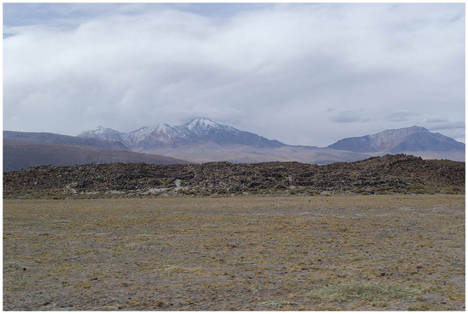
Peat ground and Turi Pukara at the background.

Estancia between Ayquina and Caspana, near the main highway.
Another important element in these lands, especially in the highlands, are the guaras, which are usually associated with mountains or vegas: Here, is a place where there used to be a guara and it was called Agua Chica. From there down here (pointing the map) and it goes down to San Pedro de Atacama, that is called Jauna and this is Putana river. (Interviewee E, male, 70) (Image 10)
Jauna Guara.
The roads to sacred places, as a concept described in landscapes of movement’s theory, in this space lead to altars or shrines (Image 11), the former chullpas, which were used for the patronal celebrations and to carry religious images from one village to another: They are also called as rest places, for the processions carried out during the pilgrimages from town to town . . . . Toconce has their rests on their side, by the Salado River towards up, that is the last chapel from Ayquina to Toconce. Other chapels are in the sector of the cross, then Pila, and then one on the Salado River. (Interviewee A, female, over 40)
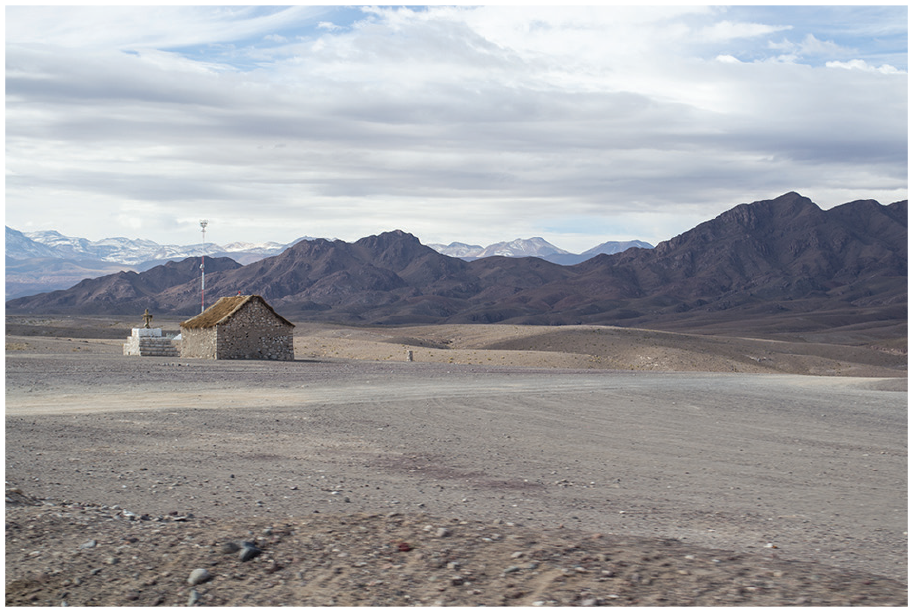
Altar between Ayquina and Caspana, used in the past for pilgrimages.
Tierras compartidas are outlined between more than one community, which originally were lands for livestock, and Corporación de Desarrollo Indígena, CONADI (Corporation for Indigenous development) incorporated those lands to the official maps. These lands are outlined by cairns, or mojones, as in Puente del Diablo, a landmark of the “shared lands” between Caspana and Ayquina (Image 12).

Puente del Diablo Cairn. Today there is also a memorial of the narrowest point in the Salado River where people built a bridge using rocks as the structural element.
The ritual territory
The “ritual territory” considers the ancestral space reduced to the chacra (farming garden), which is the space for crops (Martinez, 1985), and the village as alternate residences (Imilan, 2007), meaning houses that families inhabit for intermittent periods of the year alternating with another house in the city: We have terraces in two sectors, the large ravine of the school sector upwards and in the other sector (indicating the other ravine). We do not have everything planted but at least one is complete. We sow flowers, vegetables and vegetables. (Interviewee A, female, over 40)
The “ritual territory” consists of the walkable space where the community identified sacred places and where they practice ancient and private rites: the cleaning of canals, the water ceremony towards the Kablor hill (Caspana’s protecting hill) and the ritual where the animals are blessed with colourful wool ornaments are practised every year in the nearest areas of Caspana. This is a landscape in daily movement, where people leave their homes and walk miles to take animals to graze or to work on their terraces.
Floramiento del Ganado (livestock flowering) is a ceremony that consists in putting colour wool in the ears of animals. The aim is to maintain traditions. It is for good reproduction of animals and to celebrate them: We go to the corral and we put colour wool in the ears and body. Afterwards, a lunch is made to share with the people who participate. Some families, not everybody does it. We do this for San Juan, in June 24 and also during the Carnival on February. These are traditions from the past, however only some families still do it. (Interviewee A, female, over 40)
The ritual, Limpieza de canales (canal-cleaning ceremony), is essential for the articulation between “the sacred” and “access to resources” by combining a ceremony for the water irrigation and the canal maintenance. A community member explained that this celebration consists of community work, accompanied by costumes and traditions, or rituals, in other words. The interviewee explains how rooted this tradition is in the community and the value it has for them. She also highlights the practical meaning of this ritual. As it is a shared asset for the community, the collaboration in the cleaning must be equal for all. Therefore, they take turns, and the alférez (high-ranking official) is the person each year who must coordinate the ceremony (Figure 5): There are several days of community work. It has customs, traditions. Is a habit that is remembered a lot . . . . first, it seems that it was voluntary, and since nobody wanted to pass, the committee said as we all occupy the water, we are all part of Caspana, so every family must go through the celebration of canals, and it follows the order of the houses. (Interviewee A, female, over 40)
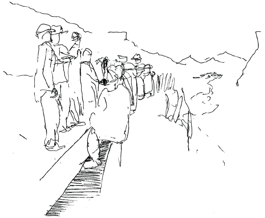
Drawing during Limpia de canales ritual (no pictures were allowed).
Los danzantes (the dancers) is the rock painting describing the ritual dance performed during the ceremony of 23 dancers: We dance in the same way for the cleaning of channels. There are 23 dancers. The camelids below mean the sacrifices. The ceremony is August 23. They sing in Kunza and do the same steps back and forth very smoothly. That means giving thanks to nature. (Interviewee D, female, over 40)
Ceremonia del Agua (water ceremony) is an ancient tradition related to a mallku worship (Lynch, 1993–1996; Pino Matos, 2016). It consists of bringing water from the sea and performing a ceremony on the hill, and it has been discussed by some authors; however, it is a private tradition (Villagrán et al., 1998): Consists in when you put water from the sea to make it rain. Where there is a hill, the hill of Kablor, there is a ceremonial place. Sea water is brought, placed on the hill and then prayed. Here in Caspana there are also two places, one that is down here, another is up here. (Interviewee E, male, over 60)
When the interviewee highlighted “here in Caspana”, he pointed out the area near the village on the top of the ravine near the “heritage road”. Another interviewee described the place where those rites are performed, and the sacred hills: “The Sacred hills are Two, the Kablor and the Koller, where the water is born, at the foot of the hill, Caspana water is born” (Interviewee B, male, over 40). After, he also added a third hill, the Colorado hill, “because there we perform the ceremony pedidos de agua (asking for rain) . . . . that is why they are sacred” (Interviewee B, male, over 40).
Discussion and conclusion
The engagement with an Indigenous self-definition of space and their environment has contributed to landscape theory, as it links different academic discourses, such as sacred places, resources and rituals, to landscape theory recreating the process of space signification and locating the intangible heritage. Hopefully, the results of this research will be used as a statement for an alternative approach towards Indigenous participation methodologies in Chile (instead of consultation), evidencing the need for understanding a different perspective of the territory, its spatial organisation and the value of the rituality behind religious celebrations.
The contribution to the community was the 3D map itself, along with the inventory and the symbology of valuable elements in the landscape. A year after visiting the community, they said that the map has been intensively used during meetings as an educational tool and to communicate limits and the territorial extension of the land they have inherited. It is their will to continue with this process focused on the ritual territory and the rescue of kunza place names, as a language rescuing strategy.
This investigation offers a practical approach where intangible cultural heritage is endangered. The protection of the intangible is not possible without locating the rites and the traditions in terms of a path or an area where they are usually carried out, and for this case, valuing movement as a physical representation of the intangible. The distinction between an “ancient” and a “ritual” territory is essential to specify areas of intangible value. Today, the ancient territory is protected by law; however, it is exposed to a range of potential hazards in terms of heritage protection, principally mining extraction, as the subsoil does not belong to the community but to the Chilean state. On the ritual territory, the intangible heritage is located in the places were ancient rites are practised, the pictoglyph are connecting sacred places with interpretations of the past in the Images and all the features composing Caspana’s tenure map as an inventory of the community’s heritage.
The localisation of these features becomes a legal argument for intangible heritage protection. Individually, these elements could have protection only if they are considered archaeologically valuable, as for the rock painting. Places such as ceremonial sites, with no visible constructions or traces of previous cultures, have no protection in terms of heritage. By putting together all these elements, they acquire value as a whole. The map as an inventory allows the community to ask for the protection of all these sites as part of their cultural heritage.
However, the findings of the research, especially the location of sacred places, can also become a weapon against the communities that value them when it becomes information they do not want to share. That is the reason why, as a community requirement, this article will not reveal specific locations, although the researcher is aware of all the places located on the map.
Footnotes
Declaration of conflicting interests
The author(s) declared no potential conflicts of interest with respect to the research, authorship and/or publication of this article.
Funding
The author(s) disclosed receipt of the following financial support for the research, authorship and/or publication of this article: This work was supported by CONICYT (Comisión Nacional de Investigación Científica y Tecnológica/ Chilean National Commission for Scientific and Technological Research) “Becas Chile” Master Fellowship program; Grant No. 73171337 to Melisa Miranda Correa; and the Tweedie Exploration Fellowship fund 2017, The University of Edinburgh, Edinburgh College of arts, PG Research Office to Melisa Miranda Correa as MPhil student.
Data accessibility statement
The data that support the findings of this study are available on request from the corresponding author. The data are not publicly available due to containing information that could compromise the privacy of research participants and it was their request not to share details about the location of sacred spaces or territorial boundaries.
Glossary
Alférez: Spanish word. For this context, is a person each year who must coordinate the ceremony limpia de canales.
Apacheta: Quechua and Aymara word. Landmark formation as stone piles next to roads to facilitate movement.
Calama: Kunza word. Town in the middle of water. This is Caspana’s nearest city.
Camino patrimonial: Spanish words. Heritage road.
Caspana: Likan Antai word. Chilean town located 85 km north of the city of Calama, Province of El Loa, in the ravine formed by the homonymous river and which is a tributary of the Salado River.
Chacra: Spanish word. Farming garden.
Chullpa: Aymara word. Funerary tower, a rectangular construction with the shape of a shrine, where locals used to pilgrimage to.
Estancia: Spanish word. Grazing stay. A construction of rocks and straw for the roof, used for previous Likan Antai generations as alternate residencies for grazing cattle.
Floramiento de ganado: Spanish words. Livestock flowering is a ceremony carried out above the ravine where the animals are celebrated with wool ornaments to ensure their fertility, a tradition that only some families have kept.
Guara: Word used by Likan Antai people. Refers to the place where water emerges, which is usually associated with mountains or vegas.
Kablor: Likan Antai word. Caspana’s protecting hill.
Kunza: Likan Antai language.
Likan Antai: Indigenous people from the Atacama Desert and Altiplano region in the north of Chile and Argentina and southern Bolivia.
Limpieza de canales: Spanish words. Canal-cleaning ceremony.
Mallku. Aymara word. Meaning the spirit of the mountain
Mojon: Spanish word. Stone piles to outline social boundaries.
Qhapaq Ñan: Quechua word. Main Andean road.
Tierras compartidas: Spanish word. Shared lands.
Turba: Spanish word. Peat.
Vega: Spanish word. Flooding valley used for grazing in the highlands.
Yareta: Quechua word. Is a flowering plant native to South America. Used for fire, today almost extinguished, therefore its extraction is forbidden.