
Abstract

Introduction
Sets of powerful earthquakes and following destructive tsunamis hit Indonesia on Friday afternoon, killing more than 1300 people there. The strongest 7.5-magnitude earthquake shook the province of Central Sulawesi, Indonesia at 17:02 local time on 28 September 2018. Following a series of tremors from 14:00, this earthquake occurred at some 11 km depth and continued with tens of aftershocks. Soon afterwards, a massive 6-m-high tsunami smashed into Palu city which is about 80 km south of the epicentre of the earthquake. The tsunami, as well as the earthquake, destroyed extensive infrastructure and caused a vast humanitarian disaster. The spokesman of Indonesia’s disaster mitigation agency, Sutopo Purwo Nugroho, is quoted
1
as saying, When the (tsunami) threat arose yesterday, people were still doing their activities on the beach and did not immediately run and they became victims … The tsunami didn’t come by itself, it dragged cars, logs, houses, it hit everything on land …
The 2018 Indonesia tsunami has been ranked the largest one since the 2011 Tohoku tsunami. However, the 2011 Tohoku tsunami was caused by the Tohoku earthquake which was one of the world’s largest earthquakes. The 2018 Indonesia tsunami was massive compared with these tsunamigenic earthquakes, with the implication that some additional factors worsened the tsunami.
Tsunamis typically are the consequence of the vertical motion of water columns due to large submarine megathrust earthquakes at tectonic plate boundaries. 2 Nevertheless, the Indonesia Sulawesi earthquake was not a megathrust earthquake. This earthquake exhibited a primarily strike–slip motion, meaning the displacement was lateral. This horizontal motion is less likely to be associated with tsunami generation.3,4 There are also some alternative hypotheses regarding the possible trigger mechanism including submarine landslides.5–8 Only a few per cent of tsunamis are believed to be triggered by submarine landslides. 9 For example, the 2010 Haiti earthquake occurred along a strike–slip fault, but generated a tsunami. Hornbach et al. 9 suggested that the Haiti tsunami was a result of combined strike–slip faulting and submarine landslides. As for the 2018 Indonesia tsunami, it is noteworthy that three large terrestrial landslides have been found after the earthquake in Palu. 10 The head scarp width of the first landslide, on the outskirts of Palu, was about 1 km and the length was over 3 km. The second landslide was near Palu airport runway, and this landslide was about 1.5 km wide and about 2.5 km long. The last landslide was a smaller one in the city centre with width of 500 m and length of 1 km. Similarly, the earthquake may have already generated more remarkable submarine landslides, which consequently worsened the 2018 Indonesia tsunami. However, only the subsequent geological survey will tell us whether there was a submarine landslide or not.
In addition to the earthquake and possible submarine landslides, the shape and topography of Palu bay were also responsible for the surprise tsunami (Figure 1). The need for a comprehensive mechanism of past tsunamis, the monitoring of ongoing events and the early warning of future hazards are all challenges that must be addressed in future studies. It is time for disaster mitigation to catch up.
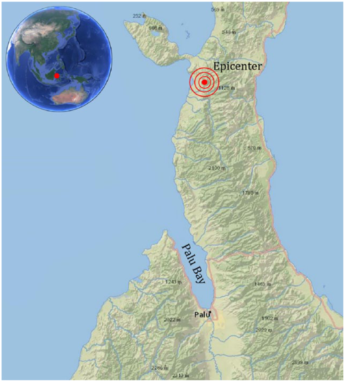
Map showing Palu bay and the epicentre of the earthquake.
Footnotes
Declaration of conflicting interests
The author(s) declared no potential conflicts of interest with respect to the research, authorship and/or publication of this article.
Funding
The author(s) received no financial support for the research, authorship and/or publication of this article.