
Abstract
Framed by a utopian rhetoric, the Open City emerges as a potential guiding principle to the contradictory tendencies and calamities of cities. As an elusive concept with a panoply of context-bound interpretations, the Open City is an open-ended project that manifests through different situations across the city. The article aims to explore different attributes of the Open City, in the context of Berlin, based on a thorough literature review and operationalizes the concept using a systematized approach. Results revealed that openness in Berlin followed a center-periphery pattern, where areas that fostered a high degree of openness were mostly found in inner-city neighborhoods while a lower potential of openness prevailed along the edges. By analyzing the conditions of openness in relation to the built environment, we sought to contribute toward a better understanding of the Open City concept and provide an approach for analyzing openness that can be adapted to different geographic contexts.
Introduction
Cities can be considered as engines of growth and innovation that offer new opportunities and provide access to resources and services (Colenbrander, 2016). Cities promise emancipation and nurture possibilities of encounter (Merrifield, 2013; Schmid, 2012). They often fulfill conflicting and complementary needs: “the need for security and opening… the needs for the predictable and the unpredictable, of similarity and difference, of isolation and encounter” (Lefebvre, 1996: 147). These contradictory tendencies manifest spatially and problematize the Open City (OC)—a contested concept that is characterized by ambivalence and that embraces the long-standing tensions of the urban (Ipsen, 2005).
Apart from its military and cinematic interpretations, the OC elicits a panoply of connotations. From a socio-spatial perspective, the OC is perceived as an unfinishable and open-ended project that continuously adapts to changes (Friedmann, 2002; Porqueddu, 2018; Sennett, 2018). As a “socially and culturally pluralistic” entity, the OC accepts immigration and productively manages cultural complexity (Ipsen, 2005: 91). It seeks to develop shared values and rules while acknowledging the independence of multiple cultures (Ipsen, 2005; Shields, 2013). It is a socio-political construct that engages citizens to actively participate in urban processes (Brenner, 2013; Rolshoven, 2014). The OC is forward looking with a capacity to accept differences, new ideas, and unpredictable tendencies. Friedmann (2002: 237) defined the OC as one “that reaches out to others who are not necessarily like us, and that acknowledges our common humanity and the pleasures of a life lived among multipli/cities.” Rieniets (2009a) considered the OC as an inclusive, diverse place of encounter where resources and opportunities are equally accessible to inhabitants. As an experimental and inconclusive vision (Lindner, 2011), the OC remains an ideal construct that builds on current conditions and contradictions of the city and promises diversity, participation, inclusivity, and accessibility.
The term OC is gaining momentum in urban planning and architecture with the growing discourse on open data, digital citizenship, and data sovereignty. The underlying philosophy embodied in these concepts centers on improving citizen participation and promoting an ethos of transparency and democracy—characteristics that ultimately underpin open cities, foster a culture of openness, and engage with policy, politics, and the public (Chan, 2013; Praharaj and Bandyopadhyay, 2020). However, it is worthwhile noting that the OC remains one of the various derivatives of the concept of openness. Therefore, the terms OC and openness are sometimes used interchangeably in this study. In effect, the OC is interconnected to other derivatives such as open access, open data, and open government, which have been widely used across the literature and in different contexts and disciplines.
Given its different understandings, defining the OC is a difficult undertaking. Suggesting that all interpretations can be contained in a definition is essentially denying the openness of the concept to new interpretations (Goldstein, 1989). Generally, dichotomies, such as open and closed or inclusion and exclusion, emerge when addressing openness in the context of urban studies. Contrary to prevalent dualisms, the concept entails a degree of flexibility—a continuum between opposite unrealistic ends, namely, openness and closure. In this regard, the degree of openness represents the acceptance of new and foreign concepts, people, and commodities (Ipsen, 2005). This continuum brings forward questions regarding what is considered open, to what degree, and the ways in which it is analyzed in relation to the city.
While various scholars have identified numerous conditions of the OC (Christiaanse, 2009; Ipsen, 2005; Sennett, 2007), an operationalization of the concept remains limited in literature. Thus, the article presents different attributes of the OC derived from urban studies literature and aims to operationalize the concept using an equal weighting approach. We focus on Berlin, a renowned OC (Allon, 2013a), to develop a systematized understanding of the concept, its attributes, and implications for future urban transformations. While we acknowledge that the OC cannot be predicted or designed (Christiaanse, 2009; Porqueddu, 2018), we intend to emphasize the conditions that can potentially foster this positive value in cities.
The paper is structured as follows: section two provides an overview of the OC concept in relation to the built environment. Section three presents the attributes, method, and scoring approach used to operationalize the OC concept. Section four presents the results, and section five provides an interpretation of the findings and concludes with future research directions.
Attributes of openness
The conceptualization of the OC often draws on the ideals of the Open Society—a concept introduced by Popper (1945) that refers to an inclusive, liberal, and tolerant society with democratic and transparent institutions. Understandings of openness derive from the Enlightenment and evoke a range of associations with diversity and inclusivity (Ipsen, 2005; Sennett, 2007); impartiality and acceptance (Lundgren and Westlund, 2017); accessibility (Friedmann, 2002; Gleeson, 2001; Schmid, 2012); participation and political transparency (Moore, 2018; Rolshoven, 2014), etc.
Building on Jacobs’ (1961) urban vitality concept and her advocacy for complexity, dissonance, diversity, and density, Sennett (2007) proposed three “systematic elements” of the OC, namely, passage territories, incomplete forms, and development narratives. He later expanded his analysis to include five conditions: (1) permeable or porous boundaries (passage territories), that facilitate exchange across different areas; (2) incomplete forms, or an open architecture that consists of unfinishable architectural type-forms to accommodate changing needs; (3) seed-planning where type-forms become breeding grounds for complexity and openness; (4) punctuations, such as landmarks or street furniture; and (5) synchronicity of activities. Sennett’s (2018) seed-planning concept resonated with Christiaanse’s (2009) findings, who concluded following an overview of projects, that the OC is fostered through gradual interventions based on a careful analysis of the status quo and interplay of hybrid and contrasting tendencies. More specifically, the OC rejects top-down planning driven by state institutions and private interests and orchestrates variations, substitutions, and additions in the built environment, using minimum rules, to encourage adaptations and support the emergence of open systems (Porqueddu, 2018; Sennett, 2018). It is a future-oriented approach that reflects a city’s dynamism and adaptability, influences design practice, and considers uncertainty, contingency, and democratic engagement (Davis, 2014). Accordingly, designing accessible and mixed neighborhoods with public spaces and an integrated transport network does not necessarily guarantee openness but can form the basis for fortunate developments. Overall, both Sennett (2018, 2007) and Christiaanse (2009) emphasized the role of urban form in promoting the OC and noted various attributes of openness such as permeability, accessibility, diversity, and democratic engagement.
Following theoretical discussions, Rieniets (2009b) underscored six “situations” that embody the OC’s complexity, namely, (1) refuge, which is the retreat of particular groups to protected urban enclaves; (2) community, which denotes the voluntary clustering of individuals based on common affiliations; (3) collective, which refers to the socialist city that was initially conceived as an egalitarian model with equal living conditions; (4) squat, which examines informal settlements that defy urban plans; (5) reciprocity, which emphasizes exchange between urban spaces and informal actors; and (6) “Maakbaarheid,” which literally means make-ability and describes a shift in the Dutch society from multicultural openness to market-driven planning. While community and refuge can result in segregation that threaten diversity and cultural complexity, these conditions can give rise to neighborhoods that together form a network of communal economy while providing their individuals with safety (Ipsen, 2005). Overall, the “situations” emphasized conditions that foster and challenge the OC.
Beck (2007) differentiated between the “city of Either-or”—a city of segregation, security, and control—and the “city of And,” one that embraces diversity, difference, and cohesion. The “city of And”—the OC—is marked by “cultural tolerance, socio-economic inclusion, a democratisation of public space and a radical opening out of non-political spheres” (Gleeson, 2001: 261). This city produces a flexible urban form and an architecture of hospitable places that meets individual needs while offering spaces for communal life (Beck, 2007). In this OC, difference is celebrated and borders are diminished to establish new rules of social belonging.
To achieve the City-of-And, Beck (1998) called for democratizing practices that affect urban developments and emphasized the importance of institutions in shaping democratization processes. Findings from Beck (2007) are similar to notions presented by Brenner (2013) who also highlighted the need to democratize institutions and transform urban governance to foster the OC. Brenner (2013: 45) called for “open[ning] up urban space to democratic redesign through an ongoing process of grassroots appropriation and reappropriation.” He built on Lefebvre’s (1996) “Right to the City” concept, which highly resonates with the OC. The concept extends beyond the accessibility to resources and guarantees that investments attend to social needs, institutions protect common resources, and inhabitants equally participate to influence decision-making processes. The concept emphasizes people’s agency to (re)make their cities (Harvey, 2003). As a notion deeply rooted in the right to the city concept, the OC involves a democratic, socially just, and egalitarian reshaping and appropriation of urban space. It emancipates inhabitants from the hegemony of capitalism transforming them into new citizens (Shields, 2013). In effect, the OC is conceived as a space of opportunities where access to resources, appropriation, and active participation are key.
A significant feature of the OC is the acceptance of social diversity, foreignness, and heterogeneity. By hosting different ethnic minorities, the OC transforms into a site where new forms of belonging emerge and practices of inhabitance in relation to the right to the city are exercised (Allon, 2013a, 2013b). In this regard, Allon (2013a) proposed the perspective of urban citizenship to understand these dynamics in the context of the OC. As an alternative form of citizenship and belonging, urban citizenship includes political and grassroots activism, everyday activities of urban inhabitance as well as frictions resulting from negotiations, resistance, and struggles to claim space. It provides different social groups the potential to form communities and participate in creating and shaping urban spaces. This inclusive citizenship enfranchises the right to active engagement in political life, equally for all inhabitants, and is fostered through public debates on “civic and other citizen virtues” (Friedmann, 2002: 239). Such discourses offer different perspectives on the meaning of local citizenship, strengthen individual belonging to the city, and support the development of a meta-culture (Ipsen, 2005). The meta-culture derives from existing cultures and is based on common rules of coexistence and values to form shared spaces that cultivate the OC. Its development requires cultural complexity and manifests across the urban fabric (Ipsen, 2005; Yildiz, 2013).
Nonetheless, fear of others begets borders that often threaten heterogeneity and the meta-culture—prerequisites of the OC. While certain borders are abstract, others materialize by partitioning spaces. In the context of the OC, thresholds break the rigidity of borders and catalyze opportunities of exchange. Indeed, an OC “is a city of thresholds” (Stavrides, 2010: 42). By perforating edges of enclaves, thresholds create in-between experiences and enhance the porosity of spaces. Porosity promotes encounter and negotiation that mediate between divergent cultures. The term is associated with thresholds, permeability, and has “all the iridescent connotations of openness” (Wolfrum, 2018: 16). Indeed, a porous city is the cornerstone of an OC, one that embraces diversity and enables exchange between different cultures.
In sum, the OC is a continuous negotiation between contradictory forces and a process that considers a city’s dynamism while adapting to future uncertainties and contingencies. Different modes of enquiry such as urban citizenship, reflexive architecture, and the right to the city were used to understand the OC. Based on our review, six attributes of the OC that foster or challenge openness were derived, namely, diversity (social and typo-morphological); accessibility; borders and porosity; participation and appropriation; safety and surveillance; and synchronicity. Since Jacobs (1961) is credited for the OC concept (Rolshoven, 2014; Sennett, 2007), her conditions of urban vitality were considered and previous research that examined vitality through an applied perspective was also consulted to develop our methodological framework (Delclòs-Alió and Miralles-Guasch, 2018; De Nadai et al., 2016; Xia et al., 2020; Ye et al., 2018). Correspondingly, variables associated with these conditions were included to analyze openness. In addition, attributes that resist openness, such as surveillance and borders, were investigated to understand whether they defy the emergence of the OC.
Methodology
Case study
We focused on Berlin and considered its administrative boundaries as the limits of our study area. Home to 3.85 million inhabitants (Amt für Statistik Berlin-Brandenburg, 2023), Berlin is a symbol of a cosmopolitan city. After reunification, the city entered a new stage of development and was rebranded to eliminate historical images of division. This place-making strategy focused on the concept of openness that materialized in policies and new architectural forms. The “Open City” concept in Berlin was built on a general tolerance for cultural differences, grassroots movements, counter-culture scenes, and social diversity (Stahl, 2008). Openness was also an emblem that portrayed Berlin as a receptive, experimental, and malleable city, open to differences and innovation with an outlook to global trends (Allon, 2013a: 293). However, this celebrated image belied practices of exclusion that reinforced marginalization and segregation. These ongoing tendencies question Berlin’s openness and the right of the inhabitants to the city.
Operationalizing the OC attributes
Attributes of openness, their categorization, and data sources. References pertaining to the data sources are listed in Supplementary Material.
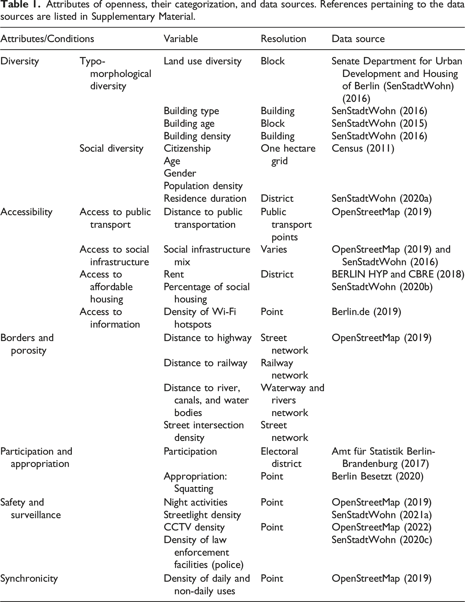
Diversity
As a proxy of openness, we considered different variables to depict the typo-morphological and social diversity of Berlin.
Typo-morphological diversity
Land use diversity
Land use diversity or a sufficient mix of primary and complementary uses is key to the vitality and openness of urban areas (Jacobs, 1961; Montgomery, 1998; Talen, 2006). Following Manaugh and Kreider’s (2013) classification, three land use categories were considered: (1) residential; (2) commercial, government, institutional, and industrial; and (3) recreational (excluding peripheral open areas). We calculated land use diversity (LUD) as follows: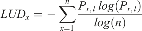
Building types and building density
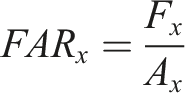
The urban fabric and its diversity of architectural type-forms play a role in fostering openness (Sennett, 2018). Following Ye et al. (2018), building types were classified into three categories: (1) point (single housing or high-rise buildings); (2) row-housing; and (3) block, namely, Wilhelminian multistorey estates and perimeter blocks common in Berlin.
The density and types of individual blocks x were considered by analyzing three measures: floor area ratio (FAR), ground space index (GSI), and building height. FAR describes the building density of a block x and is calculated by dividing the buildings’ gross floor area F
x
by the block area A
x
:
GSI reflects the relationship between built and non-built areas in block x (Berghauser-Pont and Haupt, 2010) and is calculated as follows: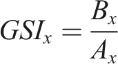
Building age
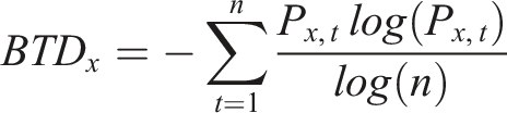
A mix of building ages can attract different socio-economic groups, stimulate gradual neighborhood redevelopment, and maintain social networks—characteristics that can affect an area’s vitality and openness (King, 2013). To calculate building age diversity (BAD), a total of 11 building age categories were considered, where each category referred to one decade from the year 1900 onward: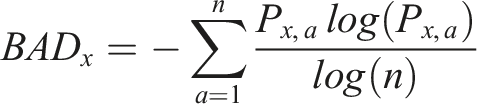
where P x,a refers to the percentage of square footage with building age a in block x and n is the number of building age categories.
Social diversity
Social diversity (SD) is the mixing of population by income, ethnicity, age, and household types in proximity (Talen, 2010). It is an underpinning of the OC that fosters cultural complexity and heterogeneity. The Simpson diversity index was used to measure the diversity of age (SDa), gender (SDg), and citizenship (SDc) in cell w: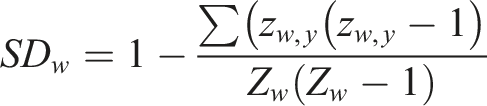
Population density (PD), a basic requirement of vitality (Jacobs, 1961; Montgomery, 1998), was also calculated using the total number of individuals 
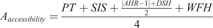
Accessibility
Accessibility is a significant underpinning of openness (Friedmann, 2002; Reijndorp, 2009). While the literature has widely emphasized physical accessibility, Bisht et al. (2010) argued that the concept extends beyond the spatial component to include non-spatial aspects such as availability, affordability, and acceptability.
Access to public transport
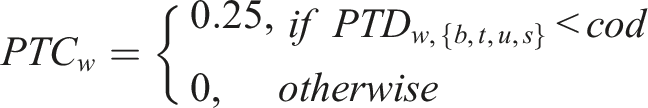
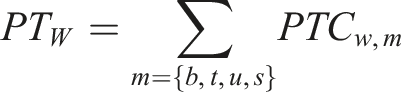
Access to public transport enhances access to opportunities and services. Four public transport modalities were considered, and the Euclidean distance from the spatial matrix cell’s center C
w
to the closest public transport hub (PTD
w
) pertaining to each modality (m) was calculated. To evaluate public transportation access, mode-specific threshold distances (cod) were used such as: bus stop (b); tram stop (t); U-Bahn stop (u) within 400 m; or S-Bahn (s) within 600 m. A score of 0.25 was given to each modality within the specified cod.
Access to social infrastructure
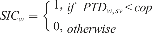
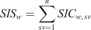
Social infrastructure refers “to the networks of spaces, facilities, institutions, and groups that create affordances for social connection” (Latham and Layton, 2019: 3). Dimensions that determine the social infrastructure’s success are its abundance, diversity, accessibility, and ability to convey an “ethos of democratic living” (Latham and Layton, 2019). Access to social infrastructure (sv) was measured by calculating the distance (cop) traveled to access a specific service type. Binary indicators (SIC) were assigned to indicate the presence or absence of a specific type of social infrastructure within the corresponding cop. Calculations were summed into a social infrastructure score (SIS) where a maximum score of 28 indicated the highest social infrastructure mix. A summary of social infrastructure services is listed in Supplemental Table S1. We calculated the social infrastructure score as follows:
Access to affordable housing
Access to affordable housing can promote mixed-income neighborhoods (Vale and Shamsuddin, 2017) and can be a proxy of openness. Since data on income was limited, rent data in Berlin (AHR) was aggregated to the spatial matrix:
The density of social housing (DSH) in district d, which is closely related to affordable housing, was also calculated: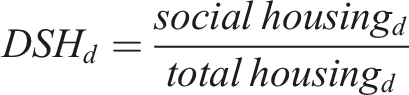
Access to information
To understand the relationship between virtual and physical spaces, Kim (2018) proposed the location of Wi-Fi access points as a proxy of virtual vitality. Building on Kim (2018), access to public Wi-Fi networks (WFH) was calculated within a 500 m radius, to understand virtual vitality, access, and openness: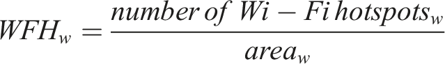
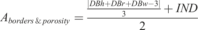
Borders and porosity
As forms of segregation and exclusion, borders and boundaries, such as walls and fences, limit access and can result in impermeable passages that challenge the OC. To map border vacuums (Jacobs, 1961), large infrastructure networks, particularly railways (DBr), highways (DBh), and water bodies (DBw), were considered. The Euclidean distance to these border types (DB), namely, between C
w
and the closest point in border (B), was calculated as follows:
Intersection density
Jacobs (1961) argued for small blocks that encourage pedestrian activity and result in a higher number of intersections. A network of intersections promotes random encounters and improves the permeability and porosity of the built environment (Delclòs-Alió and Miralles-Guasch, 2018). Since the OC is a porous city, the density of intersections (IND) was calculated within a 500 m radius:
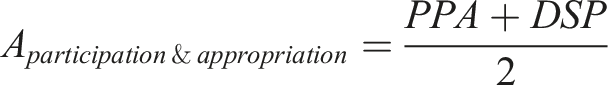
Participation and appropriation
The OC entails the production and appropriation of spaces and the active engagement of residents (De La Llata, 2021; Shields, 2013). Given Berlin’s strenuous urban struggles and renowned squatter movements, the density of squatted places (DSP) was mapped, as a proxy of appropriation:
Voting data from 2017 was used to calculate voter’s turnout ratio (PPA) in district d as a proxy for electoral participation and openness: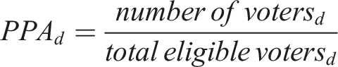
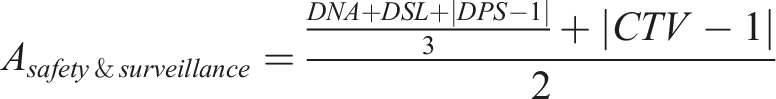
Safety and surveillance
The presence of nighttime activities encourages pedestrian street use and contributes to a nighttime economy and vibrancy (Seijas and Gelders, 2021). In addition, nighttime activities foster safety, as residents watch over streets, emphasize temporal vitality (Jacobs, 1961), and thus contribute to the OC. The density of nighttime activities (DNA) was calculated within a 500 m radius:
Improved street lighting can encourage nighttime and pedestrian activities, and thus contribute to safe spaces after dark (Cozens, 2011). The density of street lighting (DSL) was calculated as follows: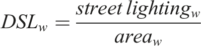
Under the guise of protection and security, CCTVs and surveillance tools are increasingly installed in public spaces as instruments for state and market surveillance (Amin, 2006). These tools can interfere with people’s privacy, regulate access, and demarcate geographies thereby questioning the openness of cities. The density of CCTVs (CTV) in Berlin was calculated as follows: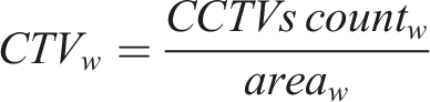
Perceived as an entity for maintaining the security of cities, Jacobs (1961) argued that safety is not primarily achieved through police presence. In fact, certain police practices can challenge openness by isolating social groups or influencing who belongs in a space (Sherman, 2020). Therefore, CCTV density and police presence were considered as variables that negatively influence the OC. The Euclidean distance to the closest police station (P) from C
w
was calculated as follows:
Synchronicity
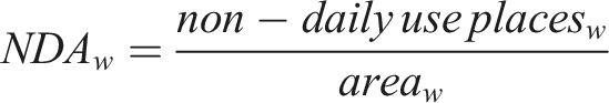
Reflecting on the temporal dimension of openness, Sennett (2018) defined a synchronic space as one that accommodates different uses and activities at the same time. In this regard, daily (DDA) and non-daily uses (NDA), based on the classification of Sung et al. (2015), were considered to calculate synchronicity (DND):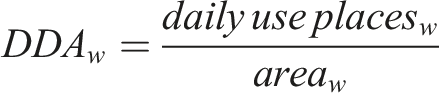

Normalization and scoring
To score the attributes, the resulting values of the openness variables (v) were normalized as follows: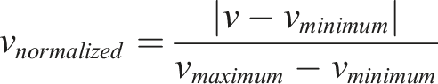
The normalized variables were then summed hierarchically with an equal weighting approach. The hierarchical structure, which consisted of three levels, followed the organization of the attributes and their assigned variables (Table 1). Starting with the level of the variables, 25 separate outputs were initially generated as normalized values. The second level consisted of six outputs calculated by summing the variables, corresponding to a particular attribute (A). The final level was calculated by summing A into a single value, which was considered the openness score (OS):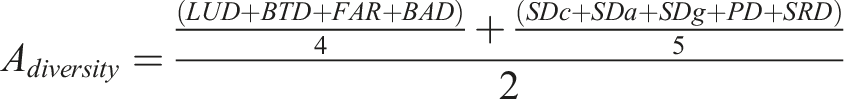


The mean average score of each district was finally calculated by synthesizing the corresponding spatial matrix cells wi,j.
Results
The results of each variable were analyzed separately to understand their influence on the overall openness score.
Diversity
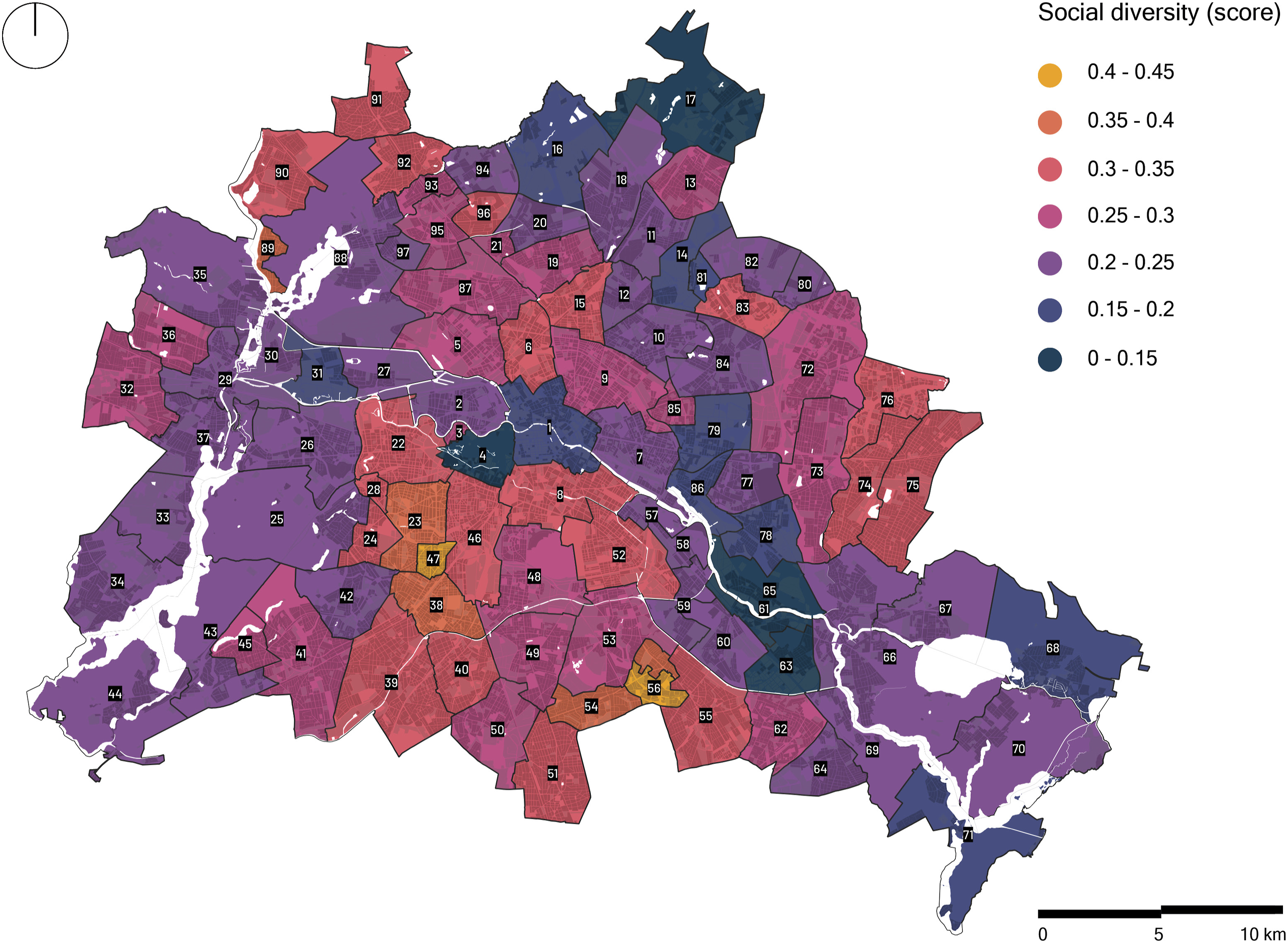
The diversity score consisted of two equally weighted sub-attributes: typo-morphological and social diversity, where Friedenau, Gropiusstadt, and Wilmersdorf exhibited the highest values for both sub-attributes (scoring ∼0.4— Figures 1 and 2). High LUD values (> 0.8) were mainly found in central and certain peripheral areas, such as Friedrichshain, Hansaviertel, and Hellersdorf, as well as industrial and service areas along the Spree (Supplemental Figure S2). Districts with a high diversity of building types accommodated a high LUD. Relevant examples include Hansaviertel (0.88), Friedrichshain (0.86), and Mitte (0.85—Supplemental Figure S3). Historic districts such as parts of Charlottenburg, Kreuzberg, Prenzlauer Berg, and Wilhelmstadt had the highest percentage of old buildings (1900‒1920), namely, from the Wilhelmenian period. In addition, various central districts such as Neukölln, Mitte, and Friedenau were characterized by a historic building fabric that overlapped with a high building age diversity (scoring > 0.5—Supplemental Figure S4) as well as high building and population densities (scoring > 0.03 and ≥ 165 people/ha—Supplemental Figures S5 and S10). Synthesized score of typo-morphological diversity in Berlin integrating land use diversity, building density as well as the diversity of building age and types. The values refer to mean averages per district. The numbers indicated on the map refer to different districts (Ortsteile) in Berlin and are listed in the Supplementary Material—Supplemental Table S2. Synthesized score of social diversity integrating population density, age, citizenship, gender, and residence duration.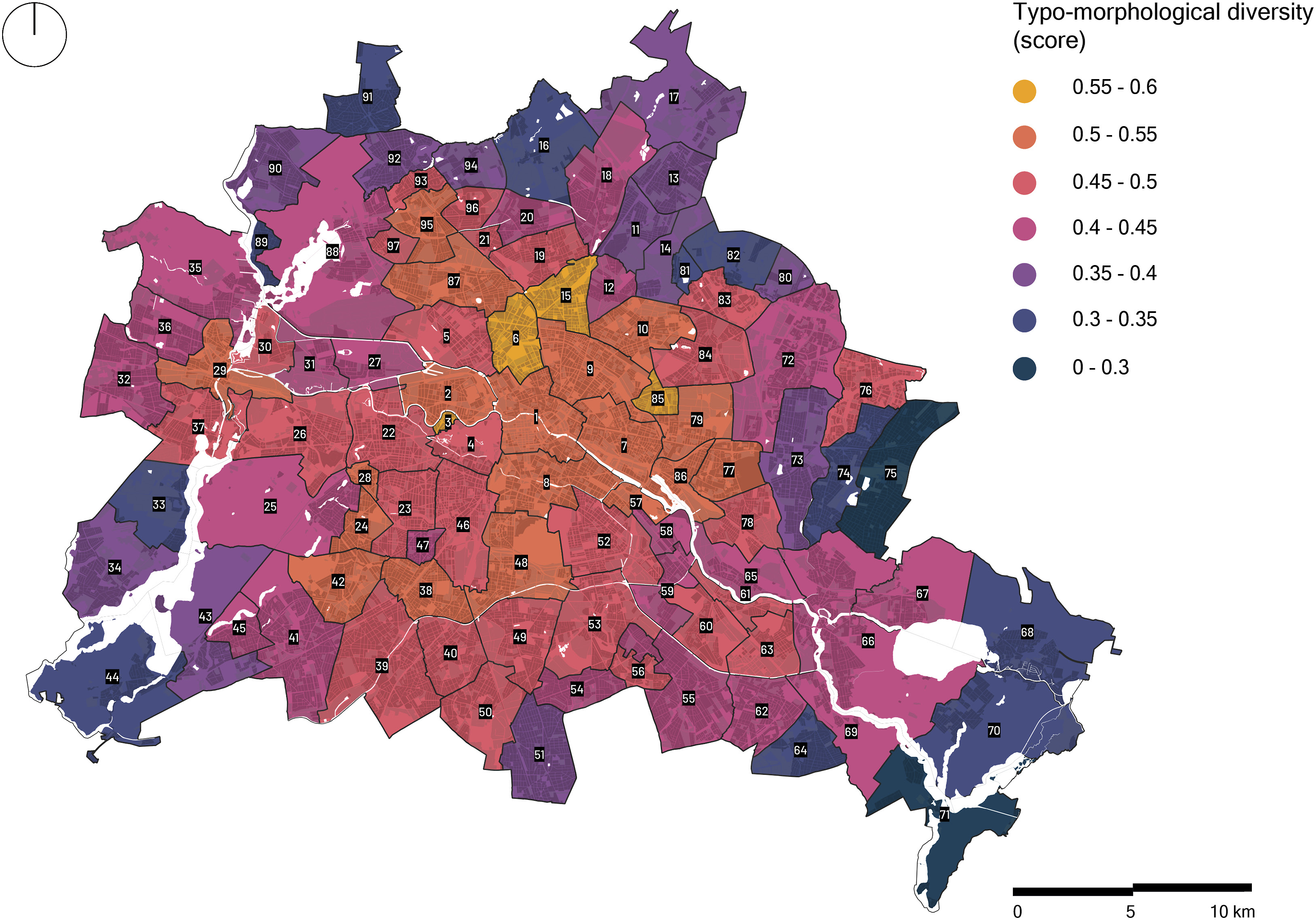
Although certain peripheral conurbations are considered post-war developments, consisting mainly of mid- and high-rise prefabricated large-scale housing, these areas, such as Waidmannslust, Wittenau, and parts of Zehlendorf, encompassed a high number of buildings with varying ages (scoring > 0.6—Figure S4). A high building diversity (scoring ∼ 0.6—Supplemental Figure S3) was observed in certain peripheral neighborhoods such as Fennpfuhl, Hellersdorf, and Gropiusstadt, where some of Germany’s largest post‒WWII housing projects can be found. A corollary of these high-rise post-war developments was a high population density across these areas (> 150 people/ha).
People with different backgrounds were mostly found around Kreuzberg, Gesundbrunnen, and Neukölln (> 0.25—Supplemental Figure S7). A high citizenship diversity—a proxy of cultural heterogeneity in our study—coincided in districts with high population and housing densities. This is particularly the case of Charlottenburg, Friedenau, and Mitte that had a high cultural diversity (≥ 0.12) along with a high FAR (scoring ≥ 0.05).
Some inner-city districts with a high building density and cultural diversity had the lowest average residence duration in Berlin. Examples included Mitte, Friedrichshain, and Tiergarten, which encompassed a high FAR and citizenship diversity (scoring ∼ 0.05 and ∼ 0.1, respectively) and where 46% of inhabitants resided for less than 5 years. In addition, a contrast was observed in some central northeastern areas, particularly in Prenzlauer Berg, that scored relatively low on the overall social diversity (∼ 0.2—Figure 2) and relatively high on the overall typo-morphological diversity (> 0.5—Figure 1).
Accessibility
Accessibility to public transport was highest in central and eastern central areas including Mitte, Friedrichshain, and Pankow (scoring ∼ 0.8). Our results indicated that Berlin is overall a well-connected city with few peripheral isolated areas including Stadtrandsiedlung Malchow and Müggelheim, scoring below 0.1 (Figure 3). Similarly, accessibility to social infrastructure followed a center-periphery rationale, where central areas such as Mitte, Kreuzberg, Prenzlauer Berg, Friedenau, and Wilmersdorf exhibited the highest accessibility to social infrastructure (scoring > 0.7—Supplemental Figure S13). These neighborhoods hosted a large mix of uses and different touristic attractions and are characterized by a high population density. Access to public Wi-Fi overlapped with areas characterized by a high social infrastructure (e.g., Gesundbrunnen and Kreuzberg—Supplemental Figure S16). Accessibility score to four modalities of public transport: subway (U-Bahn), city train (S-Bahn), tram, and bus in Berlin.
Rents were highest in central areas of Mitte, Samariter Quarter (Friedrichshain), and Charlottenburg (Figure 4 and Supplemental Figure S14). These areas’ high rents correspond to the high density and mix of social infrastructure and uses, particularly the density of touristic hotspots, as well as a variety of building ages and types. High rents (> 7 euros/m2 per month) also overlapped with a short length of residence in various areas including Friedrichshain (where 45% of the population has been residing for less than 5 years). Alternatively, the social housing percentage was highest in Rudow (18.6%), certain parts of Kreuzberg (13.5%), and specific areas in Schöneberg (around 6%—Supplemental Figure S15). Synthesized score of normalized inverted rent and normalized ratio of social housing in Berlin.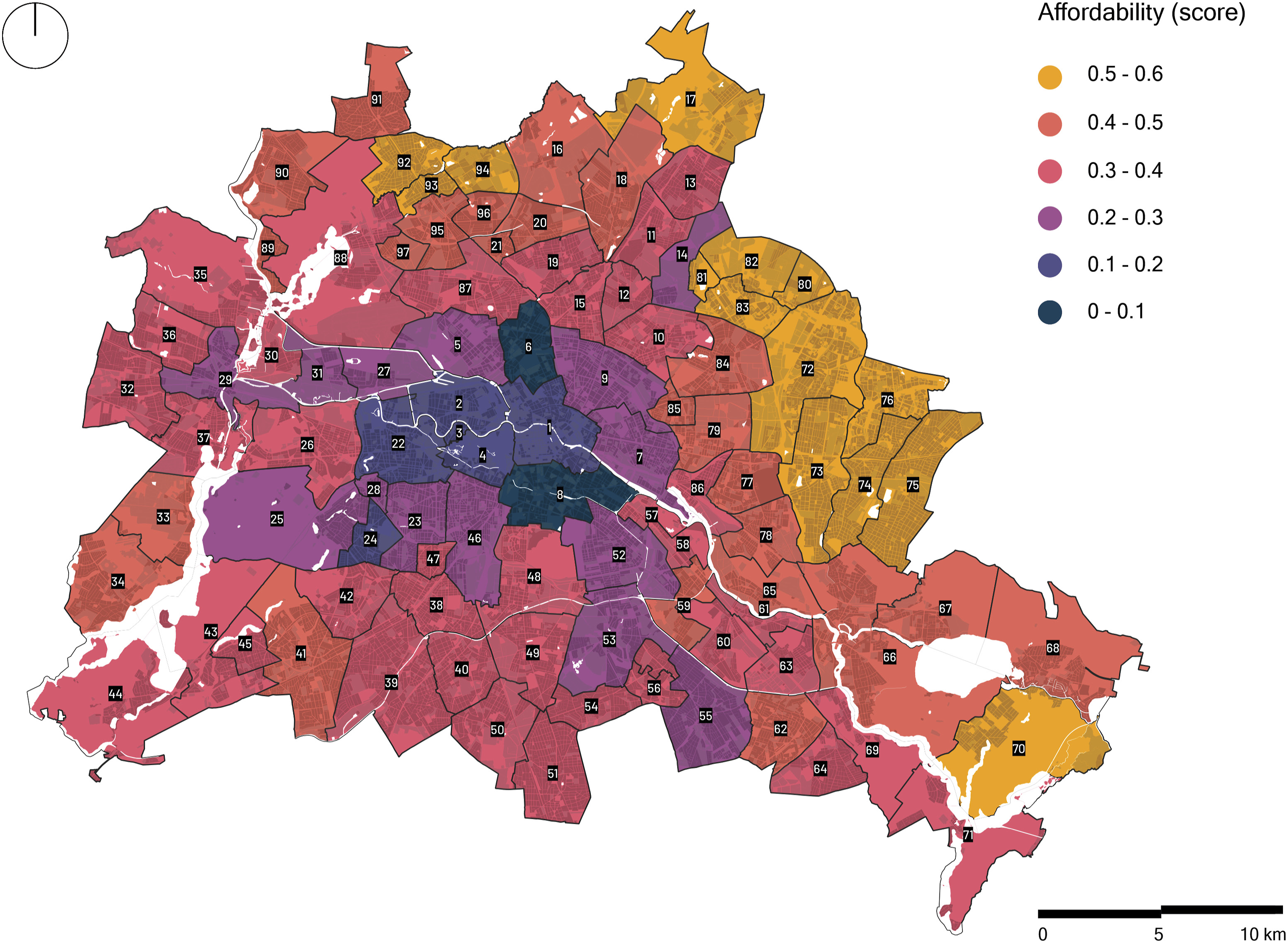
Porosity and borders
Our results support previous debates that border vacuums, such as large infrastructure networks, demarcate and separate between two different natures in cities (Jacobs, 1961; Wolfrum, 2018). Since Berlin is cut by the Spree and Havel rivers as well as the Ringbahn (circular railway), various areas, such as Tiergarten, Malchow, and Plänterwald, are in proximity to border vacuums (> 500 m on average—Supplemental Figures S17–S19). While large infrastructures are typically found at the periphery, Berlin’s inner-city districts are also divided by dense infrastructure networks resulting in short distances to border vacuums. Examples include Prenzlauer Berg and Wedding, with average distances of 280 m and 301 m respectively. These border vacuums potentially inhibit pedestrian activity and can negatively affect the porosity and thus openness of neighborhoods.
Various scholars emphasized intersections as indicative of the porosity of the built environment, where a high number of crossroads corresponded to a high number of streets, smaller blocks, and shorter walking distances that encourage pedestrian activity and spontaneous encounters (Ewing and Bartholomew, 2013; Montgomery, 1998). In this regard, a high porosity was observed in Friedenau (scoring 0.88—Supplemental Figure S20), Wilmersdorf (0.78), and Schöneberg (0.62), given their high density of intersections (> 350 intersections within a 500 m radius) and high LUD (scoring > 0.5—Supplemental Figure S2). These districts were also characterized by a high building age diversity (scoring ≥ 0.63) as they are largely composed of perimeter blocks.
Participation and appropriation
While Berlin was renowned for different squatter movements that came to oppose urban renewal processes, squatting is currently limited to Kreuzberg (scoring significantly high 0.6), Friedrichshain (0.28), and Schöneberg (0.2—Supplemental Figure S21). These districts have historically been the center of squatter movements since the 1980s. The high density of squatted places in these districts coincided with a high density of nighttime activities (Supplemental Table S3).
High levels of electoral participation were observed in peripheral areas such as Blankenfelde, Schmöckwitz, and Falkenberg (Figure 5 Mean average voter turnout score per district in Berlin.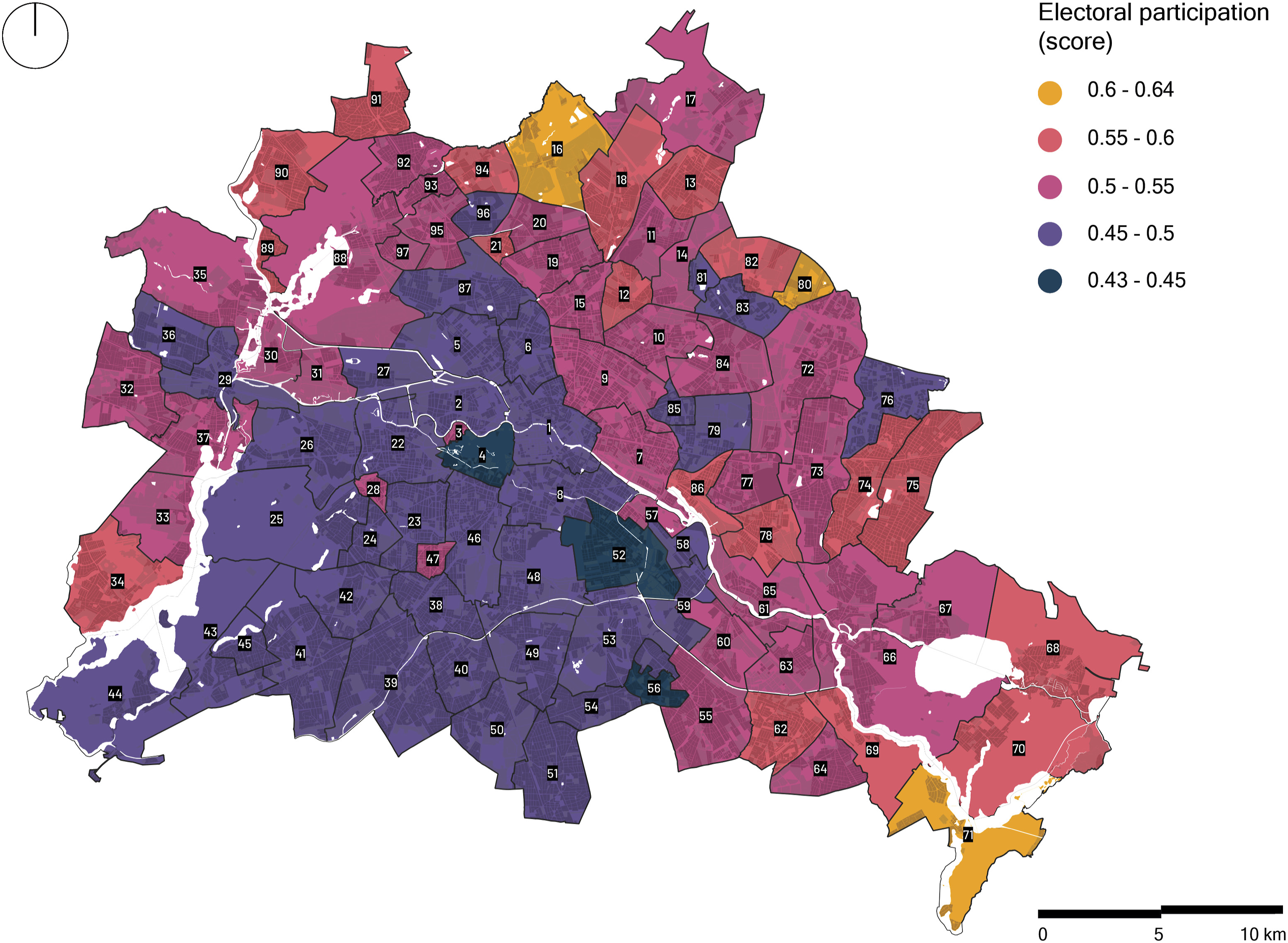
Safety and surveillance
Nighttime activities in Berlin were highest (∼4 activities/ha) near the center particularly in Friedrichshain, Kreuzberg, and Gesundbrunnen (Supplemental Figure S23). These areas’ relatively high LUD (scoring 0.8), abundance of streetlight (Supplemental Figure S24), and high density of nighttime activities, such as restaurants and bars, may be indicative of their safety (passive surveillance). Presence of law enforcement is adequately distributed across the city (Supplemental Figure S25) but fades toward the edges. Police stations are circumscribed around Friedrichstadt and Scheunenviertel where a high density of CCTV cameras (∼3/ha—Supplemental Figure S26) was also found. The high levels of formal surveillance are attributed to the presence of government entities and institutions in these areas. Similarly, a high density of CCTV cameras was found in Kottbusser Tor (Kreuzberg), a crime hot spot that has been widely associated with drug dealing and violence.
Synchronicity
Simultaneous daily and non-daily activities were primarily found in Kreuzberg, Friedenau, and Gesundbrunnen (scoring > 0.7—Supplemental Figure S27). Our results indicated a high mix of uses and a diversity of destinations in these areas. Additionally, a high density of non-daily uses was found in Prenzlauer Berg and Neukölln (∼10 uses within a 500 m radius).
Openness in Berlin: Synthesized scoring results
We synthesized the six attributes of openness and calculated the mean average openness score per district (Figure 6). Overall, the results emphasized a center-periphery pattern, and the data followed a normal distribution (μ = 3.93 and σ = 0.67—Supplemental Figure S28). Higher values (> 4.5) indicated areas that are more likely to foster openness (Supplemental Table S3). Results revealed that a low percentage of districts (21% covering an area of 11,774 ha) had a high degree of openness and were mostly situated in the center and southern central areas of Berlin. More specifically, Friedenau exhibited the highest mean openness score of 5.03, followed by Kreuzberg (4.98 — Supplemental Table S3). Areas with a moderate degree of openness surrounded central neighborhoods, constituted most of the analyzed territory (49% covering an area of 27,707 ha), and offered a gradual transition toward conurbations with the lowest potential of openness (28% covering an area of 15,818 ha). A lower potential of openness was evident along the peripheries, particularly in Wartenberg and Blankenfelde with a score of 2.86 and 2.96, respectively. Despite its centrality, Tiergarten scored significantly low (3.46) due to the large Tiergarten park and thus the district’s relatively small built-up area and low population density. Given the high rents, Mitte exhibited a moderate degree of openness scoring 3.89. It is worth noting that certain peripheral areas, such as Buckow and Gropiusstadt, exhibited relatively high degrees of openness, scoring above 4.0, given their high LUD and social diversity. Mean openness score per district in Berlin.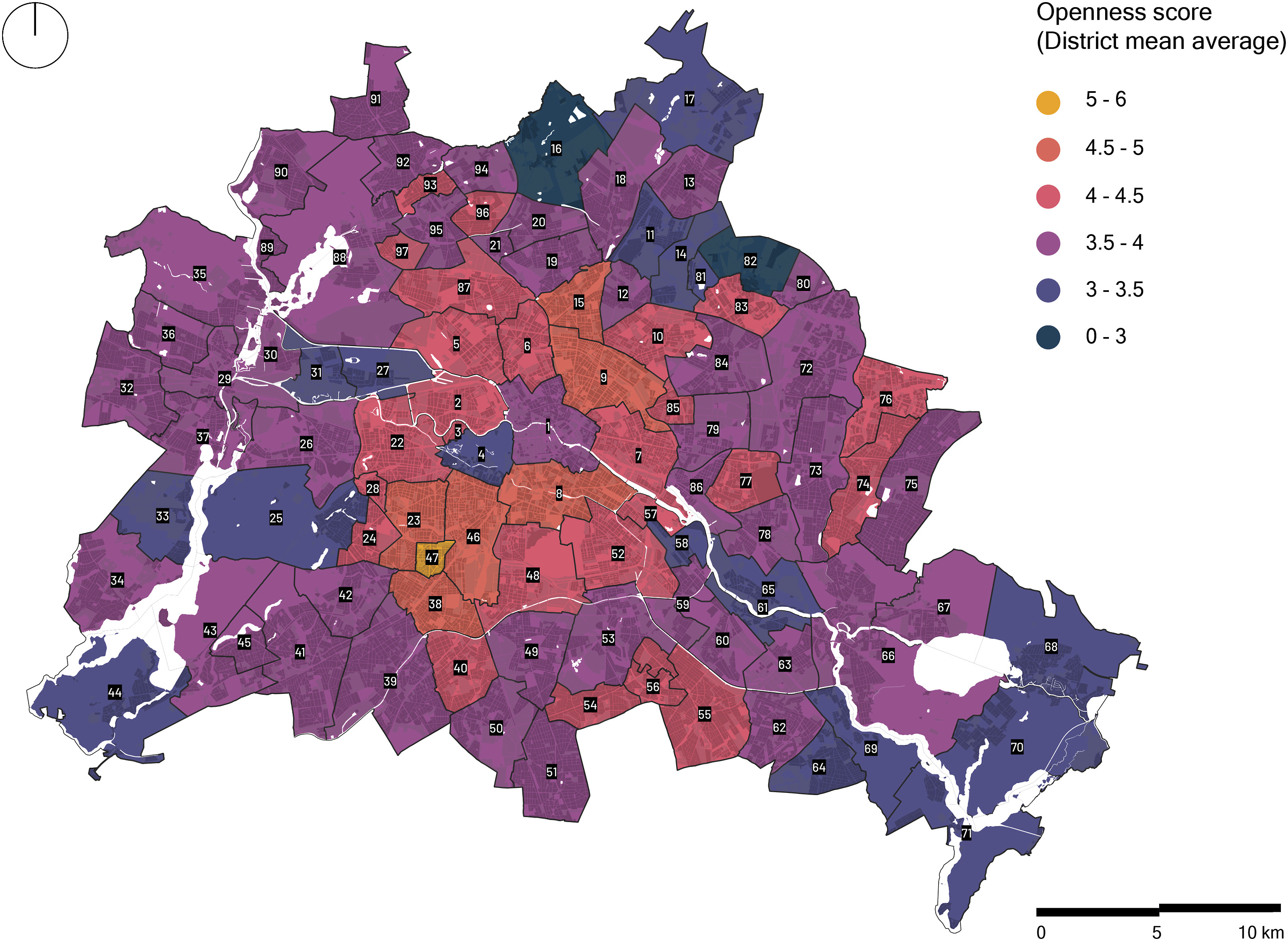
Discussion and conclusion
This study aimed to operationalize the OC concept across Berlin by systematically mapping six attributes of openness derived from the literature, namely, diversity; accessibility; borders and porosity; participation and appropriation; safety and surveillance; and synchronicity. An equal weighting approach was implemented to synthesize the attributes and map areas that demonstrated a high potential of openness. To the best of the authors’ knowledge, this is the first study that spatially analyzed the OC attributes through an applied perspective. Since identifying certain attributes and investigating their geographic manifestation support the comprehension and planning of cities, this study contributed to current understandings of the OC concept by providing a detailed spatial analysis of the OC attributes in relation to Berlin. The systematized approach proposed can subsequently be adapted to other cities.
Overall, results for the city of Berlin emphasized a high potential of openness in the center that gradually faded toward the periphery. The concentration of a high degree of openness in the center corresponds to the high levels of accessibility, LUD, social infrastructure, and diversity of building ages and types. The refurbishing of the Wilhelminian housing estates and the reconstruction of the housing stock after WWII (Bernet, 2004) contributed to the center's high building density and diversity as well as the relatively high population density. These characteristics fulfill the requirements of urban vitality set by Jacobs (1961) and support arguments of various scholars who associated the OC with building diversity, accessibility, and an intricate urban fabric (Christiaanse, 2009; Reijndorp, 2009; Sennett, 2018). The high potential of openness in central districts is not only predicated on heterogenous uses but also on cultural diversity. Indeed, inner-city districts house a large population with a migration background as well as marginalized and alternative groups, squatters, and the youth (Häußermann and Kapphan, 2013; Soederberg, 2017).
Despite the high potential of openness and cultural diversity, scores varied between different inner-city districts. Variations across central districts belie contradictory dynamics and echo historic transformations. Indeed, certain inner-city neighborhoods are “conquered by tourism” and are commonly designated as tourist bubbles (Novy, 2018: 3); some are considered clusters for the creative class (Friedrichshain–Kreuzberg), particularly with the relocation of large media corporations (Bader and Bialluch, 2009); many host established older migrant populations, previously known as “guest workers”; while others remain a haven or a hip place for marginalized minorities, newcomers, and the youths who cannot afford rising rents in Mitte and Prenzlauer Berg. More specifically, northern parts of Neukölln and Kreuzberg—Kreuzkölln (Holm, 2013)—which embody the image of an arty and inclusive Berlin, are recently becoming “the epicenter of the cool” attracting urban tourists seeking an “authentic experience” (Füller and Michel, 2014). These culturally diverse and heterogenous districts contribute to the rise of multiple urban cultures and spatial identities and are “valuable markers of difference and authenticity” (Allon, 2013b: 253). While fraught with stigmatization (Soederberg, 2017), these inner-city districts are sites of urban citizenship where struggles of space appropriation and production manifest and microcultures contribute to the districts' complexity and openness. In contrast, luxury renovations of the housing stock in Prenzlauer Berg and Mitte exacerbated gentrification and displacement processes and created premium enclaves that attract tourists and capital while challenging the people’s “Right to the City.” Despite masking historical struggles and exclusions (Loeb, 2006), the multiple urban cultures and daily urban struggles across inner-city districts—that result in the variations of openness—continue to serve Berlin’s rhetoric as a cosmopolitan, forward-looking, and tolerant city that accepts change as well as social and cultural difference. In effect, Berlin built on the presence of counter and alternative cultures, the mix of uses, and the differences between central districts to symbolically create an image and promote itself as a hip and “Open City.”
The presence of atypical areas, that defied the center-periphery pattern, revealed that districts are in a constant state of transformation and confirmed that the OC manifests in parts or fragments of the city. Indeed, certain peripheral areas presented surprisingly high values of openness. While these districts do not necessarily retain a historic fabric, they constitute safe havens for migrant communities. This is particularly the case of Gropiusstadt, where over 40% of the population has a migration background (Stollmann, 2016). These results show that not only inner-city districts can foster the OC but also areas that are relatively newly developed. Despite their overall moderate score, a low potential of openness was found across certain in-between districts, such as Niederschöneweide and Charlottenburg-Nord. These results can be attributed to the areas’ proximity to border vacuums and large infrastructure, particularly the extensive railway networks. The findings support conclusions that border vacuums weaken the vitality of urban areas (Jacobs, 1961; Sung et al., 2015) and ultimately challenge the OC. In addition, the low potential of openness across peripheral districts can be attributed to their proximity to agriculture, forests, or large open spaces as well as industrial or municipal utilities surrounding the city’s administrative borders.
Further analysis of the results across different districts suggested a likely congruence of specific variables, such as electoral participation, length of residence, distance to border vacuums, rent, diversity of building age and types, accessibility to public transport and social infrastructure as well as social diversity (citizenship). The interplay of these specific set of attributes and their recurring pattern implies their potential significant effect on the openness score. This is particularly the case of peripheral districts such as Müggelheim, Schmöckwitz, Blankenfeld, and Malchow, that exhibited a low potential of openness. These districts typically consist of single-family dwellings and are characterized by low rent, longstanding residents, high turnout levels, low building age diversity, limited social infrastructure, and socially homogenous neighborhoods. Indeed, lower levels of rent can contribute to a longer length of residence and thus the potential development of strongly knit communities. These findings also align with evidence that suggested an increased turnout among longstanding residents due to stronger connections and face-to-face interactions (Mcclurg, 2003). In contrast, these attributes seemed to play out differently in central districts, that fostered a high potential of openness and where high social infrastructure and public transport accessibility, building and age diversity, and socially heterogenous neighborhoods coincided with high rent, low turnout levels, and shorter lengths of residence. In fact, low turnout rates were prevalent in central districts, where higher levels of rent are positively associated with shorter periods of residence and increased mobility. Examples of these districts include Mitte, Friedrichshain, and Tiergarten where the concentration of tourist attractions escalates rents, induces a decline in housing supply, and increases displacement (Schäfer and Hirsch, 2017). While Berlin is celebrated as an Open City (Allon, 2013a; Festspiele and Berlin, 1999), these findings partially support conclusions affirming the rise of “exclusive islands” and enclaves that result in spatial segregation, particularly in areas with low tourist activity (Blokland and Vief, 2021). Future studies could further explore these dynamics through spatio-temporal analysis to develop a better understanding of the correlations between the different attributes and their implications.
The distributional pattern of openness observed aligned with studies that analyzed urban vitality across different geographic contexts (Delclòs-Alió and Miralles-Guasch, 2018; Sulis et al., 2018; Ye et al., 2018). The relevance can be attributed to the similar methodological framework applied, the urban vitality conditions considered to calculate openness, and the typical concentration of uses, workplaces, and tourist attractions in the center. While the OC concept is an intangible situation and holistic phenomenon, subject to different interpretations, the study attempted to address this broadness and complexity by considering a wide range of socio-spatial attributes. Indeed, the concept cannot be captured holistically through a quantitative approach; nevertheless, the attributes used could contribute to a better understanding of the OC concept and provide quantitative information to inform urban planning processes and decisions. The study could also support practitioners and policy-makers in the development of strategies and plans by providing a better understanding of the spatial distribution and potential of certain districts to foster openness.
With the advancement of big data infrastructures, the contribution of open data ecosystems to cities and societies is becoming central to urban planning. Indeed, it is expected that open data will promote citizen participation, innovation, and transparency and leverage open government (Zuiderwijk et al., 2014). However, as cities continue to rigorously invest in collecting and using big data, significant concerns arise regarding the potential exploitation of data for control and surveillance purposes. In lieu of sharing critical datasets publicly to guarantee transparency and improve the performance and delivery of public services, technocratic approaches and imaginaries are suspected to exclude locals and the marginalized by catering to the powerful, namely, governments and corporate elites (Jiang et al., 2020). As the public’s access to data is sometime restricted, a prime focus is on the ways in which the collected data is used, its major beneficiaries, and the actual influence of these big datasets on planning processes. This is particularly the case of the 100 Smart Cities Mission in India where integrated command and control centers were developed and innovative technologies were deployed to gain a deeper knowledge and real-time overview of urban processes (Praharaj, 2020). While intended to make Indian cities efficient, the proprietorship and operation of these big data projects were questioned given the increasing privatization and corporatization. Praharaj (2020) also concluded that the focus of the Indian smart cities was more on surveillance and control rather than the provision of services and the design of innovative policies and interventions. Overall, technocratic smart governance may result in unequal power relations, contribute to social exclusion, and give rise to premium enclaves (Kitchin et al., 2016). These challenges along with the increasing corporatization of big data can substantially undermine the OC. As technocratic approaches increasingly configure planning and governance processes across different levels, research at the intersection of the OC, big data ecosystems, smart cities, urban social processes, and governance could be further explored in future studies.
Findings from this study are subject to several limitations. First, since the level of investigation was restricted to the city scale, analyses at the architectural level were not conducted. Second, opportunities for fieldwork were limited due to the COVID-19 pandemic. Combining this analysis with field observations would further verify the scoring results and help map additional attributes of openness. Third, various variables, that could have potentially enriched our analysis, were excluded due to the lack of data or limitations of the datasets. For instance, protest, a variable associated with participation, was eliminated given the lack of geospatial data. Additionally, with the absence of the most recent data, characteristics on population were derived from census 2011, the latest comprehensive dataset for Berlin. Above all, it should be noted that the OC is an elusive phenomenon that varies across geographic and cultural contexts. Accordingly, variables depicted and analyzed in this study may differ beyond the context of Berlin.
In sum, this study’s main contribution was to propose a systematized method to quantitatively evaluate the potential of openness across different neighborhoods in Berlin and achieve a better understanding of the OC concept. Future research can further expand on the method to consider additional attributes from diverse disciplines including politics, sociology, and economics. Since the OC varies across different contexts, future research can address disparate geographical, social, and cultural milieus. Comparative approaches and fieldwork would allow to determine which conditions hold for different cities, what characterizes and challenges the OC, and the requirements needed to enable openness in planning processes.
Supplemental Material
Supplemental Material - Operationalizing the open city concept: A case study of Berlin
Supplemental Material for Operationalizing the open city concept: A case study of Berlin by Grace Abou Jaoude, Majd Murad, Olaf Mumm, and Vanessa Miriam Carlow in Environment and Planning B: Urban Analytics and City Science.
Footnotes
Declaration of conflicting interests
The author(s) declared no potential conflicts of interest with respect to the research, authorship, and/or publication of this article.
Funding
The author(s) disclosed receipt of the following financial support for the research, authorship, and/or publication of this article: This study is supported by the Robert Bosch Foundation (Grant no. 32.5.F070.0017.0).
Data availability statement
Supplemental Material
Supplemental material for this article is available online.
References
Supplementary Material
Please find the following supplemental material available below.
For Open Access articles published under a Creative Commons License, all supplemental material carries the same license as the article it is associated with.
For non-Open Access articles published, all supplemental material carries a non-exclusive license, and permission requests for re-use of supplemental material or any part of supplemental material shall be sent directly to the copyright owner as specified in the copyright notice associated with the article.