
Abstract
This paper outlines a speculative artistic research project, Orbital Reveries, which develops an alternative representational practice for engaging with satellite sensing. The project appropriates terrestrial satellite imagery and parses it through various algorithmic processes to generate visual-poetic ‘textscapes’. The goal of this exercise is to resituate satellite sensing within other modes of representational knowledge-making, exploring the value of creative speculation and experimental emergence in mapping ecological crises.
Orbital Reveries is an artistic project that speculatively reworks satellite imagery. It uses algorithmic processes to rearticulate and respatialise various source texts of environmental writing and criticism, generating a form of hybrid visual poetry. While Earth observing satellites are critical for revealing serious ecological degradation, they have been critiqued by some observers as stratifying, ocularcentric drivers of datafied, ‘view from nowhere’ representations of the planet. 1 Such disembodied views both result from and bolster the techno-scientific worldview in which the planet is parsed as a body of resources to be managed, rationalised and exploited – which cultural geographers have long critiqued. 2
Orbital Reveries generates representations that resist these modes of satellite sensing by reworking their digital representations through creative practice. The project finds inspiration in the work of artists such as Heidi Nielson, whose gathering of live weather satellite data across various installations, such as Here GOES Radiotelescope (2020), aims to highlight the accessibility and multiple representational potentials of data. 3 In line with other cultural geographer-practitioners, 4 this project echoes critical geographic scholarship on satellite sensing, environmental data and the potential of digital technologies for engaging environmental crises 5 through artistic practice.
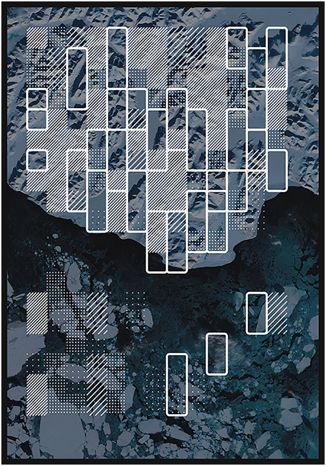
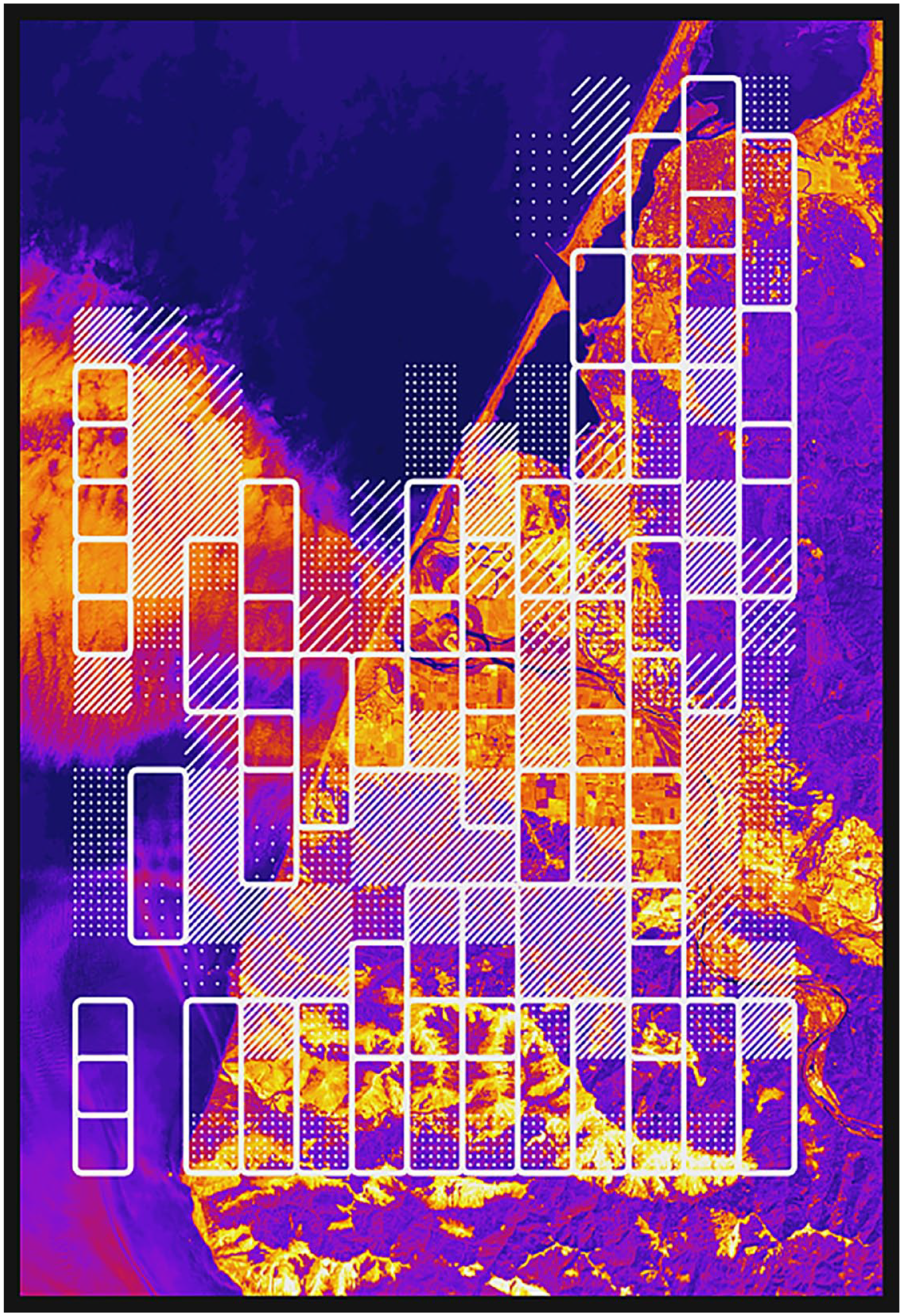
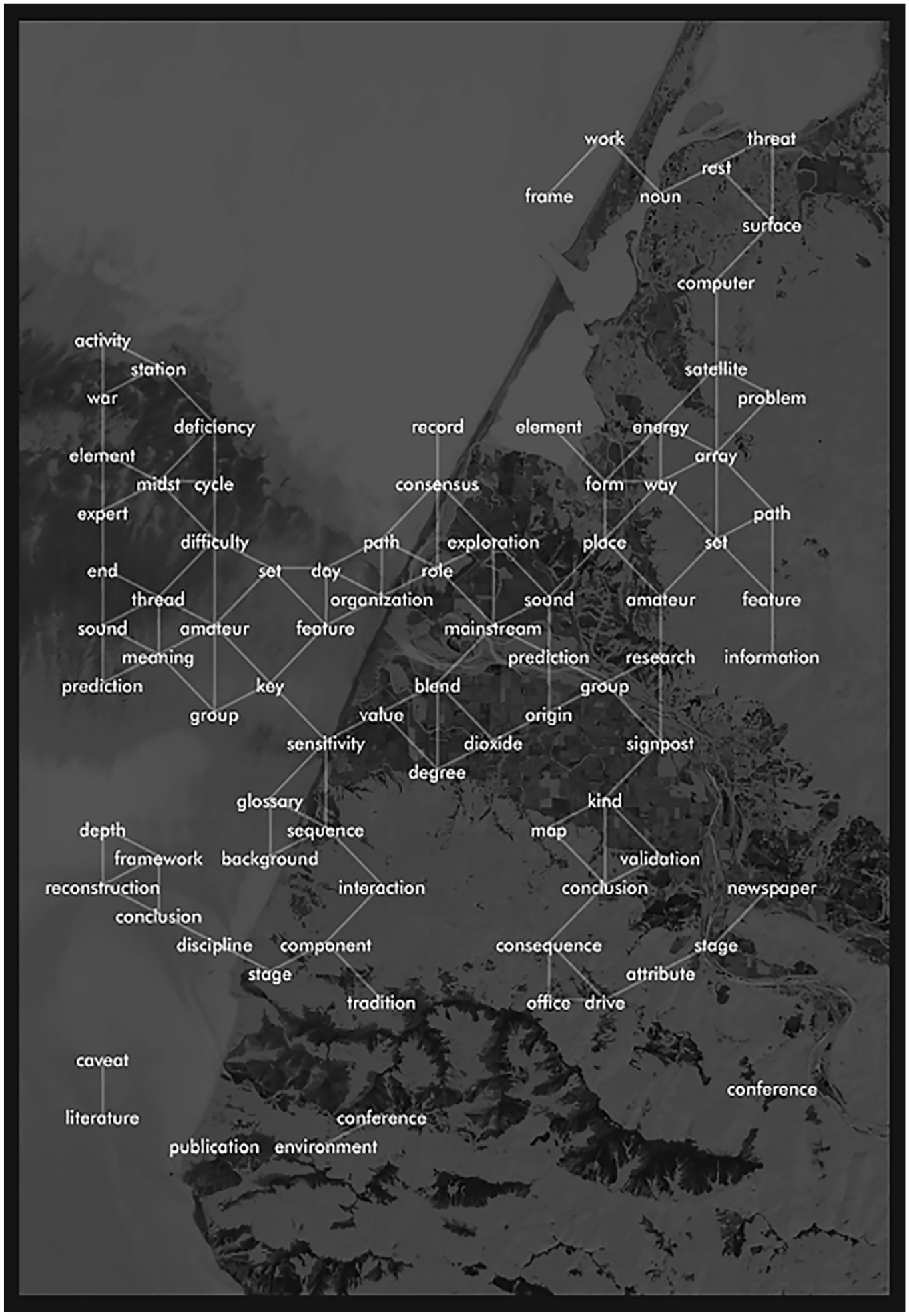
Orbital Reveries appropriates terrestrial satellite imagery for generating visual-poetic outputs. The images were derived from recent Landsat 8 data and were selected for their depictions of landscapes that are either overtly human influenced or are ecologically vulnerable to such activities. For instance, Figures 1 to 6 include a densely developed Arabian coastal region, wildfire smoke over a Californian city and ice floes around the Kamchatka peninsula. These images were processed using a simple machine vision algorithm, which maps a patchwork of varying brightness regions across the source image. Each region, depicted in the final image as a white rectangular outline or crosshatch shaded, is used to select words from a lexical database derived from an inputted source text. This is achieved by mapping individual words from this text onto an invisible, two-dimensional grid proportionate to the source image. The spatial coordinates of each region demarcated by the machine vision algorithm is used to select the corresponding words that reside at these points on the grid. The selected words are then finally overlaid onto the source image, forming a lexical constellation.
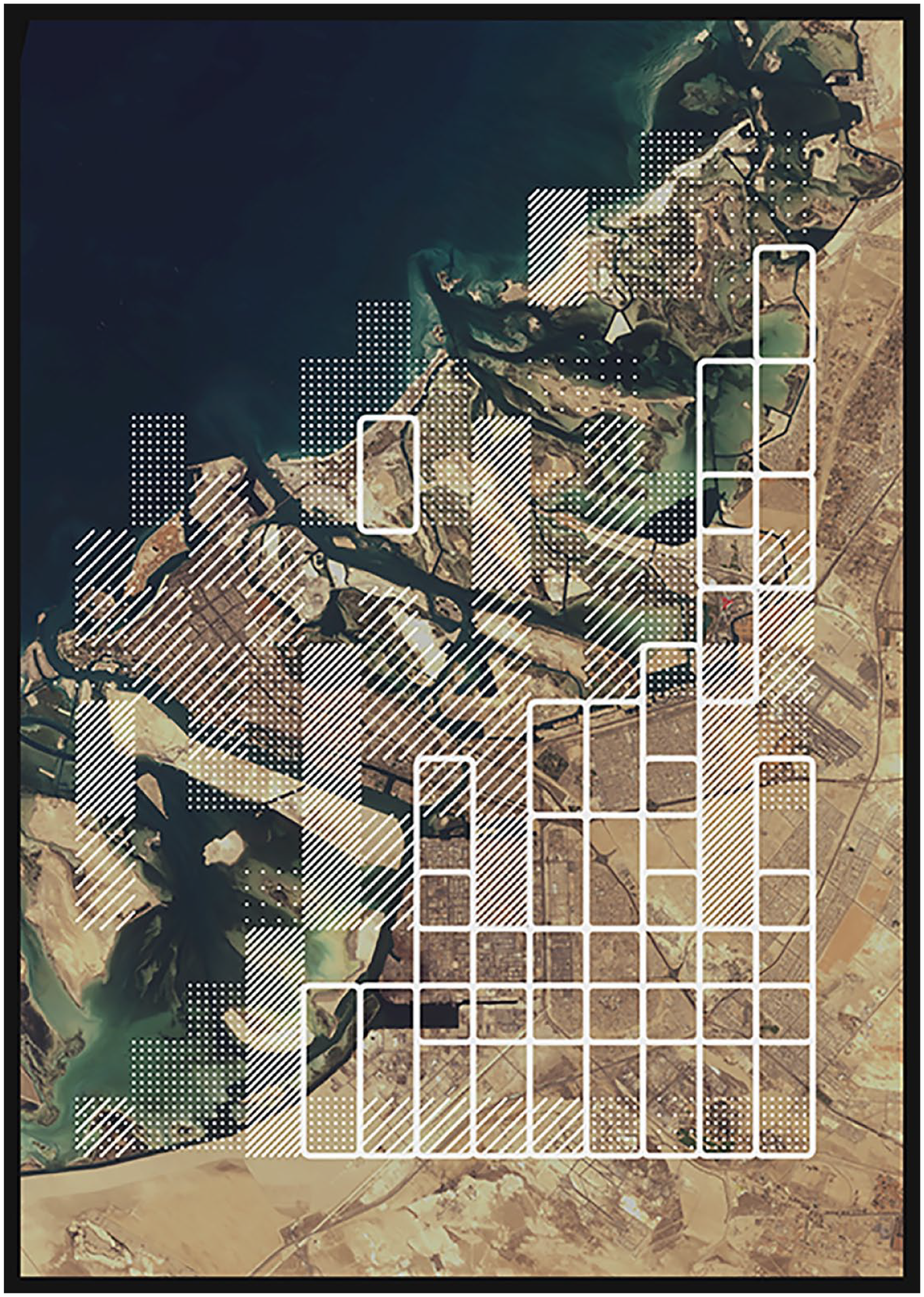
‘LC08_L1TP_160043_20210403_20210409_B432_EYEINTHESKY_LITFIN_97’. Image by author.
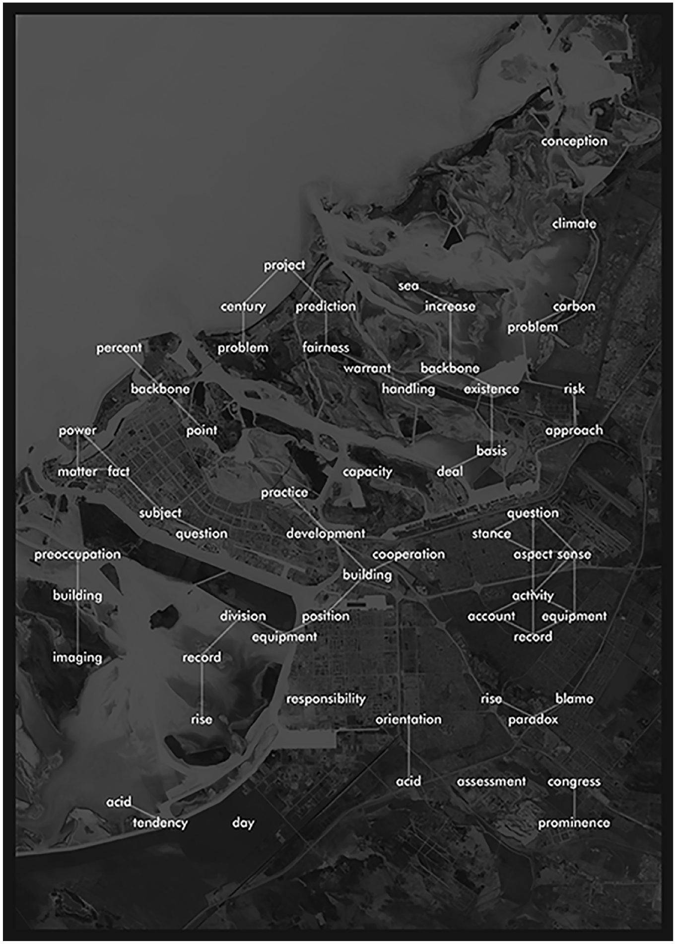
‘Textscape’ from Figure 1. Image by author.
‘LC08_L1TP_085015_20200301_B543_MACHINE_EDWARDS_10_C’. Image by author.
‘Textscape’ from Figure 3. Image by author.
‘LC08_L1TP_046032_20200908_B652_MACHINE_EDWARDS_10’. Image by author.
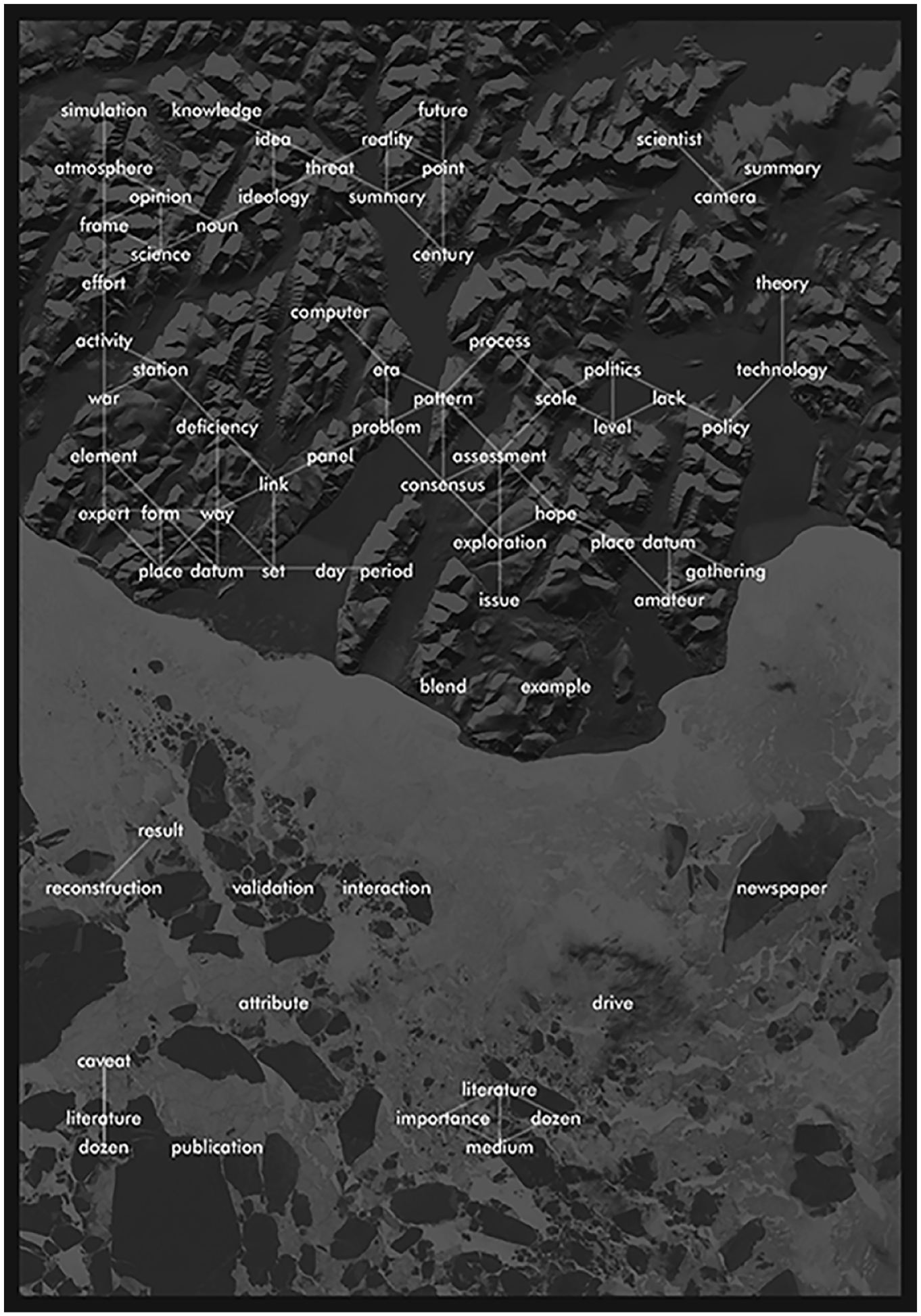
‘Textscape’ from Figure 5. Image by author.
The source texts used in the project include works of academic criticism, collections of poetry, technical papers and assorted historical materials. Texts were chosen for their shared thematic concern with environmental representation and its implications, whether through art, technology or scholarship. For instance, in Figures 1 to 6, the source texts stem and fuse scholarly work from Karen Litfin and Paul Edwards. 6 Litfin’s early work, writing in the 1990s, is highly critical of the role of observational satellites in producing datafied planetary representations that can erase the multiplicity of experiences and sensations that constitute Earthly life. Such erasures fail to acknowledge the lived geographies, human and non-human, that are impacted by decisions made using satellite imagery. In a different vein, Edwards’s work traces the origins and evolution of the ‘vast machine’ of sensing and observing systems that enable atmospheric measurements and modelling at a planetary scale. Edwards draws attention to the provisional conjunctions of forces behind this global endeavour – political and economic, as well as scientific and technical – and which are critical to the efficacy and authority of planetary sensing data. For cultural geographers, both authors provide contrasting, but not necessarily oppositional accounts of the cultural contingencies behind ostensibly objective satellite data gathering, and how the representations generated are bound up in flows of power that shape the uses to which they are put, and the impacts they exert.
In Spring 2023, plates from Orbital Reveries were compiled into an artist’s book and published on the artist’s website. 7 The intended goal of this collection is to showcase a speculative, alternative vision of satellite data that is oriented away from the pursuits of mapping, information generation and environmental management. 8 The aim is to depict and invite a more ambiguous, playful mode of planetary representation.
Demonstrating that satellite imagery is one representational technique among many disrupts its authoritative view from above. The textual contents of each piece draw attention to the lexicon that articulates satellite sensing as an activity – both in terms of its operation and its impacts on the world. In revealing this representational multiplicity, Orbital Reveries prompts the viewer to consider the specific technological materialities that bring these representations into being, a key focus in digital ecologies scholarship which aims to contest ideas of digital representations as immaterial. 9 The aim is to prompt people to consider how satellite imagery can be remade differently, is always subject to cultural and technoscientific design and is generated within specific political-economic contexts. This work contributes to practices of cultural geographers (and others) working creatively with digital technologies to explore and enact alternative modes of environmental representation, and to consider how these technologies influence how ecological issues might be framed.
Footnotes
Funding
The author received no financial support for the research, authorship, and/or publication of this article.