
Abstract
‘Gateshead’, the Tory playwright Samuel Johnson said, is ‘the dirty back lane leading to Newcastle’. What his derogatory dialectic misses is the significance of the back lane as a place in and of itself. Although not written about much, at least not in geography, I believe that these streets are important places to understand neighbourhoods and communities in the Northeast of England. Without the lives and places of the back lane a Northern town is only nominally northern. Sticking to the limitations imposed by the COVID lockdown restrictions at the time of writing, which asked people to remain indoors whenever possible, I chose to travel and explore the significance of these streets digitally. Using both autoethnographic reflections from memories of walking in these streets and Google Street View, I explore the hidden geographies of back lanes in Bensham, a neighbourhood of Gateshead, Tyne and Wear, England, where I live.
The lives of back lanes
Often with that of ‘inferior, mean, obscure,’ as in back alley, back lane, back road, back slum, back street
This article explores the hidden geographies of back lanes in Bensham, a neighbourhood of Gateshead, Tyne and Wear, England, where I live. Framed by Covid lockdown restrictions, I use auto-ethnographic reflections and travel through my neighbourhood using Google Street View imagery to study the lives and materialities of these intriguing, yet largely unseen places. Research on back alleys is the domain of a relatively small group of committed scholars who call them ‘community landscapes’. 1 They describe them as places where households connect with each other in ways that are different from those of the more formalised, structured and regulated places of the main street. The back lane constitutes the historically unseen and unregulated place that sometimes deliberately and sometimes unconsciously is forgotten, left unthought or skipped over. Paul Dobraszczyk, an architectural writer who has written on Manchester’s ‘ginnels’, writes about back lanes as physical and metaphorical boundaries – ‘boundaries between the present and past, where a host of secret stories, both good and bad, linger on in these cracks in the city’. 2 I argue that travelling through these openings gives insight into how they make unexpected encounters possible at a time when back lanes are at risk of disappearance. Walking here means being exposed and engaging with the intimate lives and worlds of others. They are central to what makes distinctive the neighbourhood and community I am part of (Figure 1).
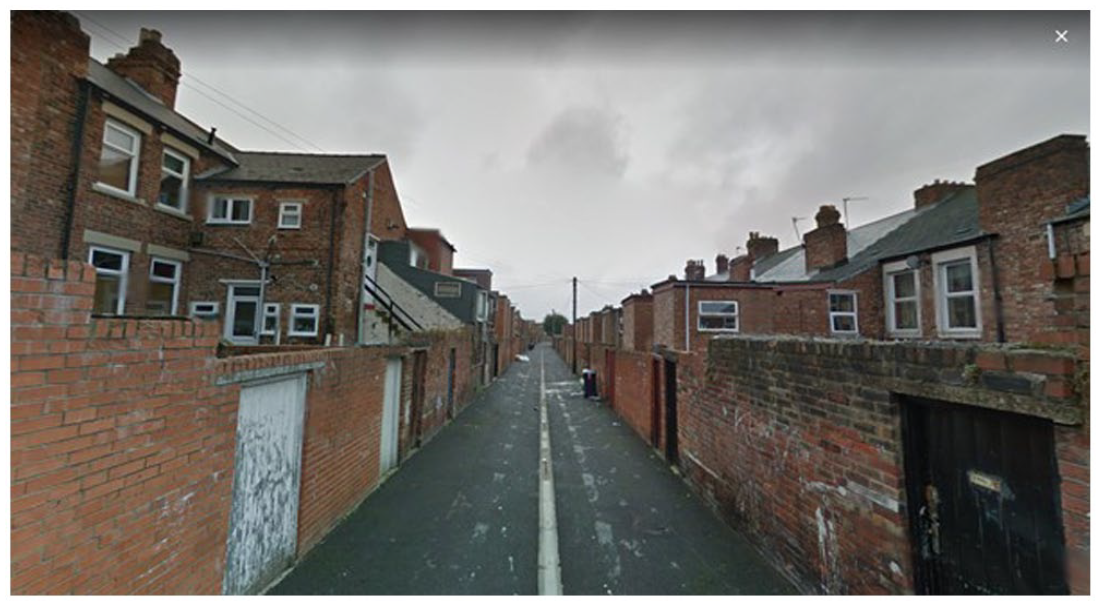
Back lane Bensham, Gateshead (credit: Google Street View).
I grew up in a city and country without many backstreets. The Netherlands is a place where every inch of land is carefully (and predictably) planned to serve specific, often economic, purposes. There is little room for ambivalent or hidden geographies of unexpected encounters. Backs streets (or ‘chares’) in the Northeast draw me in because they appear unfamiliar to me. Once adorned with names such as ‘Half Moon Lane’ (Gateshead) and ‘Love Lane’ (Newcastle), many back alleys are left nameless or hidden on today’s city maps. A back street’s existence is subsumed under and dependent on the ‘main street’ which means that its geography can be suspended in a ‘liminal. . . place situated “in-between”’. 3 The main street is located at the front of the house, an opening to the world, whereas the back street is located at the rear of the house, which unlocks to an othered world. The life that unfolds there is of a fundamentally different character and quality then the world here. Back lanes are places with different rules, different rhythms, smells, sights and different animals and people live, walk and work there.
Upon moving to Northeast England, I learned that the streets behind our terrace flat were once used by ‘coal men’ to deliver coal bags to yards and sheds. Local Bob Olley’s painting ‘Back Lane of Eccleston Road’ shows a local scene of children playing, a dog barking, whilst women hang out laundry and others quarrel with the local coal man. 4 Back lanes in the Northeast trace and tell the lives and afterlives of coal and the origins of the early industrial world. They also tell stories of encounters with difference. A few blocks away from Eccleston Road, in South Shield’s Laygate, a back alley stands central in a theatre play by former resident and writer Ann Ahmed. ‘Our Laygate’ is the story of post-WWII Laygate Place which brought together migrants and white working-class Northerners to shape a unique community in a geography often imagined to be white. 5 A focus on back lanes gives a glimpse into hidden worlds. Today, however they appear a little forgotten, abandoned, avoided and at risk of disappearance (Figure 2).
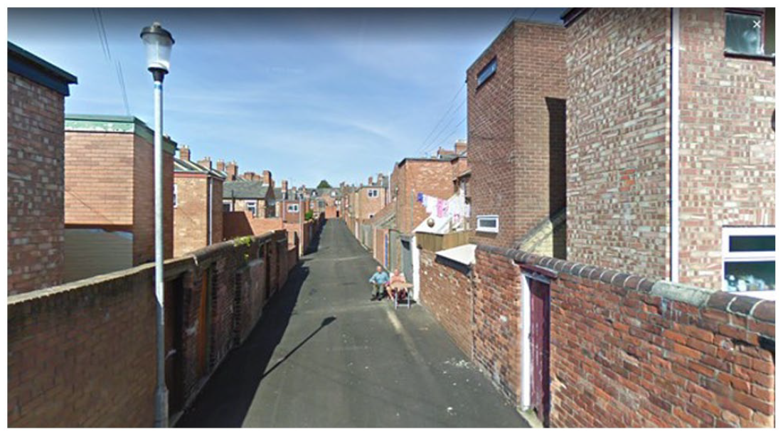
Tanning in a back lane, Bensham, Gateshead (credit: Google Street View).
Blind alleys
Back lanes in the Northeast are also different than those I walked in the West Midlands of England, where I used to live. They seem more present, accessible and visible in everyday life. Sometimes, after a visit to the park or the Gateshead Leisure Centre, I used to walk home using only the neighbourhood’s back streets. It is easy because they are wide and well-connected and safe because my male body makes them feel so. 6 These lanes offer alternative sounds, lights and atmospheres than those from the main street. They work differently and are designed differently. I can walk here without drawing attention from inhabitants whose bodies are ‘instructed’ not to look backwards. Houses are designed, furnished and aligned with a focus and view on the world in front. Back lanes are metaphorical as much as lived places. The adjective ‘back’ refers to a retrograde, discarded, disregarded or different negative social quality that is inscribed in or attached to this specific place. Yet, at the same time, ‘back’ also points to a real physical location that is directionally thought to be distinct from the street in ‘front’ and the house in the ‘middle’. Candid photographs capture things and scenes that cannot be seen from the main street, an unseen world of back entrances to bakeries, hidden car repair shops, graffitied love, doors with painted smiles (Figures 3–5). They offer relief from the strict codes of the street in front.
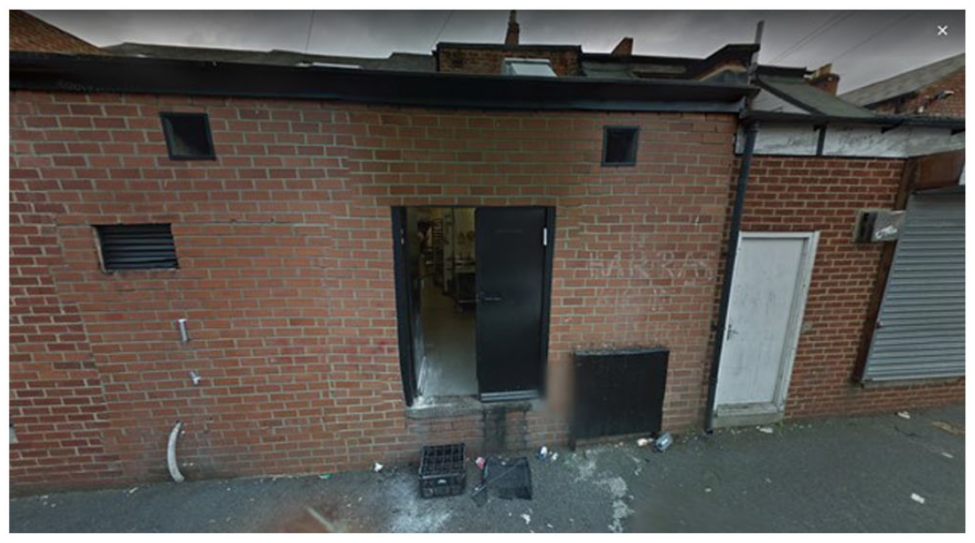
Bakery, Bensham, Gateshead (credit: Google Street View).
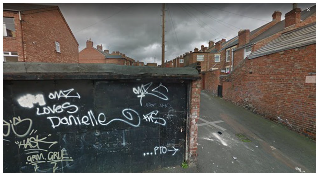
Back lane love, Bensham, Gateshead (credit: Google Street View).
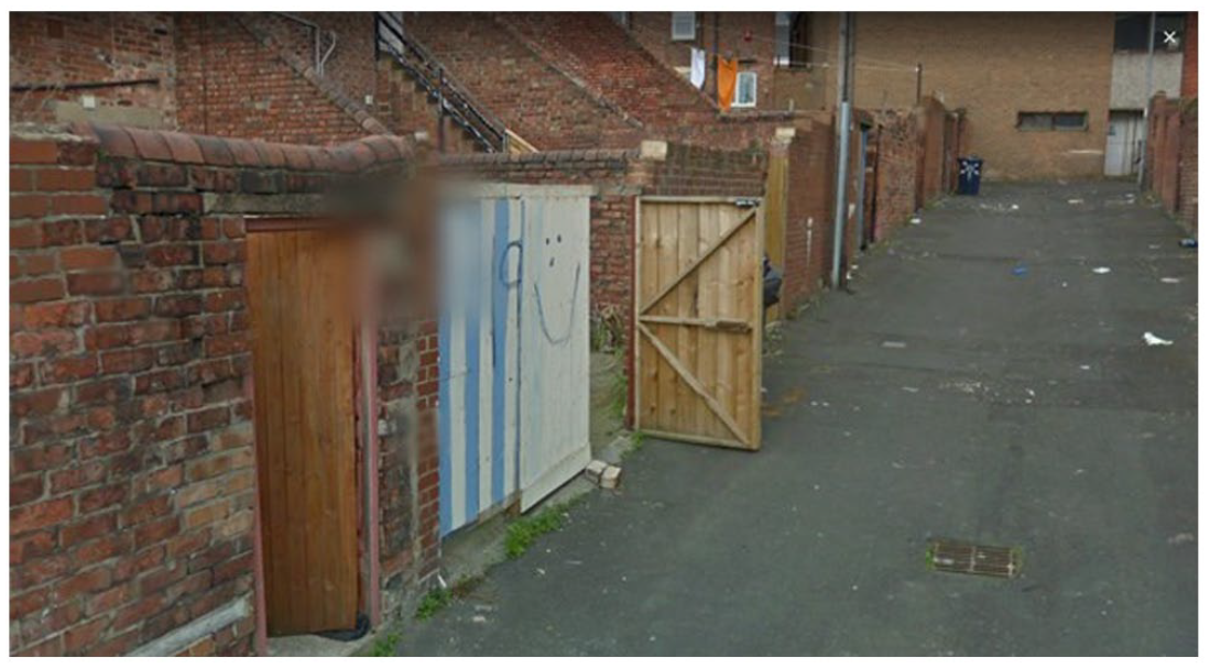
Smiley door, Bensham, Gateshead (credit: Google Street View).
In the Midlands, in contrast, I found most of the back streets (‘jitties’) either fenced or, in some other way, blocked off. The rare ones that are accessible are narrow and difficult to find. Alleys that are open on the one end don’t necessarily have an exit on the other. Exploring and walking these lanes, I was often forced to turn around and walk back in the direction of the main street. I later discovered that this is not by coincidence. Since the UK Home Office’s 2004 ‘Operation Gate-it’ 7 initiative, a deliberate crime prevention strategy, described by police researchers as ‘access control’, has become an important part of many urban landscapes in post-industrial British cities, including some in northern England (Figure 6). 8
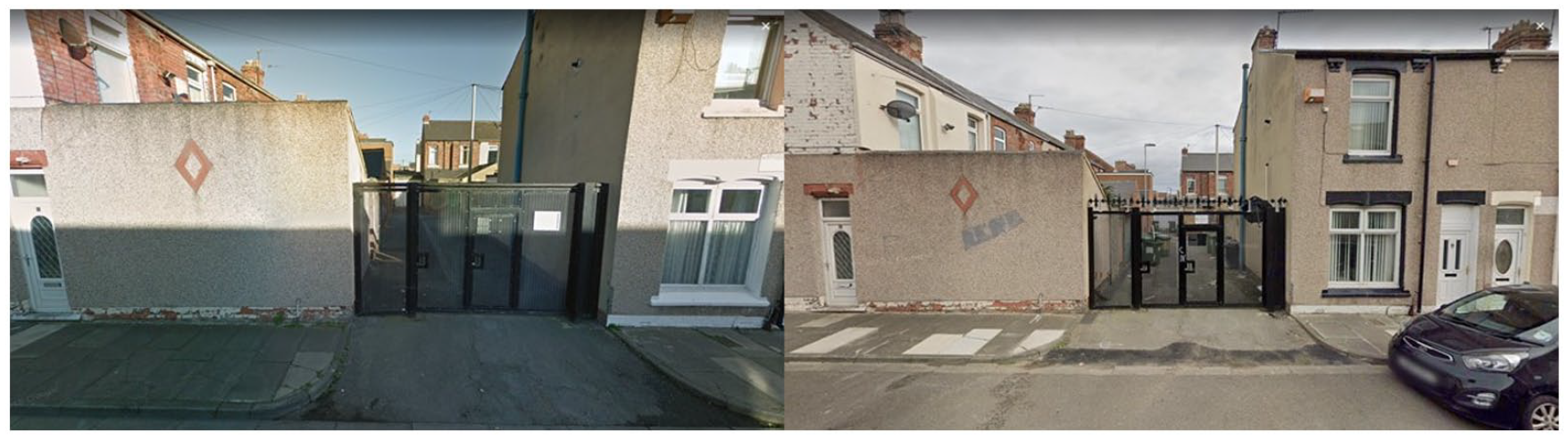
Hartlepool example of alley gating in 2014 (left) and with added spikes in 2022 (right). The Google Street View car can’t enter (credit: Google Street View).
An increasing number of cash-stripped councils in the UK are using so-called ‘alley gating’ (or ‘lane gating’), sometimes accompanied by video surveillance, as a cost-effective response to crime. 9 They prevent access to anyone that is not a resident and serve the specific aims of deterring burglary and preventing anti-social behaviour. The national College of Policing, which describes back alleyways as ‘unregulated spaces where signs of disorder are produced’, encourages ‘[residents]. . . to see the alley as their territory and take an interest in the behaviour of people who access it’. 10 In Gateshead, where back streets are still a public right of way, alley gating has not (yet) made an appearance. They remain sites of affective encounters that can be surprising, eccentric, unwanted and sometimes smelly.
Fly-tipping
‘Fly-tipping’ is a relatively novel word in the English language. Imaginative, yet difficult to translate, its invention is associated with the act of ‘on the wing’ littering by car or van. Today, the term has become synonymous with back lanes in the UK. The things I find in our back street often surprise me. Every morning, I look out of our kitchen window to discover what has been left behind overnight. Why do people leave their stuff here? Which people? Why this stuff? Bed frames, chairs without tables, tables without chairs, mattresses, microwaves, washing machines, canoes, emptied bottles of beer, flasks of polish vodka, worn sofas, painted cupboards, bikes without tyres, broken motor steps, sewing appliances, industrial drilling machines, the bones of someone’s chicken dinner, jerrycans, children’s dresses, sanitary towels, tracksuit trousers, Aldi and Lidl bags, but never an Asda one, leather shoes, suitcases, plastic sandals, broken glass, animal carcasses, always more and different stories.
One anonymous 2022 online commentary speculated that fly-tipping in Newcastle’s West End is a deliberate strategy to resist creeping gentrification: It’s direct action against gentrification, innit. That’s what being opposed to gentrification looks like. They’re quality houses within walking distance of downtown, so why aren’t the rents as high as they are in West Jesmond? Because it’s obviously not in the interest of the renters to allow them to be.
People in New York go out in the street and fire a gun every so often to keep the rents low, but we don’t have guns so we do it with trash.
11
Wheelie bins
Walking in Bensham’s many back lanes, sometimes with my dog, sometimes without, I observe a noticeable spatial unevenness in the distribution of fly-tipping. I encounter considerable smaller amounts of waste as I walk closer to the wealthier area around the local park. When entering neighbouring Low Fell, a middle-class suburb in Gateshead, I rarely come across abandoned refrigerators. Wheelie bins here are positioned upright with lids closed, neatly aligned on the side of well-maintained alleyways with overhanging tree branches. ‘Are these still back lanes?’, I wonder. Maybe they deserve a fancier name? An ‘allée’, perhaps (Figure 7). In Bensham, in contrast, wheelie bins are overflowing with rubbish falling out. They have numbers painted on or scratched in them that no longer correspond to their house numbers. Last summer, upon returning from a stroll, we found our neighbour’s bin on fire. Local youth (wrongly) believe that sniffing the toxic fumes can get them high. 12 Some councils in the Northeast recommend residents to keep their wheelie bin out of sight or to use a chain to secure them. Here, wheelie bins are shared goods, collectively owned and stolen, and some flats appear to have more than one. The blue and green one we currently keep have numbers from different streets.
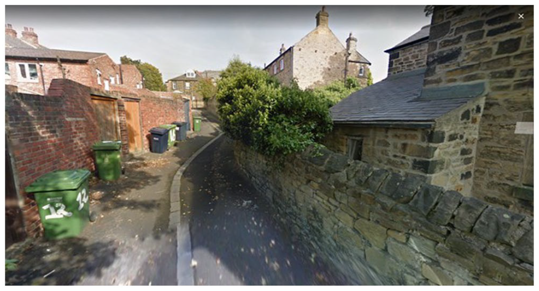
Low fell, Gateshead, 2016 (credit: Google Street View).
Back lane people
Local kids, many of them on bikes, use back streets to get around. They wear tracksuits in grey or black. Many of them are boys, teenagers with accents beautiful and bold. There are many people that frequent and inhabit these social spaces. We share the back lane behind our flat with Roma neighbours who use the public space of the lane as an extension of their yard. They chat, laugh and socialise while consuming sunflower seeds when the sun is out. The family’s child, a boy roughly 8 years of age, not only plays football on the pavement in the lane but spends so much time here that his language is informed by the specific vocabulary of this place, Back Lane England. At the time of the COVID restrictions, which forced the Shul to close, back lanes were used as a prayer site for Bensham’s large Orthodox Jewish community. Charedi men, dressed in long suits (‘rekel’), black fedoras and gartels, lined up facing the wall praying with a minyan. Social distancing meant that prayers had to be chanted loud enough for all to hear while, at the same time, ensuring that neighbours were not disturbed. Back lanes proved ideal places of acoustic negotiation.
Back lane erasure
In many post-industrial British cities, where back lanes can be most found, they are often being erased as part of rejuvenation and urban renewal programmes. In the early 2000s, this erasure awaited 440 Tyneside Flats in the Bensham ward. As part of a controversial regeneration project, in which the existing flats were stigmatised as ‘low demand’ and ‘obsolete’, precarious households were forced out of their homes, while terrace houses and their coal histories were razed to the ground. The municipal council’s plan to build more expensive houses foreshowed a desire to replace the existing residents with ‘aspirational’ families with more capital at their disposal. The 2008 financial crisis and the government’s ensuing austerity regime meant that the local council could no longer afford to realise the redevelopment plan. 13 Demolition came to a halt while the site deteriorated into a derelict landscape. What remains of the places and lives of the back lane today is a silhouette waiting to be erased permanently from sight and, eventually, from memory (Figures 8 and 9).
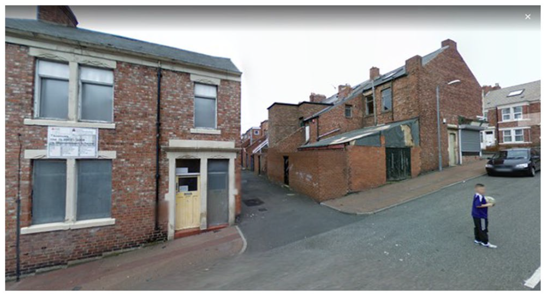
Westminster Street, 2008 (credit: Google Street View).
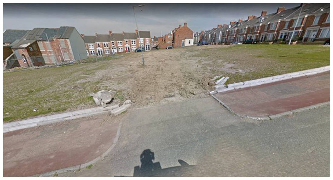
Westminster Street, same spot, 2016 (credit: Google Street View).
Ends
Alley-gating, privatisation, gentrification and regeneration are developments that form part of a broader narrative of a place at risk of disappearance and social forgetting. Ambiguity and instability, hallmarks of its identity, serve as reasons for erasure or their transformation into car-parking spaces, orderly cul-de-sacs and private court yards. Sometimes, of course, ‘taming’ these unruly places may be for the better. Their ungovernability, invariably recoded as ‘wasteful’, ‘dirty’ and ‘dangerous’, however, is also what makes them attractive as sites of creative and meaningful potential. Walking in them cultivates a sense of awareness of them as sites of engagement with memories and worlds that the main street has banned a long time ago. They connect residents and visitors in chance encounters that become neighbourhoods. No one plans to meet in back lanes, but everything somehow travels through them. By capturing my inhabitation of them, I hope in this short article to have contributed to making visible their rich, layered and complex worlds.
Footnotes
Acknowledgements
I would like to thank Caleb Johnston for his editorial guidance and commentary.
Funding
The author(s) disclosed receipt of the following financial support for the research, authorship, and/or publication of this article: This research was made possible with support from The NewBridge Project’s For Solidarity programme.