
Abstract
This paper examines one of the historical antecedents of Big Data, the social physics movement. Its origins are in the scientific revolution of the 17th century in Western Europe. But it is not named as such until the middle of the 19th century, and not formally institutionalized until another hundred years later when it is associated with work by George Zipf and John Stewart. Social physics is marked by the belief that large-scale statistical measurement of social variables reveals underlying relational patterns that can be explained by theories and laws found in natural science, and physics in particular. This larger epistemological position is known as monism, the idea that there is only one set of principles that applies to the explanation of both natural and social worlds. Social physics entered geography through the work of the mid-20th-century geographer William Warntz, who developed his own spatial version called “macrogeography.” It involved the computation of large data sets, made ever easier with the contemporaneous development of the computer, joined with the gravitational potential model. Our argument is that Warntz's concerns with numeracy, large data sets, machine-based computing power, relatively simple mathematical formulas drawn from natural science, and an isomorphism between natural and social worlds became grounds on which Big Data later staked its claim to knowledge; it is a past that has not yet passed.
Introduction
Physicists not only know everything; they know everything better. (Stauffer, 2004: 1)
Rather than focus on the future, our paper is about the past. William Faulkner (1994: 73) famously said, “the past is never dead. It’s not even past.” For Faulkner past and future are inextricably joined. We cannot escape history because the past never fully passes. Instead, we always carry the burden of the past into the future. The purpose of our paper is to unpack some of Big Data’s historical burden. Its past is not a unified whole, however, a single complete history. It is much looser, fragmented, multiple, set in relation to many different historical processes (Jacobs, 2009).
Consequently, Big Data’s past is complicated and fraught. It is tangled up with, among other things, complex histories of computerization, superpower weaponry and defence strategies, military funding, commercialization and advertising, corporatization, government regulation, epistemological fashion and debate, and academic disciplinary research agendas. Clearly, we can’t follow all these variegated histories in this short paper. Instead, our aim is much more modest. It is to set out historically only one of the antecedents of Big Data: social physics. We suggest that social physics is connected to Big Data historically through spatial analysis: social physics, as we will argue, influenced spatial analysis, and spatial analysis was then incorporated into Big Data.
We recognize that not all spatial analysis derives from social physics, however. For example, within spatial analysis there is the long tradition of German location theory that includes von Thünen, Weber, Christaller, and Lösch that doesn’t subscribe to social physics at all (Barnes, 2003). The underlying rationales for the individual works comprising the German locational tradition vary with the particular author, and are also bound up with the historical and geographical context in which the particular theory was devised (Barnes, 2003). In none of these cases is social physics the motivation, though. But there is a strand of spatial analysis that comes from social physics, and which in turn has shaped contemporary practices of GIScience and Big Data (see Anselin, 2012; Goodchild, 2004, 2009). In particular, we contend that practices of exploratory data analysis, pattern recognition, and data mining within GIScience and Big Data, which have produced such analytical outcomes as prediction, modelling, intelligence, and design, stem in part from an earlier spatial analysis and social physics. This is not to preclude other influences on Big Data and other forms of spatial analysis, but it is to make the connections between social physics and spatial analysis explicit.
Social physics is a long-standing interdisciplinary mode of inquiry. From the beginning it was driven by a belief that laws, theories, and models of physics applied as much to social as to natural worlds. This view is known as monism, the idea that theories of physics explain both human and non-human worlds (and also represented by the chutzpah found in our paper’s epigraph). The origins of monism are in Ancient Greece, but social physics as a specific form of enquiry did not emerge until the 17th century in Western Europe. Following several hundred years of fits and starts, social physics was finally institutionalized in the 1940s, the result of the energetic efforts of a motley of American academics of which the two most important were Harvard’s George K. Zipf (1902–1950) and Princeton’s John Q. Stewart (1894–1972).
Social physics entered geography in the mid-1950s through the American geographer William Warntz (1922–1988), who later became Director (1968–1971) of the Harvard Laboratory for Computer Graphics and Spatial Analysis. Warntz, who collaborated with Stewart early on, emphasized the importance of recognizing general geographical patterns through the spatial analysis of large sets of geo-coded data. He thought those patterns were best represented and explained by models and theories of physics, particularly the Newtonian (Lagrangean) potential model (Rich, 1980). 1 That is, his spatial analysis was based on social physics. To that end, Warntz made literally billions of calculations during the course of his career. At first, a small proportion were by hand using mechanical calculators and taking months of his life. Later, and by far the bulk, were undertaken by a computer first in only a few hours, which diminished to minutes, then to seconds. Those calculations were the bases of countless contour surfaces of population potential that Warntz made for the United States. On one occasion, Warntz even made a 3-D version on his dining room table, constructed from plywood, plaster of Paris and many, many nails, each one standing at exactly in the right spot and at the right population potential height. 2
In telling historical stories of social physics, and particularly of Warntz’s work within that tradition, we are not claiming that social physics is the equivalent to what now passes as Big Data, or even that it is its embryonic version. It is more complicated. The work that Warntz did, as well as other social physicists on whom he drew, contained some of the elements that were later incorporated into Big Data via advancements in spatial analysis, providing one of its proving grounds, helping to shape its formulations and practices. Our larger point is that Big Data and its use in geography didn’t start de novo, from scratch, after the rubble of the past was cleared away. It was erected on that past, which consequently must be examined.
Historical foundations of social physics
In an early study, Sorokin (1928: 3) argued that the intellectual foundation of social physics was the Ancient Greek philosophical idea of monistic materialism in which “psychical and social phenomena [were] mere variations of natural phenomena.” As a result, regularities and laws found to hold for natural phenomena applied equally as forcefully to social phenomena. Natural and social worlds were isomorphic: one world, one set of principles.
Monistic materialism, thought Sorokin (1928), became especially important from the 17th century with the beginning of the scientific revolution in Western Europe. That revolution was defined in part by the use of mathematics. Galileo famously said in the early 17th century that the Book of Nature was “written in the language of mathematics,” and “without [it] one wander[ed] about in a dark labyrinth” (quoted in Drake, 1957: 238). If society was isomorphic to nature, it therefore followed that the social should be written in mathematics too. That was what social physics did. It strove to convert all forms of society into numbers, using mathematics to shed light on its own dim labyrinthine corners. In some cases, leading scientists also became leading social physicists. For example, the English astronomer Edmond Halley (1656–1742) turned his astrophysical skills in the early 18th century to the life insurance business, using his mathematical expertise to invent actuarial science by setting out statistical regularities from a large-scale analysis of mortality data. In other cases, concern was with only the social. John Graunt (1620–1674) sifted through statistical data on disease, laying down an intellectual basis for epidemiology. And Graunt’s contemporary, Sir William Petty (1623–1687), was the first to compile national statistics of income and wealth, providing a foundation for the “dismal science.” According to Stewart (1950: 243), each of these three works of large-scale numerical data compilation and analysis represented early examples of “social physics.”
Not that “social physics” yet existed as a name. When it finally arrived, it was in French: “physique sociale.” The Belgian astronomer, statistician, and social tabulator Adolphe Quetelet coined the term in 1835 in his book Sur l’Homme. 3 Specifically, Quetelet assembled a large data set of Parisian crime figures, subjecting it to a demanding social statistical analysis, making scientific predictions of “terrifying exactitude” (quoted in Hacking, 1990: 105). He was able to do so because, following the monistic line, he believed social life was governed by statistical laws revealed by applying the methods of social physics.
Quetelet in his analysis drew especially on “the error curve” (the Gaussian normal distribution) to understand social regularities. Curiously, though, he eschewed his own home discipline of astronomy to provide other explanatory theories. But they came from that subject in 1858, although not from a trained astronomer, but oddly from a retired autodidact and Philadelphia publisher, Henry Carey. Carey unabashedly believed in monism, writing that “the laws which govern matter in all its forms, whether that of coal, clay, iron, pebble stones, trees, oxen, horses, or man are the same” (quoted in Sorokin, 1928: 13). But he went further. His three-volume Principles of Social Science applied Newtonian gravity formulations to terrestrial human movement. Carey wrote that under “the great law of molecular gravitation … man tends of necessity to gravitate toward his fellow man [sic] … . Gravitation is here, as everywhere else in the material world, in the direct ratio of the mass and in the inverse one of the distance” (quoted in Tocalis, 1978: 68).
But all of this was just a protracted warm-up for what was to come. Beginning from the early 1940s and continuing to the present, social physics burgeoned, drawing in research money, establishing institutional bases, fostering specialized workshops and conferences, and launching its own journals as well as thousands of academic papers. The current form of the field, also called sociophysics or statistical physics, is dominated by physicists (see, for example, Battencourt et al., 2007; Gabaix and Ioannides, 2003; Stauffer, 2004, 2013). They call what they do “interdisciplinary”: applying principles and methods of physics to subject matter traditionally investigated by other disciplines such as economics, psychology, sociology, political science, and geography (Stauffer, 2004, 2013). But the earlier mid-20th-century incarnation of social physics, and this paper’s primary concern, was interdisciplinary in a different sense. It was constituted by researchers from many different disciplines and which, from the early 1950s, included geographers, producing an explicit spatial analysis. 4
Mid-century social physics
Only one of the two founders of the mid-20th-century version of social physics was a physicist, John Stewart, Professor of Astrophysics at Princeton. The other was a linguist, George Zipf, who taught in Harvard’s German Department. From 1939, he was given a one-off position of University Lecturer that allowed him free rein to teach in the College any subject he wanted: he chose social physics.
George K. Zipf
Zipf was fascinated, maybe obsessed, with numerical patterns. He was originally appointed at Harvard’s Department of German. Strangely, though, his research was not about that language but Chinese. It involved taking 20 extracts of Chinese writing, each with at least a thousand syllables, and generating in total 20,000 separate individual syllables (Rousseau, 2002: 12). Carrying out a large-scale numerical analysis, making use of student “human computers” to undertake the calculations, Zipf found that the frequency distribution of syllables conformed to the power law
5

The power law finding perfectly catered to Zipf’s obsession. It implied a set numerical pattern in which the second most frequent Chinese syllable occurred approximately one-half as often as the first, the third syllable one-third as often, and so on down the line. Moreover, Zipf found that the same power law distribution held in other languages too, and not only for syllables but also for words and phrases (Zipf, 1932, 1968). In each case, the frequency of use of an element of language was inversely proportional to the rank of its frequency. In English, for example, Zipf found by examining texts as different as the King James Bible and James Joyce’s Ulysses that “the” is the most frequently used word in the language, which is twice as common as the second most frequently used word, “of,” and three times as common as the third most frequently used word, “and.”
After Zipf was appointed as University Lecturer, he took his original finding and in true social physics fashion applied it to other social phenomena. In this he was guided by his faith in monism. As he put it in a 1942 paper, “the same natural law governs the structure and behavior of our planet, of life on our planet, and indeed, of even the smallest minutiae of living activity including the most subtle emotional and intellectual elaborations of the human mind” (Zipf, 1942: 48).
His immediate work was on city-size distributions, and published as National Unity and Disunity (Zipf, 1941). Resting on an enormous amount of data collection and analysis, making use of even more human computers than for his studies of language, Zipf found his power law formulation applied to city-size distributions not only across different countries but also over time as well. Further, when plotted on log paper the power law distribution of city-size distributions took on a striking linear form, making the relationship even more beguiling (Figure 1). It established that within a given urban system the second largest city was half the size of the largest city, the third largest city a third of the size of the largest city and so on. Under such conditions the total population of the entire urban system was given by
USA 1790–1930. Communities of 2500 or more inhabitants ranked in decreasing order of population size. Reproduced with permission from Zipf, 1949: 420.

Zipf called the right-hand side of equation (2) the rank-size rule, which was later eponymously dubbed Zipf’s Law. For any given ranked city n, its population was equal to

Before his premature death from cancer in 1950 at age 48, Zipf, through prodigious feats of data collection and calculation, tried to show in his magnum opus, Human Behaviour and the Principle of Least Effort (1949), that the power law he had found for word frequency and city-size distributions applied to all phenomena. 6 He seemingly had no problem in showing that it applied to countable things like populations of cities, words used in English language publications from Beowulf to T.S. Eliot, and the “length of intervals between repetition” in Mozart’s Bassoon Concerto in Bb Major (respectively Zipf, 1949: 420, 123, 337). But he also suggested that it applied even to more tricky phenomena that one might think would resist enumeration, such as “the death wish,” multiple personalities, and “erotic substitute action” (it is best not to ask) (respectively Zipf, 1949: 240–241, 264–266, 269–270). In each case, the power law holds because, as he argued in his 1949 volume, that distribution is the manifestation of the ultimate monist principle, lex parsionae, the principle of least effort (Zipf, 1949: ch. 1). Zipf (1949: 1) contended that all parts of nature, and consequently all parts of society, beat the most efficient path to any given end, “minimiz[ing] the total work that [is] … expended in solving both … immediate problems, and probable future problems [original emphases].” That resolution always takes the form of the power law distribution; it is the statistical manifestation of the Principle of Least Effort.
Zipf’s ambition was overweening. He thought social physics “could be applied to everything … down to and including man’s innermost dreams. The soul… offers a perfectly legitimate problem to science” (Zipf, 1942: 62). Those who resisted that end he termed “verbalists,” who he thought should be excoriated, if not suffer something even worse. 7 Moreover, he believed he was on a modern-day crusade: “My dear John,” he wrote to Stewart on 22 May 1949, “the intellectual battle of the second half of the twentieth century is on; you and I are both in it up to our necks with no earthly possibility of retreat (and there is no desire). I propose to keep the canons barking.” 8 He did until the day he died. But his death was a half-century too early. He would have been in computational heaven had he lived to experience a world of Big Data. A world in which vast amounts of social data were available to be sifted, arranged, and analyzed, made to show the power of the power law distribution and lex parsimonae, and with neither a verbalist nor a human computer in sight. Our suggestion is that Zipf’s work in part prepared social science, and geography in particular, for that very world.
John Q. Stewart
Even more important for the social physics movement than Zipf, who was a loner, was John Quincy Stewart. His work directly linked to geography, and he also had on his side, at least for a time, some heavy-weight US East Coast institutions and intellectuals including the Institute of Advanced Study at Princeton directed by Robert Oppenheimer, and Warren Weaver at the Rockefeller Foundation that funded his social physics project for four years (1949–1953). It was Stewart from his Princeton base who energetically and systematically constructed, maintained, and promoted social physics as a new stand-alone discipline. Continually on the look-out for new resources and allies, never missing an opportunity for endorsement (for both his project and for himself), he strove to turn social physics into a new social science.
Stewart was a Princeton man through and through. All his degrees were from there, and two years after his PhD he was back as a Princeton professor. Initially interested in matters extraterrestrial by mid-career his research focus became increasingly earthly. It centered on weather and navigation and, important for the later story, led to the publication of a widely circulated primer used in the US Army Air Force, Coasts, Waves, and Weather for Navigators (Stewart, 1945).
Part of that same terrestrial turn was his interest in models of population potential; that is, applying ideas of gravitational potential to the geographical distribution of population. There are different ways to interpret population potential, but perhaps the most common is as a measure of the influence of a given population at one location (j) on another location (i) (Rich, 1980: 5)

Equation (4) says that the population influence of location j on location i is proportional to the size of the population at j doing the influencing, and inversely proportional to the distance between the two locations. True to his roots, Stewart first applied this potential equation to the geographical distribution of the “Princeton family,” that is, the 20,438 members listed in the 1940 edition of Princeton University’s Alumni Directory. 9 Devoting his 1939 “Christmas holiday to statistical study,” and drawing on the “vigorous assistance of Philip Wilkie … [for] some of the computations,” Stewart first measured the population potential of every state in relation to New Jersey, Princeton’s home state. From that he worked out the expected number of Princeton alumni for every state, and compared that number to the actual count from the Alumni Directory. Stewart found that expected and actual numbers of alumni “more or less” lined up. It showed him that potential models applied not only to objects in the heavens but also to those down on earth within the social field, thus fulfilling the promise of monism; that is, a social physics one-size-fits-all theory.
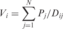
Stewart subsequently expanded his inquiries, calculating total population potential for the US as a whole. For any given location i, total population potential is equal to the sum of all the individual potentials created by populations found at every location j (j = 1, 2, … N)
With total population potentials known for all locations i, an equipotential (isopleth) map can be constructed. Each line on the map connects all places with the same population potential. Figure 2 shows population potential isolines calculated by Stewart for the United States for 1940. Population potentials are especially high in the North East (NE), indicating the considerable influence of the population on any given location within that region, but it falls off markedly for locations in the West until it rises again on the Pacific Coast.
United States: potentials of population, 1940. Reproduced with permission from Stewart, 1947: 436.
Drawing equipotential maps took an immense amount of computational effort. That’s why Stewart had to give up his Christmas holidays in 1939, shackled to log tables, slide rule, and Mr. Philip Wilkie. But by the late 1940s help was on its way in the form of electrical computation and cartographic production. Stewart enlisted into his project Thomas B. Bissett, a Princeton senior undergraduate electrical engineer, and inventor of a nationally award-winning “computing device.” Taking second prize at the American Institute of Electrical Engineers’ meeting at Pittsburgh in April, 1949, Bissett’s machine “permit[ed] the rapid drawing of contours of equipotential.” As Stewart described it, Bissett’s was an analog machine that “applies Ohm’s law … to the computation of potential of population (number of people divided by distance). Threads attached to the scriber controls a set of resistances as it moves.” 10 Admittedly, Bissett’s machine wasn’t of the same caliber as other contemporary computers such as Jay Forrester’s at MIT, the “WHIRLWIND” (Hughes, 1998), or John von Neumann’s at the Institute of Advanced Studies, Princeton, the “JOHNNIAC” (Dyson, 2012), but it was certainly more reliable and quicker than Stewart’s former standby of human computers.
By the summer of 1949, Stewart thought it was time for both he and the world to lose the quotation marks that usually accompanied the term “social physics.” He approached a key post-war science manager and well-known scientist in his own right, Warren Weaver, head of the Division of Natural Sciences of the Rockefeller Foundation, for funding to develop social physics as a proper social science. Shannon and Weaver (1949) had published that same year The Mathematical Theory of Communication, which became a central text of the early post-war period, linking science, mathematics, computing machines and society and according to Edwards (1996: 203), enabling a “complete statistical analysis of human social activity.” Weaver wrote back to Stewart, “I am completely sympathetic with your approach.” And best of all, he offered him a grant of $15,000. 11
Stewart used the money to mount seven conferences, as well as to help form in 1951 a Social Physics Committee of 40 strong, associated with the American Association for the Advancement of Science (AAAS), which produced its own bevy of special sessions. Stewart also increasingly adopted the language of “isomorphism” to describe the relationship between natural and social sciences. In a paper he gave in Boston at an AAAS meeting in December 1953 he suggested that “isomorphism means reliable item-to-item correspondence between two or more fields which superficially may seem altogether dissimilar. The fields are exhibited as more or less identical in their patterns of concepts.” 12 Of course, this was another version of monism, and justification both for more computation, data compilation, and mathematization within the social sciences, and further exploration of points at which concepts from physics corresponded to items and relationships within the social world. In the December paper, Stewart was emboldened to assert isomorphisms between thermal, electromagnetic, and chemical energy and, respectively, human meaning, feeling, and authority, as well as an isomorphism between mechanical work (kinetic, elastic, and gravitational energy) and decision-making. 13
But it was all a bit too much for Weaver, who wrote to him in 1953: To search for isomorphisms between social phenomena and physical phenomena is indeed an interesting idea. The real question, however, is whether or not it is a rewarding idea. It is interesting to suppose that there may be entities, social values, which play in social experience the same roles played by different forms of physical energy … But it is hard for me to sense how one can usefully assign quantitative measures to any significantly wide range of “values” in the social field. And when you link together such things as meaning, feeling, authority, and decision-making, this sounds to me like a very heterogeneous mixture.
14
Macrogeography and William Warntz
The first communication between Stewart and Warntz was about the Bissett. Warntz wrote to Stewart on 1 October 1953, to ask whether the “ingenious electrical computer designed and constructed by Thomas B. Bissett … could be made available to him?” 17 Warntz was writing his PhD thesis at the University of Pennsylvania using Stewart’s population potential model, trying to calculate equipotential lines. He needed that machine. But unfortunately it was not on hand. “No Bissett available here” replied Stewart, adding with a mathematician’s zeal, “longhand computation is not so bad.” 18 Possibly not, though. Warntz’s obituary writer, Donald Janelle (1997: 724), reckoned that in completing his doctoral dissertation alone Warntz undertook “thousands of calculations to derive population potential fields, all with a mechanical adding machine.”
Although their first correspondence wasn’t until 1953, Warntz had been a secret admirer of Stewart for some time. Warntz began his undergraduate degree at Penn in economics in 1940. But the war interrupted his studies. In 1943, he enlisted in the US Army Air Force, and trained as a navigator. In active service from 1944, awarded several military medals, Warntz served in a combat heavy bombardment group based in East Anglia. Following a crash landing as Warntz returned from a mission, he was sent to Cambridge to recuperate. It was there, presciently given his subsequent involvement with Stewart and social physics, that he read Isaac Newton’s papers at the university library, the site of the largest single deposit of such papers in the world. After the war ended, Warntz remained in the Army Air Force and was posted to Gander at the Newfoundland Base Command for sea search and rescue missions. In the base’s small library he found J.Q. Stewart's Coasts, Waves and Weather for Navigators (1945), which was to change his life. The book was primarily a how-to manual for navigators. But in an appendix, and quite out of character with the rest of the book (Warntz, 1984, 1, called it “an exotic chapter”; 1984: 1), Stewart “could not resist the temptation” to write about his new interest in population potential, likening equipotential lines to isobars within a cyclonic system. Warntz later said that was his “Ah-ha” moment (Dow, 1973: 56), when “social science and the things I learned about meteorology and navigation” came together. 19
Once Warntz demobbed in 1948, he quickly completed his Bachelor’s degree in economics at Penn, did also a Master’s degree there, and in 1951 entered its doctoral economics program, specializing in economic geography. He was supervised by Lester Klimm, an economist with an unlikely interest in location theory. His dissertation, later published as Toward a Geography of Price (Warntz, 1959a), deployed the potential model to present a geographical analysis of price, empirically illustrated using commodity statistics taken from the US Department of Agriculture. The thesis involved the construction of both an aggregate demand curve derived from population potential estimates weighted by income, and an aggregate supply curve obtained from potential estimates of spatially varying production levels of different agricultural commodities. The intersection of the two curves determined the geography of price.
After the initial contact about the Bissett in October 1953, Stewart invited Warntz to come to the Princeton Observatory. They met on 3 December 1953, and the rest is history, with Warntz becoming Stewart’s staunchest ally. The timing could not have been better given Weaver’s rejection of Stewart’s project earlier that same year. It meant social physics got a second chance with a new home, in a discipline with a well-established provenance that came with a formidable institutional structure that included both the American Geographical Society (AGS) (where from 1956 Warntz was a Research Associate running his own “special program” in social physics) and the Association of American Geographers (AAG), which brought a large prospective audience, so far untouched by social physics but potentially ready to be converted.
But for this to happen in geography, things needed to be shaken up. In an address to the Geography session at the annual meeting of the National Council for Social Studies in Pittsburgh, in November 1957, Warntz said: In our researches in geography and our contributions to the journals of learned societies, I suggest the time has come for some unruliness, for discomfiting the feeble-minded, for treading upon the weak, and for general impatience. The time has come to raise a rumpus in geography.
20
Predictably Warntz’s conception of macrogeography was uncompromisingly monistic. Warntz was fond of repeating his own choice phrases, and there was no phrase he repeated more often than “social science … and physical science are but mutually related isomorphic examples of one generalized logic” (Warntz, 1957: 422, fn. 1). That was the strength of macrogeography; it embodied the “one generalized logic.” That logic was of a single discipline: physics. It meant geography becoming like physics. And if a discipline failed to do so, as geography patently had, then it would suffer; it had suffered. That’s why a “rumpus” was necessary.
Warntz thought geography had gone wrong when it turned to what he called microgeography, which was “preoccupied with the unique, the exceptional … and often the obvious” (Warntz, 1959b: 447). It relied on Zipf’s dreaded verbalism, “subjective description,” such as “a feeling for the area,” “the personality of the region,” and “man-land relationship” (Warntz, 1957, 420). Under this regime of verbalism, Warntz said microgeography “has been tried, found wanting, and is justifiably being discarded.” 22
Now was the time to make amends, to do macrogeography – a geography unified with the “one generalized logic.” 23 Although Warntz coined the specialized term macrogeography for his approach, it was nothing other than social physics. The name macrogeography served only a rhetorical function of making the project palatable to geographers, adding nothing substantively that wasn’t already contained within Stewart’s original formulation. But the name did resonate with, and in part was picked up by, other practitioners of spatial analysis who also emerged in the mid-to-late 1950s both inside and outside geography. Walter Isard’s Regional Science Department was founded at Penn the same year Warntz finished his PhD therein 1955. Social physics was incorporated at least into Isard et al.’s (1960) tome on regional science methods, and Warntz maintained an adjunct position in regional science at Penn until 1966. Likewise there were various linkages between Warntz and the work of proponents of geography’s “quantitative revolution” that occurred around the same time. Particularly important were the so-called “Garrison Raiders,” a group of graduate students at the Department of Geography, University of Washington, Seattle, who worked with a young faculty member, Bill Garrison, who shared Warntz’s dissatisfaction with “microgeography” and who sought an alternative in some form of spatial analysis.
Core to Warntz’s spatial version of social physics was the computational task of confronting big data. In this he was fortunate, given that he and his macrogeography came of age during a period marked both by the rapidly improving power of machine-based computation as well as by increasing access to those machines. There would be no more cap-in-hand begging for the Bissett. In a paper, in the Geographical Review, Warntz (1964: 171–172) directly linked the development of macrogeography to computer development. The issue turned on the number of so-called “control points” used to calculate a given population potential map. A control point was a designated map location associated with a particular population level. Knowing those locations and population numbers was necessary before any potential calculations could be made and equipotential lines drawn. But the more control points, and clear from equation (5), the more gruelling the resulting calculations. In Stewart’s first 1940 set of population potential calculations there were just 24 control points. Calculating for even that relatively small number by hand, even with the assistance of the energetic Mr. Wilkie, still took Stewart all the Christmas holidays. Later Stewart used Thomas Bissett’s machine, but it could only handle 10 control points at a time (Warntz, 1964: 177). The breakthrough was the arrival of the digital computer. In 1958, Warntz and Stewart used “an early IBM electronic computer … [to] compute … a map with 115 control points” (Wantz, 1964: 171). And by 1963, using Princeton’s IBM 7090 computer, Warntz was calculating the US population potential using 3105 control points (one for every county in the conterminous United States). Warntz (1964: 177–178) reports that in this case: Inputs came from 3,105 punched cards … and [each card] contained for each county … the 1960 population, area, and geographical co-ordinates of the county’s population center … [A]bout ten billion arithmetic operations were required to produce th[e] map, and three other, different maps computed at the same time. About twenty-three thousand words of storage (thirty-six bit words) were required, and the programming language used was Fortan … Running time for the computer was a few seconds short of two hours.
Warntz’s work impressed Howard Fisher, who in 1965 had founded the Laboratory for Computer Graphics within the Harvard Graduate School of Design (GSD), with the intellectual support of Brian Berry of the University of Chicago and Waldo Tobler of the University of Michigan (both geographers and members of Bill Garrison’s “Raiders”). Fisher had organized a series of luncheon presentations on the state-of-the-art in the spatial representation of quantitative information, to include Berry and Warntz. 24 In 1966, Warntz was made Professor of Theoretical Geography and Regional Planning (although without tenure) within the lab (the first professor of geography on Harvard’s campus since Derwent Wittlesey’s death 10 years prior in 1956). Fisher and Warntz’s work within the lab was two-fold, according to Warntz: first, the “continued investigation into the uses of graphical analysis, and computer graphics in particular,” of which Fisher no doubt led the effort, and, second, “pure research in the framework of general systems theory and spatial patterns,” 25 much of which was also lumped by Warntz as theoretical geography and published within the Harvard Papers in Theoretical Geography (edited by Warntz, 1966–1971).
As Fisher was due to retire in 1970, at the exhaustion of the Ford Foundation grant that supported the lab, Warntz became Director in 1968 and the name of the lab became the Laboratory for Computer Graphics and Spatial Analysis. In addition to his duties within the Graduate School of Design, Warntz also led freshmen seminars within Harvard and was even asked to submit a proposal justifying the return of geography to the university (Janelle, 2000: 105). Seemingly, macrogeography really was what the Ivies wanted, with Warntz’s work representing qualities of “originality,” “erudition,” and “brilliant scholarship.” In the end it didn’t work out, with geography never returning to Harvard after all, and Warntz resigning his position three years after he became Director (see Chrisman, 2006, for an excellent history of the Harvard lab and Warntz’s role within it). What Warntz did achieve, however, was to prepare the ground of geography for Big Data, providing models of spatial analysis, stressing the importance of powerful computing machines, and championing the belief that sooner or later the entire social field could be turned into numbers.
Conclusion
The strategic positions of graphics and geometry become even more clearly defined, while concomitantly the distinction between cartography and spatial mathematics decreases. (Warntz, 1977 [1967]: 5) The engine that drives social physics is big data: the newly ubiquitous digital data that is becoming available about all aspects of human life. By using these data to build a predictive, computational theory of human behavior, we can hope to engineer better social systems. (MIT Media Lab, 2014: n.p.)
Big Data continues to vex GIScience, as can be seen in the precipitous rise of volunteered geographic information (VGI). 28 A term coined by Goodchild (2007: 220), “the most important value of VGI may lie in what it can tell about local activities in various geographic locations that go unnoticed by the world’s media, and about life at a local level.” The spatial analysis of these data inherits the affect, if not many of the techniques, associated with social physics. As Anselin and Rey (2012: 2211) write, the techniques associated with current spatial analysis and their subfield of spatial econometrics “has roots in regional economics and quantitative geography.” Interestingly, this form of macrogeography – to understand the spatial patterning of Big Data – does not preclude attention to the micro (in fact, it presupposes recording the rich details of private life). Likely, Warntz would be pleased. While, perhaps, there are other epistemologies that enroll Big Data beyond the monism of data-driven methods (for instance, Crampton et al., 2013), our curiosity is increasingly piqued by the continuities of macrogeography with some contemporary GIScience work, made more conspicuous, we suggest, by the rise of Big Data.
Our suggestion is that we’ve been here before. That the call to quantify and to represent social-spatial activity enacts a specific visibility that potentially renders invisible other phenomena. Not everything can be quantified, or only partially quantified. What’s not drops out of view. That was precisely the issue when critics in human geography took aim at Warntz's social physics version of the discipline during the 1970s. So-called humanistic geographers argued that what became invisible in Warntz’s social physics was any real, sentient human being, who could never be described by numbers alone (Ley and Samuels, 1978). Radical geographers such as Harvey (1972) thought what dropped out were social relationships, power inequalities, and class conflict – for them, vital to understanding any kind of geography, large or small.
While these criticisms led to new forms of geography emerging, the social physics kind continued, indeed flourished, finding new applications and academic homes, taking on new manifestations, one of which we’ve argued was Big Data. That’s the reason we need to trace the connective tissues between Big Data and the mid-20th century. Not to do so would be a mistake. By showing that Big Data is historical, we show the assumptions that were built into it, as well as the contestations around them. Big Data becomes no longer a black box, self-contained, sealed and impregnable, but is opened up, available for verbalist discussion and contestation.
In 1967, Warntz provided a summary of the lab’s position with respect to the mathematization of geography: Description of surfaces and paths including geodesics, spatial probabilities, central-place hierarchies in the broadest sense are the types that seem destined to replace the current arrangement characterized by specialties classified in terms of non-spatial properties and including such things as population geography, linguistic geography, cultural geography, economic geography, and so on. We agree.
29
Footnotes
Acknowledgements
We would like to thank Eric Sheppard for helpful discussions, especially around the mathematical intricacies of power laws and potential models. The excellent comments of two referees were also enormously helpful.
Declaration of conflicting interests
The authors declare that there is no conflict of interest.
Funding
This research received no specific grant from any funding agency in the public, commercial, or not-for-profit sectors.