
Abstract
The article analyzes the ideological reasoning, planning rationale, and construction of controlled/satellite neighborhoods (poblados dirigidos) in the metropolitan area of Madrid during the 1950s and 1960s. Poblados dirigidos were compact and minutely planned barrios on which the Franco regime (1939-1975) hinged its hopes for re-directing urban growth and controlling informal urbanization. While the phenomenon of poblados dirigidos was investigated by several Spanish architects and urban planners, their work focused mostly on the design of these neighborhoods, the structure of their housing units, and the innovative construction techniques. The current article suggests that the spatial crisis that drove the dictatorship to embrace the planning module of poblados dirigidos cannot be understood in isolation from the political and economic challenges faced by the regime during its “interim decades.” These challenges led to a progressive shift in the regime’s territorial representations and to a partial shift in its spatial practices, which the article analyzes.
The special issue, which this article forms part of, focuses on the relationship between space and the concept of crisis. More specifically, its contributors ask how different forms of spatial analysis add to our understanding of crises as multifaceted, historically grounded phenomena. While the articles in this volume all aim to historicize the production of space during critical periods throughout the twentieth century, the current article deals with a moment in time in which spatial insufficiencies became the core reason and a defining feature of the crisis under investigation. The article analyzes the ideological reasoning, planning rationale, and construction of controlled/satellite neighborhoods (poblados dirigidos) in the metropolitan area of Madrid during the 1950s and 1960s. Poblados dirigidos were compact and minutely planned barrios on which the Franco regime (1939-1975) hinged its hopes for re-directing urban growth and controlling informal urbanization. Some of these neighborhoods were designed as transitory solutions, while others were viewed as more permanent entities. Most were built using the cheapest materials, included the smallest housing units possible, and were designed as self-sufficient units, close, yet disconnected from the heart of the city. While the phenomenon of poblados dirigidos was investigated by several Spanish architects and urban planners, their work focused mostly on the design of these neighborhoods, the structure of their housing units (small size, ultra-economic, and aimed at working-class populations), and the innovative construction techniques (mass prefabrication, innovative use of glass and concrete). 1
These works situated the phenomenon of poblados dirigidos within the context of Spain’s 1957 Social Emergency Plan, the 1956 National Plan of Housing (whose central goal was to eradicate urban informality and redirect the expansion of Spain’s largest cities by setting clear guidelines for future housing policies), and Spain’s new Land Law. However, they did not address the political crisis undergone by the Franco regime (which took place in 1956-1957) or its shift in economic perspective (which emerged during the years 1957-1959). The current article suggests that the spatial crisis which drove the dictatorship to embrace the abovementioned plans cannot be understood in isolation from the political and economic challenges which it faced. These challenges, in their turn, led to a progressive shift in the regime’s territorial representations and to a partial shift in its spatial practices. While most of the people who pass through these neighborhoods nowadays are not aware of it, Poblados dirigidos—with their innovative potential, structural contradictions, and limitations—quite literally embodied this interim situation.
The decade of the 1950s is the least studied period in the history of Francoist Spain. 2 And yet it was a decade of significant, long-term changes, characterized by processes of defascistization and decreased levels of political repression. Over the course of the 1950s, Spain was partially integrated into the post-World War international system. The regime sought access to the UN through membership in its specialized agencies (joining the World Health Organization in 1951 and United Nations Educational, Scientific and Cultural Organization in 1952). In 1953 it signed a concordat with the Vatican and the Pact of Madrid for renewed diplomatic relations with the United States. In 1955 it was finally granted full membership of the UN. From an economic perspective, and despite some liberalization, the regime remained formally committed to its autarkic project during the first half of the 1950s. Autarky, coupled with extensive post–Civil War destruction, generated acute economic imbalances. And while the levels of political repression partially decreased, the same could not be said regarding economic repression. In 1951 the regime faced its first major strike (in the Barcelona transportation sector) followed by others in Madrid, Bilbao, San Sebastian, and Vitoria. It was not until a new generation of technocrats (linked to the Catholic movement of Opus Dei) took over the Ministries of Trade and Finance in 1957 that large-scale reforms were implemented. These culminated in the Economic Stabilization Plan of 1959 which liberalized foreign trade and opened up the Spanish economy to foreign investment.
However, the shift in economic perspective generated new pressures (such as a steep rise in the cost of living) 3 and it was only natural that it would have a destabilizing effect on the delicate ideological balance which the dictatorship struggled to maintain, as well as on its political structure. Historians who study the decade of the 1950s often focus their attention on issues of subsistence and internal migration, as well as on the university riots of February 1956 and the government crisis which followed. 4 This period, however, is rarely analyzed from a spatial perspective. While a full analysis of this period is beyond the scope of the current article, I would like to emphasize the fact that my concern is with what was, indeed, a spatial crisis and not a crisis of space. Spanish cities, in general, and the city of Madrid, in particular, did not suffer from a shortage of space for urban and industrial development during the 1950s and the early 1960s. Both informal urban development (in the form of barrios chabolistas) and the controlled neighborhoods that were intended to absorb and replace it formed along main transportation routes leading into Madrid. These areas were not only open for further development, but also directly connected to the metropole, or could easily be made so. The real problem, I would suggest, was that the shifting ideological and economic framework of the regime called for a corresponding shift in its territorial representations and practices. However, changes in the implementation of territorial practices often occur through slow and complex adjustments in planning, financing, and regulatory practices. Each of these adjustments occurs at its own pace and the immediate result on the ground might at first generate more confusion and contradictions than a new order.
To historicize this spatial crisis, the current article employs Henri Lefebvre’s conceptual framework. Of special importance is his triangular conceptualization of representations of space, spatial practices, and the space of representation. According to Lefebvre, spatial practices assign the functions of production and reproduction to particular locations with specific characteristics, while representations of space “order” and legitimize the allocation of space and the construction of spatial practices through academic and professional discourses (embedded in maps, plans, etc.). Finally, the space of representations, lived space, is the product by everyday spatial uses and perceptions as those complexly interact with both spatial representations and practices. 5 Lefebvre’s assertion that power relations manifest themselves also through built space opened the way for an extension of the classic Marxist interpretation of the concept of “alienation.” If the production of space may be carried out away from and independently of the sphere of influence of those who use space, then alienation may also occur between individuals and their environment. As Lefebvre rightly noted, space could be transformed through processes of both domination and appropriation. An important point which his work makes is that while dominated space is oftentimes transformed by scientific planning and technological manipulation (which introduce onto it new forms of use, often closing, sterilizing, and emptying it in the process), appropriated space is transformed by its everyday use in line with the needs and perceptions of those who inhabit it. 6
As Stuart Elden and Neil Brenner have shown, Lefebvre’s work On the State (De l’Etat) also contributes to a better understanding of the “territorial trap,” a concept coined by John Agnew. 7 In using this concept Agnew pointed to our tendency to ignore the State’s efforts to mask and normalize through its territorial form its own transformative effects upon socio-spatial relations. Within the framework of this article I use the term “territory” in accordance with the definition offered by Neil Brenner and Stuart Elden, who view it as representing “an historically specific political form of (produced) space.” 8 As I show, the construction of poblados dirigidos, in particular, constituted an interim step between a state of tolerance of urban informality (during the 1940s and early 1950s) and a new phase of local, regional, and national planning (starting in the early 1960s). The construction of controlled neighborhoods constituted an important step in the reconceptualization of the relationship between working-class populations and the Francoist city. From the perspective of the architects who designed them, these neighborhoods constituted a modernist experiment—an experiment that was to offer rapid, large-scale housing solutions under dire material constraints. From the perspective of the future residents of these barrios (who were at times reluctant to surrender their informal shanty homes in favor of the newly constructed apartments), they constituted work-in-progress in the worst sense of the expression. It would take over two decades of neighborhood mobilizations to make them fit basic residential needs.
In view of this, the current article is divided into two main sections: the first section analyzes the paradigmatic shift in the regime’s representations of territory and its spatial practices on the eve of the publication of the first Economic Stabilization Plan. The second section introduces the concept of “poblados dirigidos” as a new planning module by briefly examining the Partial Plans (planes parciales) of Madrid’s eleven poblados. Utilizing materials produced by both architects and neighbors, it explores the tensions which emerged between the spatial practices promoted by the regime and those promoted by the architects, as well as the inhabitants’ representations of space as those were reflected in their reception of the newly constructed neighborhoods.
The Political Production of Space: Territorial Representations and Spatial Practices under Francoism
During the early years of the Franco regime, Spanish cities embodied what Henri Lefebvre will come to define as the paradox of spatial practices under late capitalism: an association that “includes the most extreme separation between the places it links together.” 9 The material and economic destruction caused by the Civil War, as well as post-war repression, exerted a steep price from both urban and rural communities. Despite the dictatorship’s glorification of rural Spain as the epicenter of Spanish identity and the focus of its autarkic policies, already during the second half of the 1940s many rural communities were emptied out of both population and essential services (in the fields of medicine, education, culture, and commerce). 10 This process was accelerated by the annexation of supposedly “dead” rural territories into the urban one.
The 1941 General Plan of the City of Madrid, for example, increased the capital’s size by about 20 percent, annexing to its outer perimeter a series of half destroyed villages and small towns such as Villaverde, Orcasitas, and Vallecas. 11 The plan splits the capital into three concentric circles and five zones, each with a distinct function. The first circle included the historical center: this space, comprised a mixture of small residential and commercial zones, was dedicated for the most part to national monuments and administrative spaces. The second circle (extrarradio), bordering on the historical center of the city, included residential zones built mostly during the last decades of the nineteenth century, as well as additional commercial zones. Finally, the outer circle (that in 1941 was mostly made up of undeveloped land and half destroyed villages) was to be dedicated to industrial uses. The residential nuclei within this outer circle were called satellite suburbs, a term that pointed to their ambivalent relationship with the city. While the neighborhoods of the extrarradio were connected to the historical center of Madrid via a series of roads, satellite suburbs were planned in isolation from both the center and from each other. 12
All of the General Plans which the regime launched throughout the 1940s relied on the concept of “functional zoning.” The concept was coined during the Fourth International Congress of Modern Architecture (CIAM IV) which took place in Marseilles and Athens in 1933. Four functions of the modern city were set forth in what would become known as the Athens Charter: housing, work, recreation, and circulation.
13
Functional zoning was aimed at rationalizing planning processes, maximizing the use of space, and reducing to a minimum the cost of urbanization. In Francoist Spain (similarly to the case of other authoritarian regimes throughout the first half of the twentieth century), functional zoning fulfilled an additional purpose, as indicated by Abelardo Martínez de Lamadrid (one of the civil engineers who worked on the formulation of the Madrid General Plan): The division into zones went hand in hand with the accepted planning criteria of the time: facilitating the access of primary material; enabling the distribution of products; and minimizing the inconveniences of industrial production. But zoning also enables the relocation of working class masses into Satellite Suburbs—spatially independent of the city itself and with easy access to the countryside. In this manner green zones and industrial complexes provide a bulwark against the invasion of the [city] by the masses.
14
If one views the representations of territory as a “range of imagined senses of the body of a nation translated into political practice, including maps and charts; abstract ways of representing territory [. . . ],” 15 then the above citation highlights an ideal representation of Francoist territory: a territory spatially segregated according to class lines. To understand the rationale behind this ideal, it is important to keep in mind that during the initial stages of the Civil War Spain’s largest cities (such as Madrid, Barcelona, Valencia, and Bilbao) remained under Republican control, each developing a distinct pro-republican, working-class culture. It is perhaps no wonder, then, that following 1939 the dictatorship identified the threat of insurrectionist republicanism itself with proletarian dominance of urban space. As long as the regime stuck to its autarkic project, limiting the access of working-class populations to large urban centers (through traveling, work, and residence permits) did not conflict with its declared economic goals. Even during that period, however, urban residential patterns were not fully reversed and Francoist urban space was never fully “cleansed”.
However, the progressive abandonment of the autarkic project, and a drive for accelerated industrialization during the second half of the 1950s, called for a new territorial vision. Between the years 1959 and 1972, the regime launched a series of Economic Development Plans. Following recommendations of the World Bank, the Plans attempted to generate economic growth by implementing a strategy of development poles. Development poles were relatively limited geographical zones in which intensive industrial activity was promoted in the hope of stimulating the economy of the region surrounding them. 16 While the city of Madrid was not targeted by these planes specifically, the concept of development poles would become highly relevant to the thinking of planning agencies throughout the country. Against this background the growth of new clusters of urban population constituted an essential, yet problematic, step on the way toward the formation of industrial development poles.
How was this contradictory situation handled? For almost a decade, I would claim, informality became a way of dealing/doing spatial crisis for both the regime and for migrant communities throughout Spain. 17 Interviews conducted with migrant families (both at the time of resettlement and later on by historians) reveal informality to be a contextualized social response to the pressure of leaving rural or small-town communities where needs relating to stable employment, specialized medical services, higher education, and leisure culture could not be satisfied. As I have shown elsewhere, while informality was not the best choice, it was indeed an informed choice. 18 Informality clearly offered some advantages relative to the options available in working-class neighborhoods within urban centers (mostly subletting rooms with rights to a shared kitchen/bathroom space). Within a given spatial unit, it allowed nuclear families a measure of independence; the ability to host members of their extended family (a basic pattern through which internal migration expended); and the ability to supplement their formal income by growing food and accepting tenants.
My claim is that for almost a decade, informality was also the regime’s way of dealing with a critical spatial reality. The spread of informal urbanization was a process which different agents of the regime (such as the Guardia Civil, social workers, etc.) were fully aware of.
19
However, only in 1957 did the authorities in Madrid start to systematically collect information on the shantytowns’ inhabitants and tighten the control over those employing illegal migrants. Even then, however, most chabolas were not demolished. The following note, for example, was registered by a social worker and refers to a chabola which was constructed in the barrio of Orcasitas, Madrid in 1956 (C/ Madrigal no. 13). The chabola housed a married couple, their three children, and their two nephews and was inspected in 1957 and again in 1961. The inspector wrote, During a routine inspection of this chabola and the neighboring one I was able to detect several cracks in the walls and the ceiling. The cracks formed as a result of the heavy rains that flood the house. [. . . ] In view of the size of the house, and the number of the inhabitants, one notes with concern the fact that young boys and girls of different ages all share the same bedroom.
20
Despite the deplorable state of the structure, it was not demolished. Instead, its owners were repeatedly fined by the Guardia Civil.
This policy, more than indicating indecisiveness or the regime’s inability to carry out a desired policy of mass demolition, reflected its understanding that internal migration and informal settlement were both necessary evils. By monitoring informal urbanism, the local authorities could evaluate the possible political and social effects of internal migration on both urban centers and the Spanish countryside. From an economic perspective, informal settlers constituted a necessary work force within the rapidly growing urban centers, especially within the construction and service industries. By facilitating supervised informal migration, the regime could track shifts in the Spanish labor market (especially in relation to unskilled labor and within the incipient construction industry) while not committing itself to the formal abandonment of autarky. At the same time, allowing migrants to produce their own, informal urban peripheries, also meant that at least until the late 1950s, the regime did not have to commit itself to a new housing policy. Urban informality could therefore be easily revised under the existing legislation (through forced eviction and mass deportation). By the mid 1950s, the results of such “non-policy” were highly visible: in Madrid and Barcelona alone, some three hundred thousand people were living in makeshift informal settlements. Lacking in the most basic infrastructures, their chabolas were mostly classified as infraviviendas (homes that did not satisfy the basic residential needs of the inhabitants) (Figures1–3). A survey conducted in the southern periphery of Madrid in 1956, for example, qualified 65 percent of the dwellings in the districts as infraviviendas. By 1976, 12 percent of homes in the metropolitan area of Madrid did not yet have a toilet or a bath and only 35 percent had access to electricity. 21
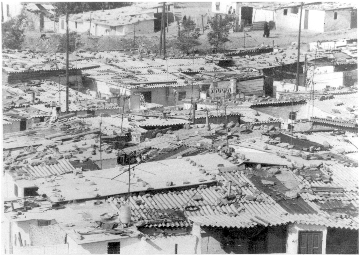
Chabolismo in Madrid.
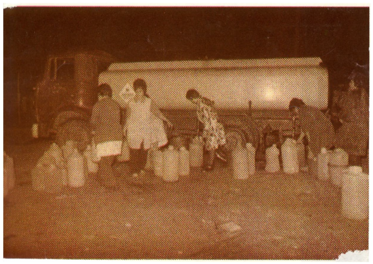
Informal collective infrastructures: Water tank in Orcasitas.
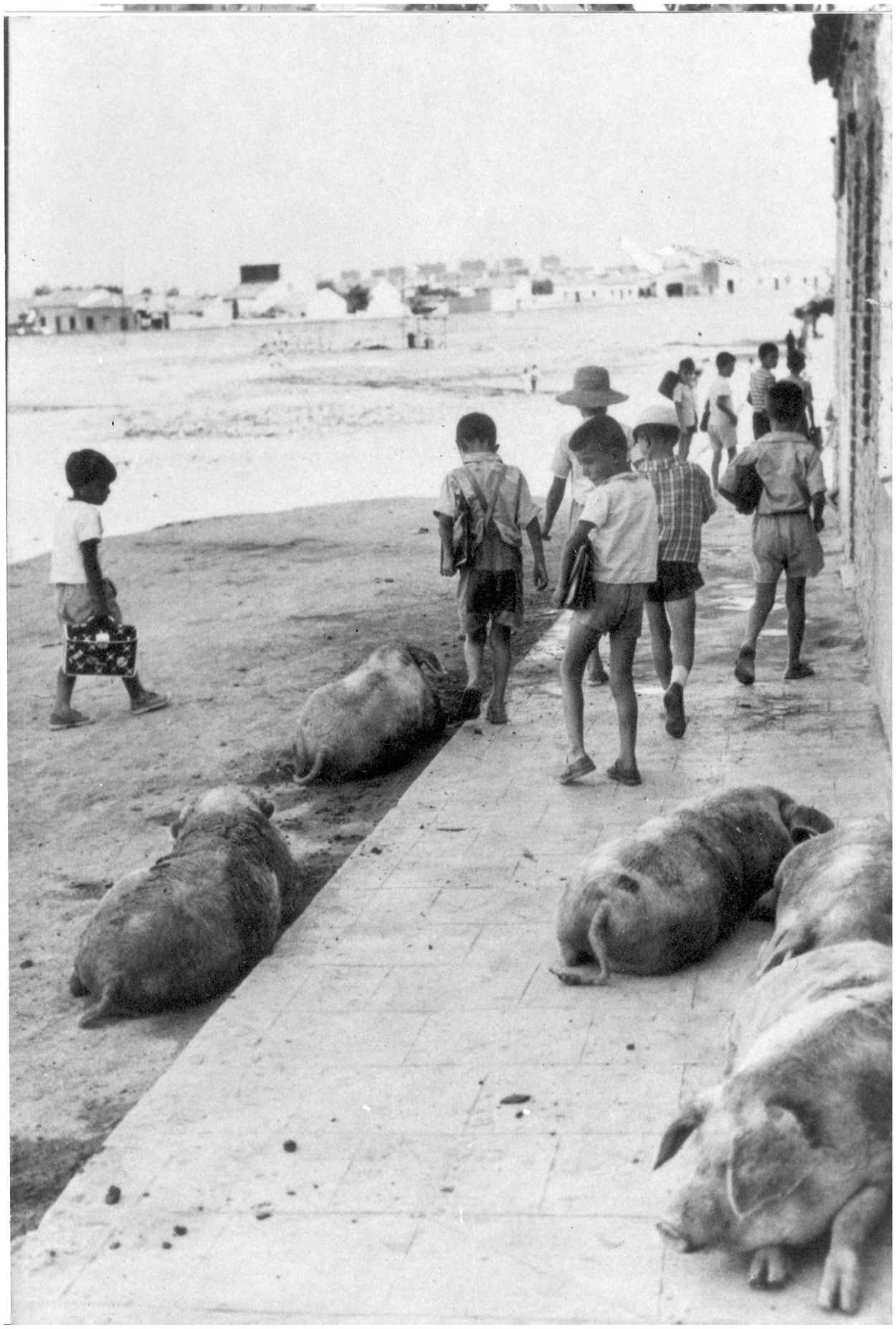
Unpaved streets.
The appointment of Luis Valero as head of the National Housing Institute (INV) and of Julián Laguna as Head of the Comisaría de Ordenación Urbana de Madrid (COUM) in 1954 signaled a change in terms of housing policies. In 1956 the INV published a new National Housing Plan, charging the COUM with what would become its single, most important mission: constructing mass, ultra-economic housing solutions for working-class families. This mission, however, could not be accomplished without the regularization and standardization of urban planning regimes. Therefore, in June 1956 the Francoist authorities published a long awaited new Land Law (Ley de suelo). 22 The professionals involved in the drafting of the law were aware of the fact that informality had become an urbanizing force in its own right, changing the de facto status of large segments of land. Land, whether urbanized or rural, was fast becoming a desired commodity. 23 The law, therefore, set two objectives: to ensure that future urban expansion in Spain would be supervised through a centralized planning process that took into consideration demographic, planning, and financial dictates; and to define once and for all the status and uses of different types of land.
The General Plans of the 1940s distinguished between urban land (situated within the internal perimeter of a city or a town and reserved for future development or settlement) and rural land (which was not intended for residential development and was therefore reserved for agricultural or small-scale industrial uses). The 1956 Law created a third category of urban reserve land (which comprised land that was included within the existing General Plans, but was not yet designated for specific residential or community uses). The Law attempted to rationalize the process of urban planning by creating a system of hierarchical planes: national, provincial/regional, and municipal/metropolitan. Municipal plans were to be executed through a series of partial plans aimed at the development of specific sectors or neighborhoods. However, local authorities often lacked the economic incentives and executionary capacities to carry out metropolitan plans, while regional plans fell prey to power struggles between different provincial and local authorities. Of the 1,116 metropolitan plans that were approved between the years 1956 and 1975, many (such as the Madrid 1963 Metropolitan Plan) were never fully implemented.
The 1956 Land Law also prepared the ground for tackling urban informality by providing a legal framework for processes of mass expropriation. Article 114 of the Law stated that all landowners whose lands were situated within an area intended for urbanization will be liable for expropriation. It further stated that owners will not be compensated for land intended for the construction of roads or green zones (Article 115). Land included under a General Plan (municipal or metropolitan) could be expropriated even if the Partial Plan of a sector or a neighborhood of which it was part was not yet approved (Article 121). Finally, while plans had to be published several months prior to their execution so that the public could be made aware of their contents, land owners could only contest the value of their expropriated land, but not the actual process of expropriation.
Following the appointment of the new government in November 1957, the local planning authorities started to consider revisions to the capital’s General Plan. While a new General Plan would only be published in 1963/4, the Social Emergency Plan for the City of Madrid (PUS)—aimed specifically at eradicating chabolismo—came out in late 1957. 24 Heavily embedded in National-Catholic rhetoric, the Plan’s introduction nonetheless reflected a shift in the spatial practices of the regime. The text highlighted the fact that the regime which arose out of a nationalist uprising on July 18, 1936, viewed Christian households as the basic units of the Fatherland. Since Christian households could only flourish within Christian homes, it was clear that the anarchic existence of chabolismo constituted a danger to the moral and political stability of the regime. As such it had to be eradicated, and since the eviction of working-class populations from the vicinity of the capital was not an option in view of the regime’s future economic plans, it had no choice but to commit itself to solving the housing shortage. However, the introductory text made it clear that future social housing schemes under the PUS will be considered not as part of Madrid’s General (Urban) Plan, but rather within the framework of Partial Plans of satellite suburbs.
In the hope to clear up the space taken by illegal settlements and offer support to the growing construction industry, the authorities called upon private developers to take part in the PUS’s execution. The target was set at sixty thousand new social housing units in Madrid (as well as fifty thousand units in Bilbao and fifty-one thousand in Barcelona) within five years. Three different organs were responsible for the Plan’s execution: the local Commissions for Urban Development were in charge of determining the location of future housing complexes, of freeing land through expropriation, and of constructing all communal infrastructures. The National Institute of Housing was charged with ensuring the provision of long-term mortgages and financial incentives for private developers. Finally, the Syndicate of Home and architecture (Obra Sindical del Hogar y la Arquitectura—OSH) was charged with formulating and executing all social housing schemes.
Controlled Neighborhoods: A Way Out of Spain’s Spatial Crisis?
Social housing units were incorporated into the PUS mostly in one of two modules: that of Absorption Neighborhoods (Poblados de Absorción) and that of Controlled neighborhoods (Poblados Dírigidos). Absorption neighborhoods were meant, as their name indicated, to absorb the population that lived in informal, self-constructed neighborhoods. The cost of constructing absorption neighborhoods was fully covered by the State and the apartments were allocated to families on the basis of short-term rental contracts. These neighborhoods were envisioned from the start as transitory solutions and were therefore built using the cheapest materials. 25 Both the internal structure of the houses and the external structure of the neighborhoods were meant to meet what Lefebvre defined as the lowest possible threshold of sociability “beyond which survival would be impossible because all social life would disappear.” 26 Despite the fact that many of these neighborhoods continued to exist well into the early 1980s, their original plans often did not include communal infrastructures, and their transportation infrastructures were sketchy at best. Poblados dirigidos, on the other hand, were envisioned as a permanent solution anchored within a specific planning and legislative framework. 27 Here the State took upon itself to provide urbanized land, construction materials, and mortgages for authorized buyers. The buyers had to cover the price of the land and a percentage of the general costs of construction. Up to 25 percent of the apartment’s cost had to be paid upon entry, while the remaining 75 percent were paid in monthly installments (with no interest) during fifty years. The Partial Plans of controlled neighborhoods in Madrid were executed by a new entity: the Organization for Controlled Neighborhoods (Organización de Poblados Dirigidos, OPD). The OPD operated in cooperation with the COUM and the INV and in each neighborhood it had a local delegation which was comprised of three representatives: the project’s leading architect (in charge of construction and a representative of the future dwellers); the Director of General Affairs (in charge of all required authorizations and of financing); and the Technical Director (who inspected the grounds assigned for construction and the construction process itself).
While existing studies cite seven poblados dirigidos in the Madrid metropolitan area, eleven such neighborhoods were in fact constructed under the joined supervision of the OPD, COUM, and the Ministry of Housing: Entrevías (1956), Fuencarral (1956), Orcasitas (1957), Caño Roto (1957), Manoteras (1957), Canillas (1957), Cerro de San Blas and San Blas H (1959), Elipe (1959), Virgen de Begoña (1959), and San Cristóbal de los Ángeles (1959). 28 The size of the projects varied, with Orcasitas and Entrevías originally designed as the smallest poblados (with 720 and 770 housing units, respectively) and La Elipa and San Cristóbal de los Ángeles the largest (with 3,910 and 4,066 housing units, respectively). Despite the fact that the Partial Plans of all of these neighborhoods were approved between 1956 and 1959, construction took up anytime between four and ten years. This depended not only on the number of housing units, but also on whether expropriation was carried out smoothly or was hindered by landowners’ lawsuits (as was the case in Orcasitas). The first neighborhoods to be populated were Entrevías, Fuencarral, and Caño Roto, while San Blas H, Virgen de Begoña, and Orcasitas were only partially populated in 1970. 29
The location of Madrid’s poblados dirigidos was determined by the limitations imposed by the city’s 1941 and 1963 General Plans, as well as the nature of internal migration and the characteristics of informality in the capital. Post–Civil War informal settlement in the capital centered on an area defined by Madrid’s 1941 General Plan as the extrarradio. This area today is delineated by two circular highways: M-30 (constructed during the 1970s) and M-40 (constructed in the 1980s). These circular highways are traversed by a series of much older radial roads (today converted into major highways) which traditionally connected the capital with the provinces. It was along the radial roads leading to the south (mostly to Toledo and Andalucia) that major nuclei of chabolismo formed. Since poblados dirigidos were intended to replace those informal settlements, they were mostly constructed on the southern and eastern periphery of the capital: Orcasitas, “San Cristóbal de los Ángeles”, and Entrevías to the south and Fuencarral, Canillas, and San Blas to the east and northeast. Thus, poblados dirigidos defined the future form of Madrid by turning what started off as the makeshift outcome of internal migratory patterns into a permanently planned reality. In the words of Antonio Egea Gil (who in 1956 migrated from the small town of La Coronada in the province of Badajoz to Orcasitas): Orcasitas [started off] as a transit station. The final one on our journey to Madrid. This is what we wanted most of all [. . . ] to enter the “promised city.” It did not matter how we did it, even under the poorest of conditions. But we never attained our goal. We were left there, in that final transit station.
30
The generic model of poblados dirigidos included three central characteristics: a partial reliance on the dwellers’ self-construction capacities; a design based on a variety of social housing units; and contestation over collective infrastructures and communal spaces. Poblados dirigidos were distinguished from all other social housing modalities due to the architects’ reliance on partial self-construction. Self-construction served two ends: first, it was a way of bypassing the inability of squatter families to produce the initial cash down-payment on their homes. As my previous research into the history of the barrio of Orcasitas has shown, 2.3 percent of the heads of households in the barrio defined themselves as qualified laborers.
31
The largest group of employed persons (35%) were day laborers, mostly in the construction industry. Bricklayers made up the second largest professional group (5.9%), followed by carpenters (3%). In view of the fact that similar data were obtained for the barrios of San Cristobal, Entrevías, Fuencarral, and el Cerro de San Blas, the OPD decided to harness this potential for cheap labor. The decision was backed by the Ministry of Housing, which viewed self-construction as a way to train large segments of the migrant male population for the future benefit of the growing construction industry. Luis Cubillo, the architect in charge of constructing the Controlled Neighborhood of Canillas, reflected in his memories the excitement which the idea of self-construction generated among the planners: The aspect I loved most in the controlled neighborhoods’ project had to do with our own personal involvement. It required tremendous efforts because we had to spend our Saturdays and Sundays sitting down with a bunch of people who had no idea what they were doing. One gentleman was a butcher another was a hairdresser, and so forth and so on. [. . .] But it was a very special experience for all of the architects who took part. [. . .] It was a miracle that things actually worked out [. . .] but they did.
32
However, self-construction also had its disadvantages. It slowed the pace of construction significantly, since the men could only work on weekends (to this day the houses constructed in that way are known in the neighborhoods as “domingueros” or those built on a Sunday). The unequal level of training led the architects to confine the men’s work to carpentry and painting and they were only allowed to work on the two-story houses. However, in the neighborhoods where self-construction was employed (Entrevías, Fuencarral, and Caño Roto) the process highlighted in the minds of both the inhabitants and the professionals involved the importance of popular participation. It also aided in the creation of a strong sense of community prior to the neighborhood’s occupation.
Before analyzing the design of the apartments, communal spaces, and collective infrastructures of the poblados as those were defined by the Partial Plans, it is worth noting the ways in which they were shaped in the informal settlements which the poblados intended to replace. The past decade had seen the growth of research into the different aspects of life in Spain’s barrios chabolistas. 33 Existing works, however, only rarely include a spatial analysis of the settlements. And I have found none which analyze the production of informal space as a meaningful and intentional process dictated not only by material constraints, but also by the moral, social, and cultural perceptions of the inhabitants. My research into the history of Orcasitas points to the fact that the production of informal space was indeed a process that reflected the needs and social habits of the community. For example, in Orcasitas, as in the countryside, socialization mostly took place alongside the unpaved streets. As most chabolas lacked the necessary light and ventilation, cooking too often took place outside of the house. The chabola’s central space functioned as an eating area by day, as well as a provisional sleeping and bathing space. Most chabolas included several minuscule bedrooms where not even a bed could fit, all for the sake of separating adults and children of different sexes and ages. In terms of distribution of outer space, the barrios included many types of businesses. Nearly, 6 percent of the heads of households who lived in Orcasitas in 1958 defined themselves as independent businessmen. With the nearest “established” commercial area 3 km away in the barrio of Usera, and no public transportation at hand, the businesses that formed in Orcasitas catered for a mixed array of needs. Of the ninety-one businesses, I located twelve were bars and taverns. They served mainly men and therefore opened on weekends and weekdays from the early afternoon and well into the night. As indicated by their names some of them functioned as hubs of socialization according to the proprietor’s place of origin. Establishments such as La Andaluza, Soria, and La Asturiana (which exist to this day) served traditional dishes and drinks and other primary products acquired during trips to the countryside. Other small businesses included a barbershop, fruit shops, bakeries, butcheries, and wine shops, as well as several shops for the sale of second-hand clothes and fabrics and mobile businesses for the sale of water and coal. 34
What, then, did poblados dirigidos have to offer the communities evacuated from informal settlements such as Orcasitas? While the housing units within the neighborhoods varied in size they were all in-line with the 1954 Ley de Renta Limitada, which specified three types of apartments to be constructed under the supervision of the authorities: reduced (between 74 and 100 m2), minimal (between 35 and 58 m2), and social (42 m2). The majority of apartments conformed to the upper category of Minimal Housing Units, but some (such the two-story town houses constructed by Francisco Javier Sáenz de Oíza in Entrevías and the duplex apartments constructed by José Luis Íñiguez and Antonio Vázquez de Castro in Caño Roto) fell under the category of Reduced Housing Units. 35 All apartments had between three and four bedrooms, a kitchen, and a living area which could be used flexibly as either a dining area or an extra sleeping space at night. In those apartments that had either a balcony or a small garden the bathroom space was located on the outside and bordered on the kitchen so as to simplify the construction of the water infrastructure.
In terms of apartments and building distribution, Entrevías was the only poblado which included only two-story town houses. The neighborhoods of Caño Roto, Canillas, Manoteras, and Fuencarral included a mixture of town houses and four- to six-story apartment buildings, while the neighborhoods of San Blas, La Elipa, and Virgen de Begoña had only apartment blocks of four to twelve stories high. Interviews which a team of architects and design students conducted with residents in Entrevías and San Blas in 1963, 1966, and 1968 indicate that the height of the buildings played a major role in determining their satisfaction or lack of it. 36 Similar to other European countries, social housing schemes in Spain changed quite radically the topography of urban space; the height of newly built apartment blocks was especially intimidating for families who came from informal settlements or directly from the countryside and who were used to low and sparse constructions. While the future dwellers might have been persuaded that high constructions were useful in freeing up space for collective infrastructures and communal spaces, those benefits only partially materialized in the neighborhoods and height, therefore, was viewed only as a disadvantage.
The contestations over communal spaces and collective infrastructures were reflected in the differences between the architects’ original plans and the constructed neighborhoods. Such contestations reflect differences in the appreciation of the population’s needs and the prioritization of such needs. The authorities’ lack of commitment to financing the construction and maintenance of most communal structures highlighted a second point: while it is true that the regime’s spatial practices were partially reversed, they were still impacted by its former territorial representations, which perceived the presence of the urban working classes as a political threat. So while the architects planned more fully equipped neighborhoods, the authorities were willing to dispense with many of the features that were supposed to turn poblados dirigidos into spaces for socialization and community formation.
In all the neighborhoods, apartment blocks were built around central plazas that were intended to provide small green spaces for socialization. In most cases, however, the level of maintenance of these plazas left much to be desired. Except for the neighborhoods of Caño Roto and Canillas they did not include any greenery or playground structures. All neighborhoods except el Cerro de San Blas were designed to include some education facilities. Of special distinction were the projects in Canillas and Virgen de Begoña. In the first, architect Luis Cubillo designed nine education facilities for children at different ages, while in the second Cortés designed two pre-schools and two middle schools. 37 However, as a document of the Ministry of Housing indicates, by 1970 only one pre-school (in San Blas H) and six schools (one in Fuencarral, one in Entrevías, one in Canillas, one in La Elipa, and two in San Cristóbal de los Ángeles) were constructed in all of Madrid’s poblados dirigidos. 38 Of the three community centers that were designed for the neighborhoods of Canillas, Manoteras, and Caño Roto, only the first was constructed by 1970. Of all the planned sporting facilities only three were constructed in San Cristobal de los Angeles.
On the other hand, it is worth noting that by 1970 the neighborhoods included five churches and Catholic community centers, as well as four regime-supervised syndical centers. This fact clearly reflected a willingness to promote some sort of social interaction so long as it was supervised by regime-sponsored entities. The lack of educational and leisure facilities was especially marked if one considers that by 1970 there were fourteen shopping centers and 758 spaces allocated for small businesses within these neighborhoods. While it is clear that the existence of small businesses within a walking distance from home was an essential requirement in the eyes of the inhabitants, the radical imbalance between the number of shopping facilities and other services reflected the place assigned to these neighborhoods within the emergent Francoist market economy: that of consumers’ hubs rather than spaces where working-class communities could prosper. Furthermore, as the bulletins of neighborhood associations in the 1970s make clear, the new businesses were not owned for the most part by locals. The businesses that formed within informal settlements hardly survived the long processes of expropriation and resettlements, and those who did could not afford to be relocated since mortgages granted to businessmen were given for shorter terms and with a much higher interest rate than those granted to homeowners.
Conclusions
In some respects, poblados dirigidos and the minimal housing units which they offered constituted an improvement over the self-constructed chabolas which preceded them. For both the authorities and the squatters a move from a self-constructed chabola to a “proper” house signified a move from chaos to an orderly built environment. The most important advantage in the eyes of the new inhabitants was the existence of permanently maintained networks of electricity and water. It soon became apparent, however, that in certain cases the newly built apartments undermined some of their most basic definitions of well-being. The scarcity of space and the architects’ spirit of experimental modernism dictated the use of multifunctional furniture (kitchen benches and sofas that could be transformed into beds; cooking spaces that could be transformed into dining tables; portable doors, etc.) that were perceived by many users as unaesthetic and mechanical in nature. Originally, spaces dedicated to private activities (such as sleep and bathing) were assigned to the back of the house. However, the poor quality of walls and floors and the dictates imposed by the size of the apartments forced many architects to locate the bathroom next to the kitchen in a way that was perceived as unhygienic and undermined the inhabitants’ sense of privacy.
The size of the apartments also dictated in many cases the elimination of a classic feature in Spanish interior design: the corridor. The disappearance of the corridor erased the gradual transition from social to private family spaces. While most chabolas were no better in this sense, their makeshift structure maintained the potential for flexibility, unlike built apartments. Furthermore, the chabolas were single-story independent structures, where some activities (such as cooking, socializing, and even the bathing of young children) could be “expelled” to an outer perimeter. In the high-rise apartment blocks, on the other hand, there was no such flexibility and the residents felt that the poor quality of materials exposed them more acutely to odors, noises, and other types of intrusion. Worst of all was the fact that most neighborhoods were still cut off from the city itself. As the struggle of neighborhood associations in the decades of the 1970s and 1980s would show, the lack of education and medical facilities and the inadequacy of shopping facilities were among the major grievances (Figure 4). 39
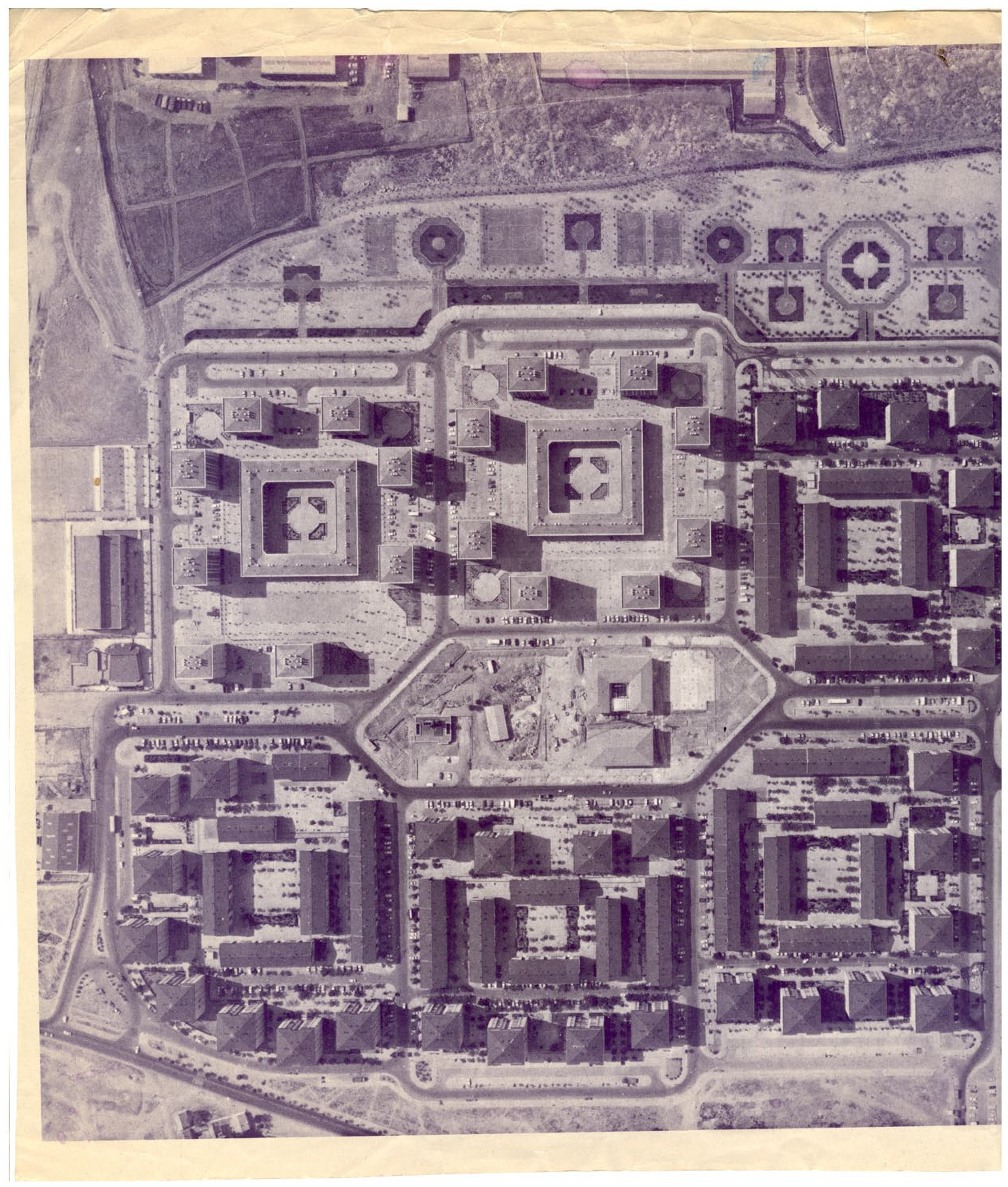
Post reconstruction Meseta de Orcasitas from the Air, 1983.
Despite all of these shortcomings, in the minds of architects such as Francisco Javier Sáenz de Oíza (Entrevías), José Luis Romany (Fuencarral), Luis Cubillo (Canillas), Rafael Leoz (Orcasitas), José Luis Íñiguez de Onzoño, and Antonio Vázquez de Castro (Caño Roto) controlled neighborhoods constituted an experiment in radical modernist planning. Their work in the late 1950s enabled them to bring into Spanish cities some of the lessons learned in their years of studying and working in the United States and the Nordic countries. In a country where a Civil War put an untimely end to experimentations with new construction materials, prefabrication techniques and the potential of social housing schemes, poblados dirigidos, constituted an initial step in a renewed dialogue with the outside world. 40 However, the constraints imposed on these visionary professionals by the Franco regime would turn the neighborhoods into unfinished projects. Their continued imperfect existence would not only determine the future development of the city of Madrid itself, but also the struggle for urban renovation and civic mobilization for years to come.
Footnotes
Declaration of Conflicting Interests
The author(s) declared no potential conflicts of interest with respect to the research, authorship, and/or publication of this article.
Funding
The author(s) disclosed receipt of the following financial support for the research, authorship, and/or publication of this article: This project is funded by the Israel Science Foundation (Grant No. 455/17).