
View from Columbia Crest on the summit of Mount Rainier (GPS: 46.8528857°N -121.7603744°W), May 26, 2018, after an approximately 8-h climb from Camp Muir. Mount Rainier stands at 4392 m (14,411 ft) and is the highest point in Washington State and the tallest mountain in the Cascade Range. From this south-facing vantage point, looking left to right, Mount Adams, Mount Hood (partially obstructed), and Mount St. Helens can be seen glistening through the clouds. In the foreground, not to be confused with vehicle tracks, the summit is intersected by footprints of other climbing parties walking single file while roped together for safety. High winds combined with heavy foot traffic in alpine boots and crampons also contribute to the sculpting of irregular snow patterns seen on the summit. Photograph by Stewart Dandorf, MD.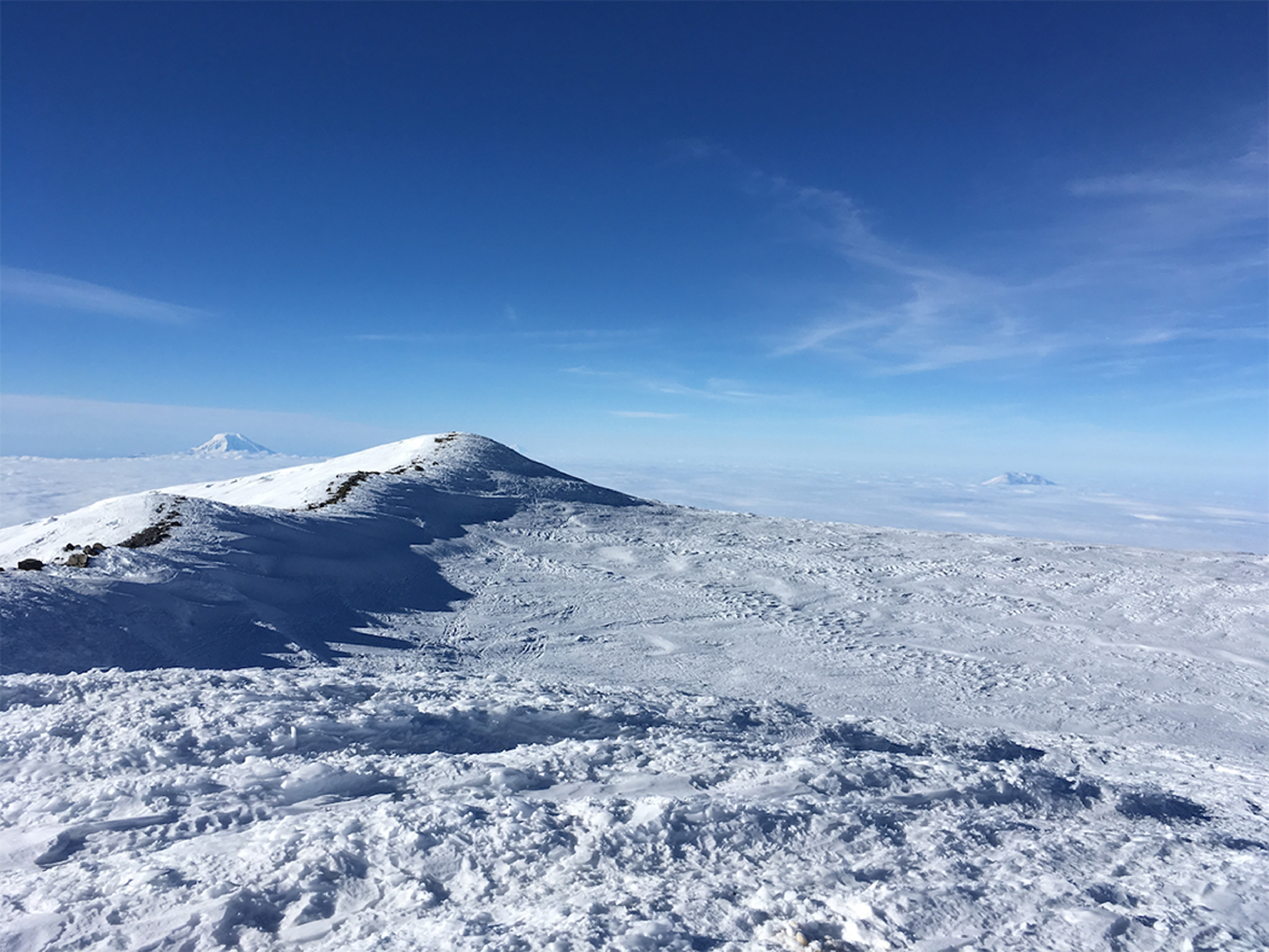
You are on the new improved site. You can view the old site in view-only mode here until June 27, 2026
Filter Results
Select search scope: search across all journals or within the current journal
Search this journal
Enter search terms…
/